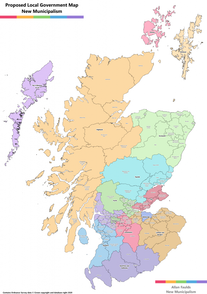
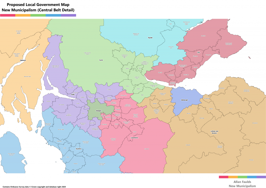
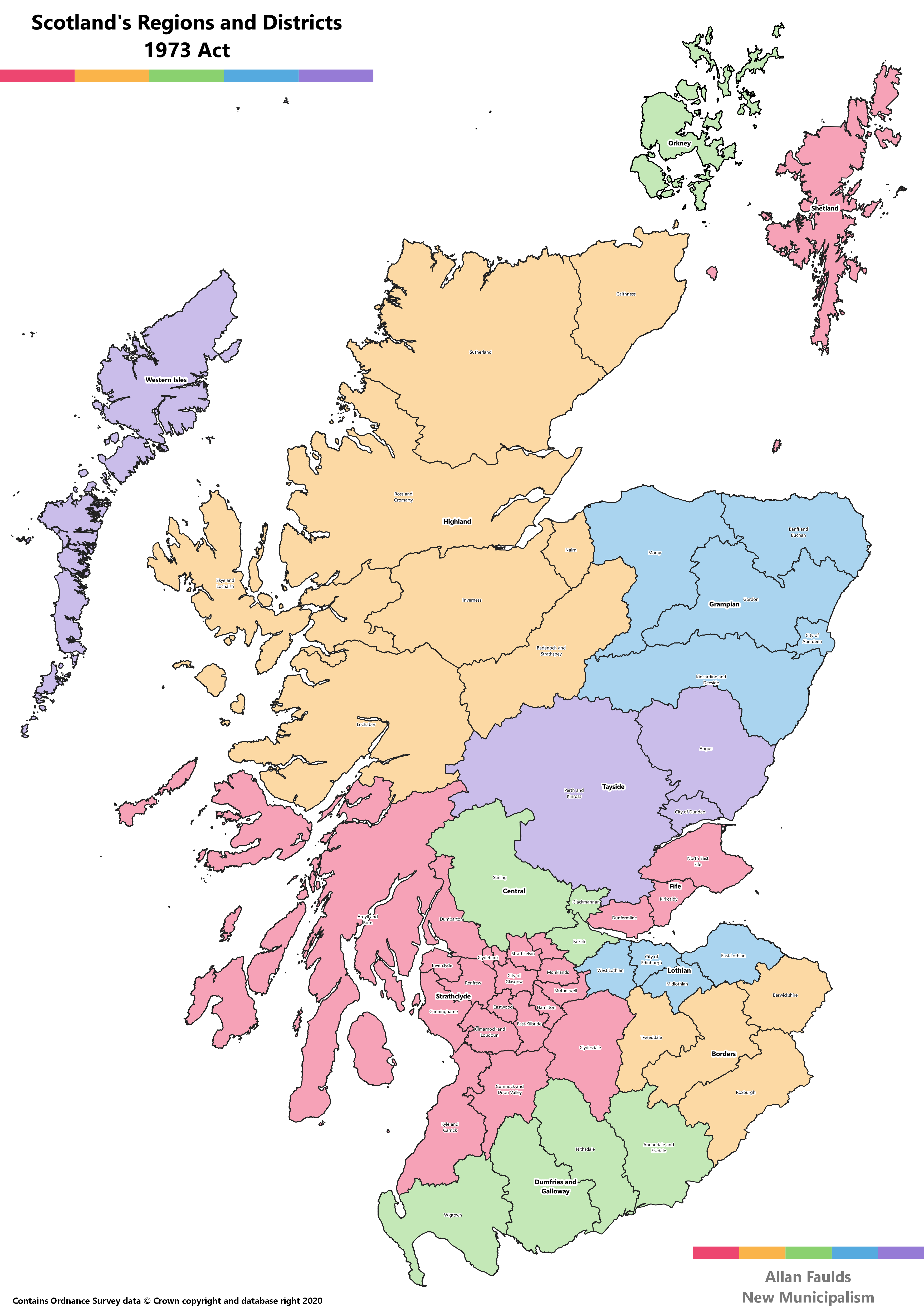
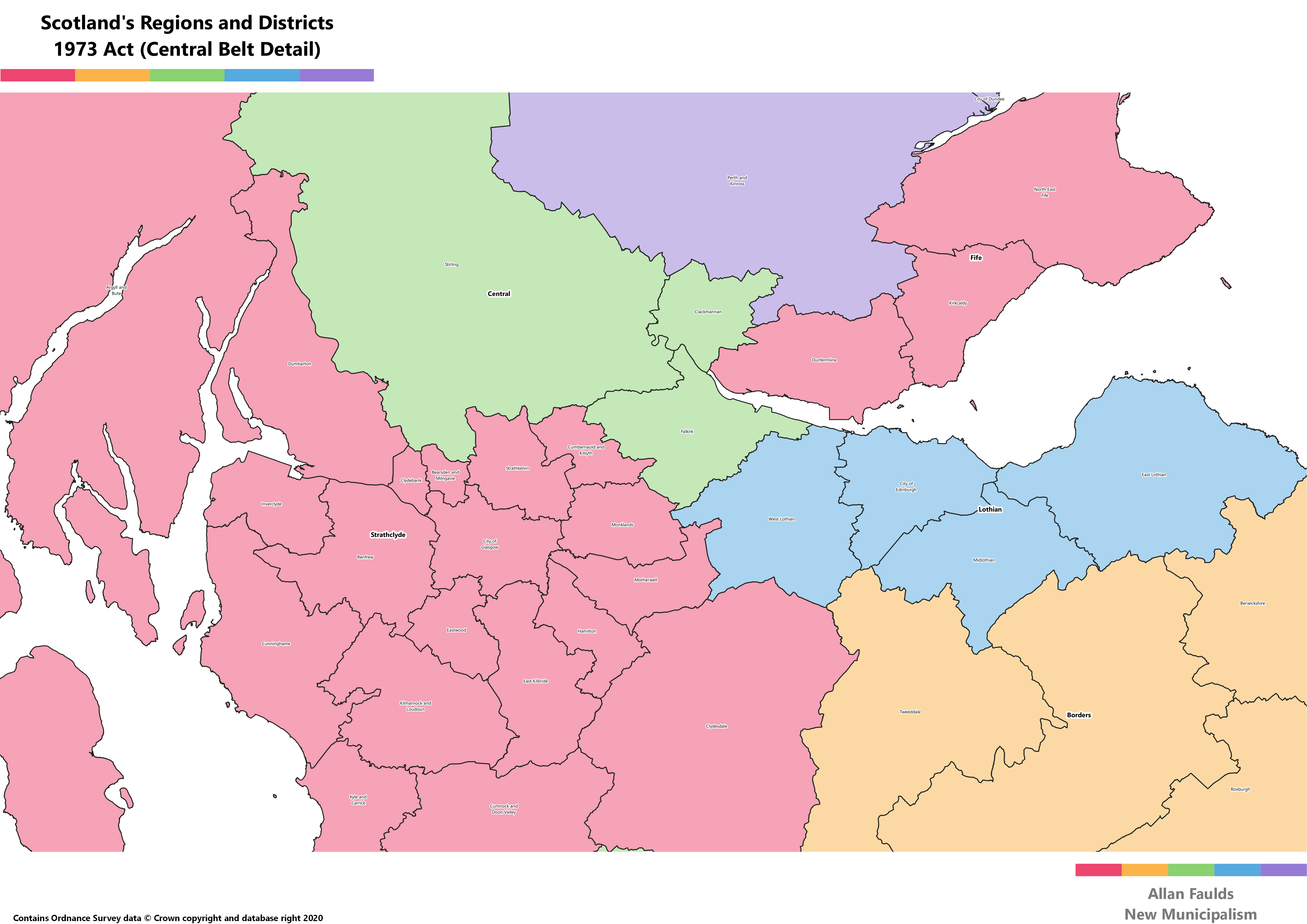
This page has some additional maps that may be useful, including of previous local government structures (and proposed structures). These are all A3 size to convey appropriate detail for the pre-1973 and New Municipalism maps, so you may need to zoom in.
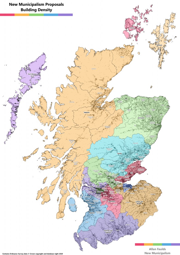
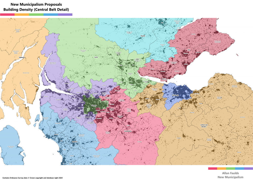
New Municipalism Proposals with Building Density
It’s one thing showing the boundaries of an area on the map, but that doesn’t necessarily tell us much else about it. By including the density of buildings we can also (for the most part) get a better sense of which areas have the largest populations, and where they are.
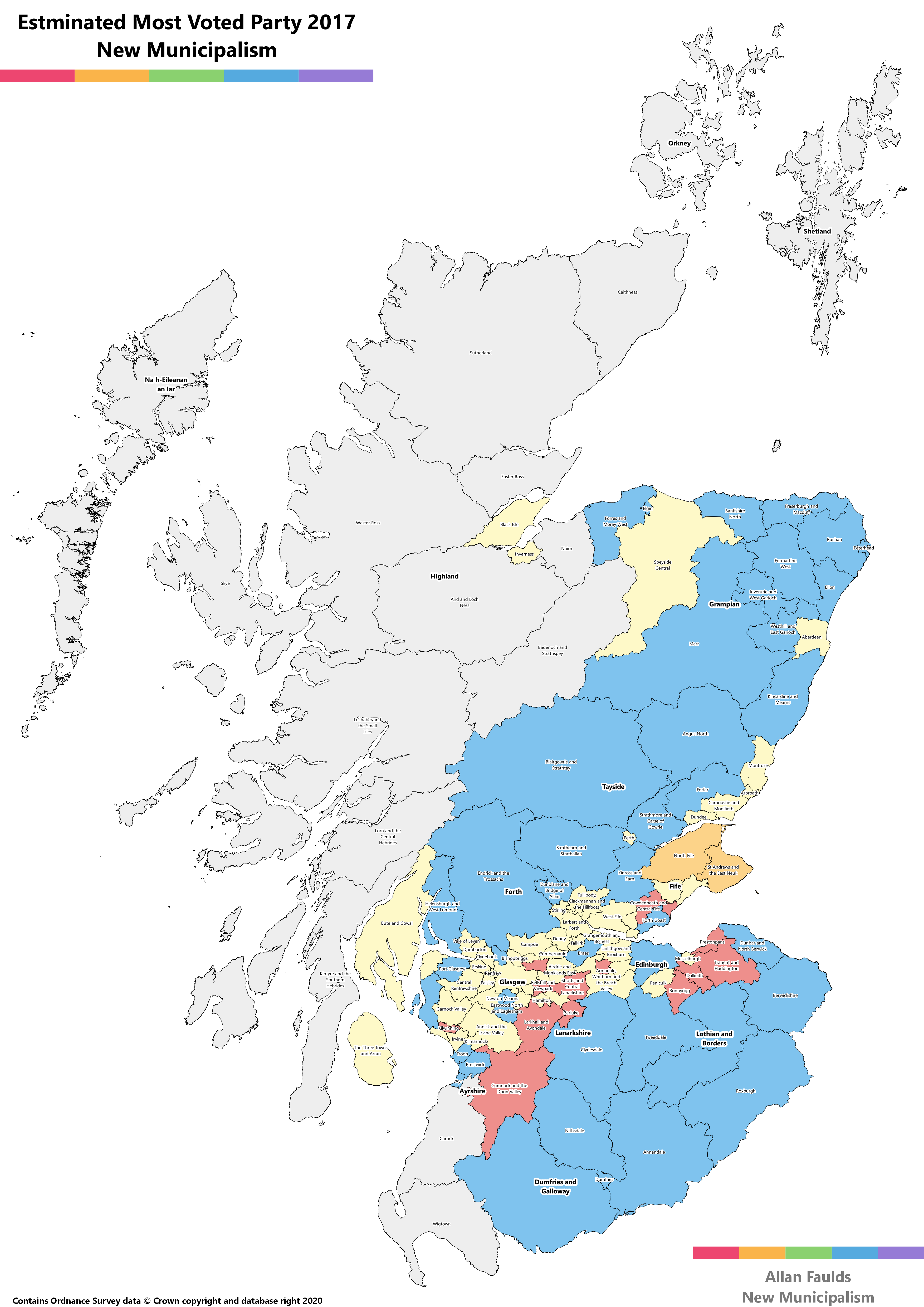
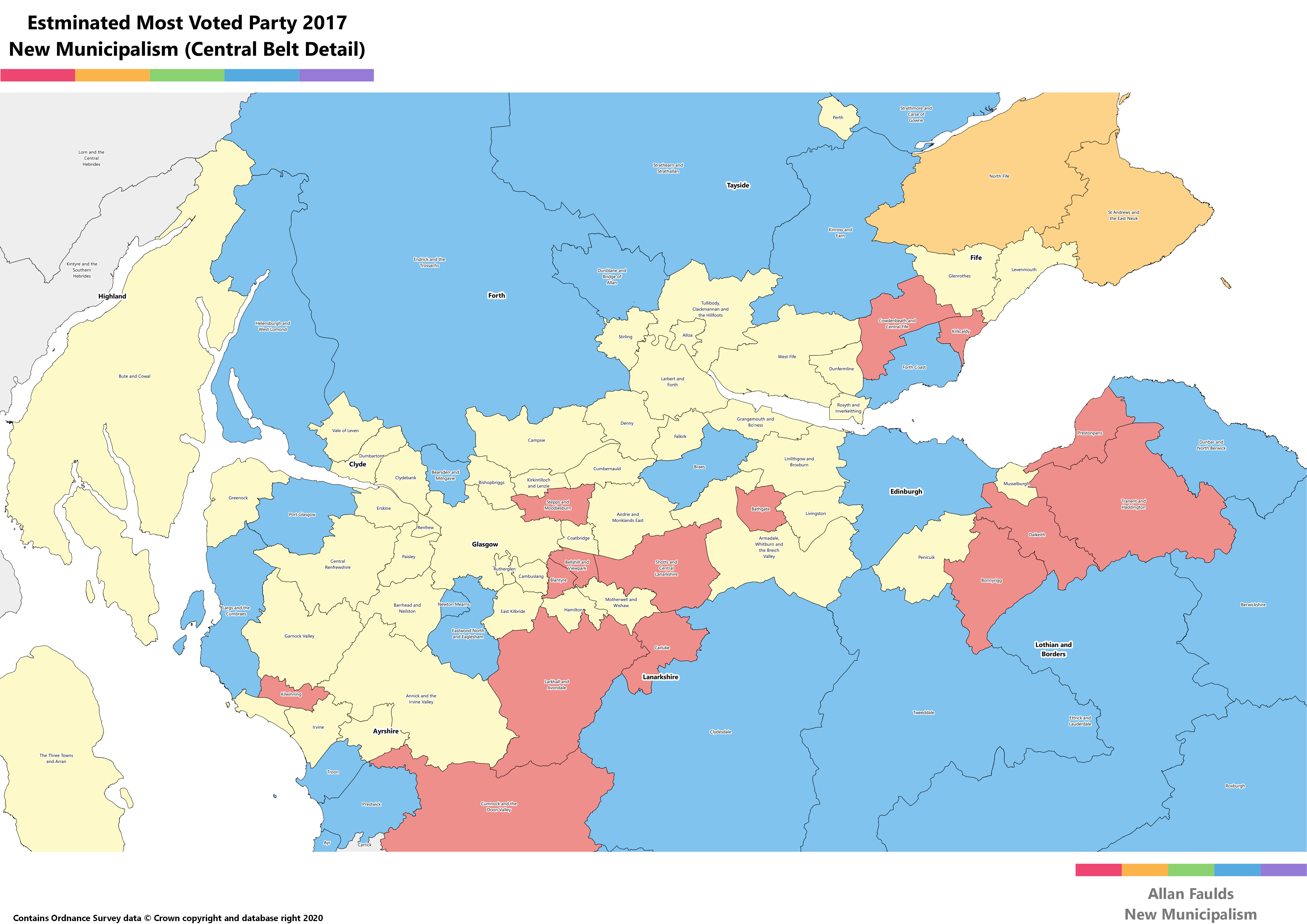
New Municipalism Proposals with Notional Most Voted Party in 2017
This map has coloured each proposed municipality according to the party winning the most votes based on 2017 results. Note that most votes doesn’t necessarily mean most seats, both because some places have a tie for most seats, and because in some places strong Independent support can’t translate to seats.
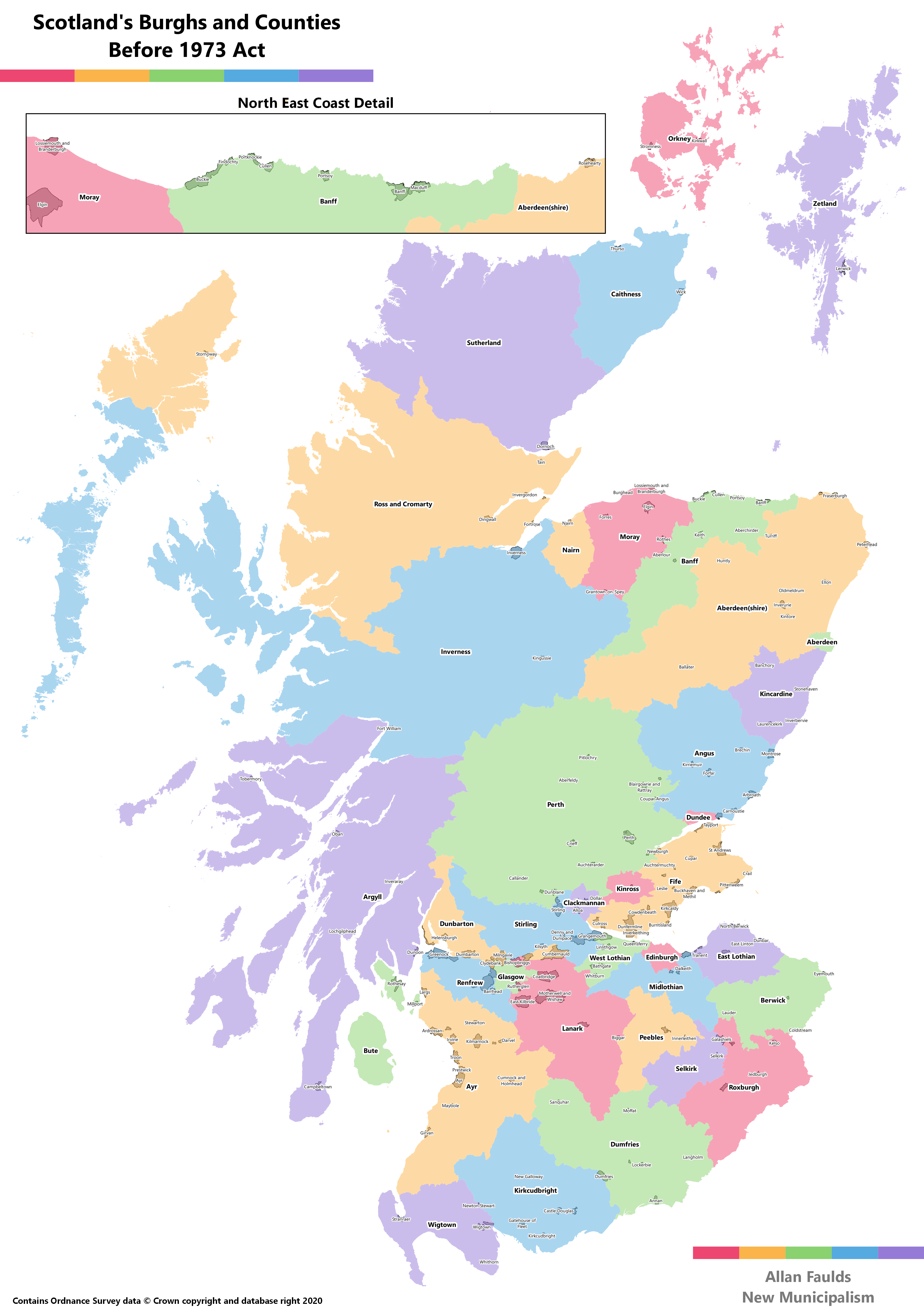
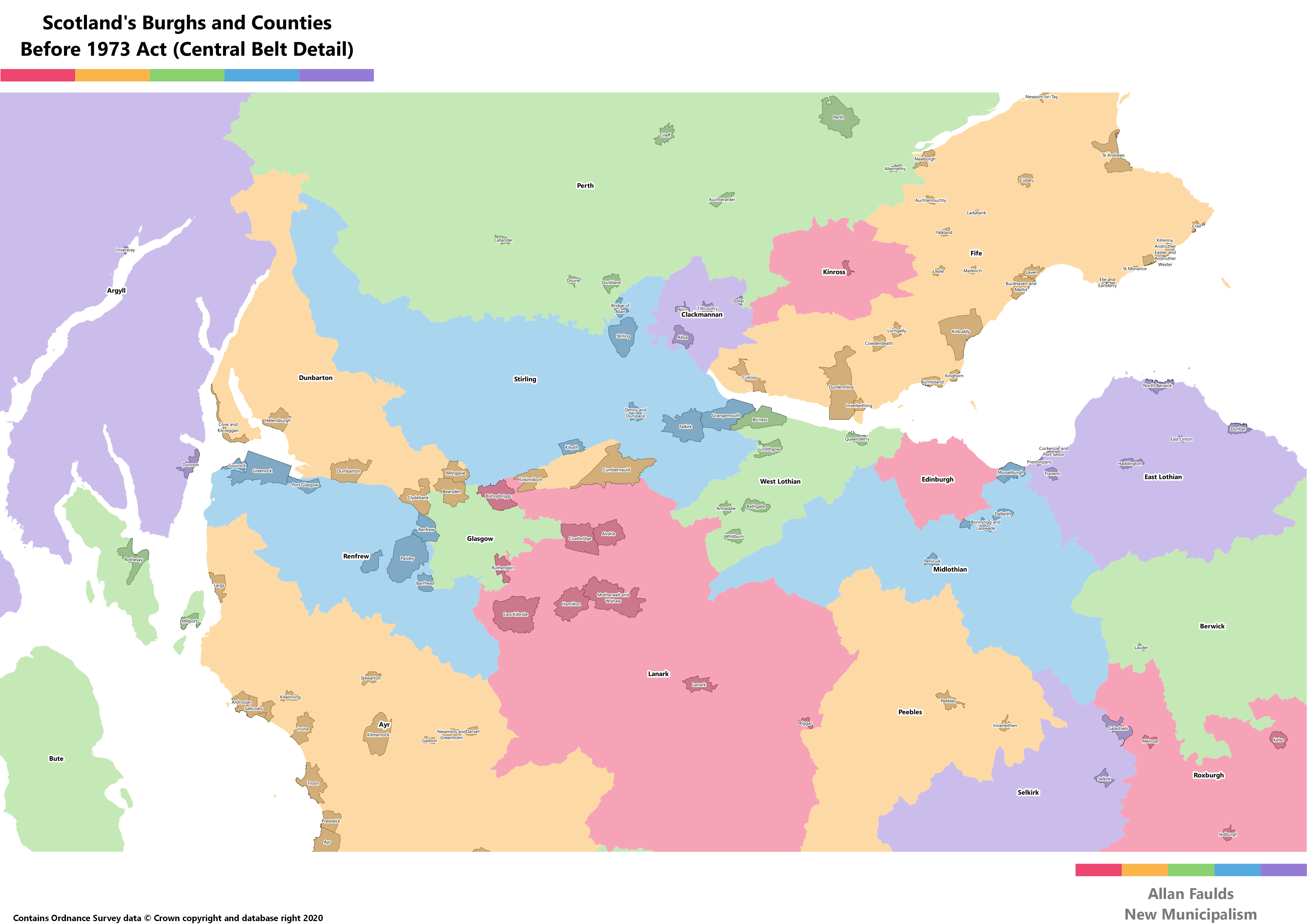
Local Goverment (just) before the 1973 Act
Scotland’s original system of local government in the modern sense dates to the late 19th century. It would go through various changes over the years, but always consisted of Counties and Burghs. This map does not capture the Landward Districts, i.e. those areas of a county not in a Burgh, as I haven’t been able to find any Shapefile data for those.
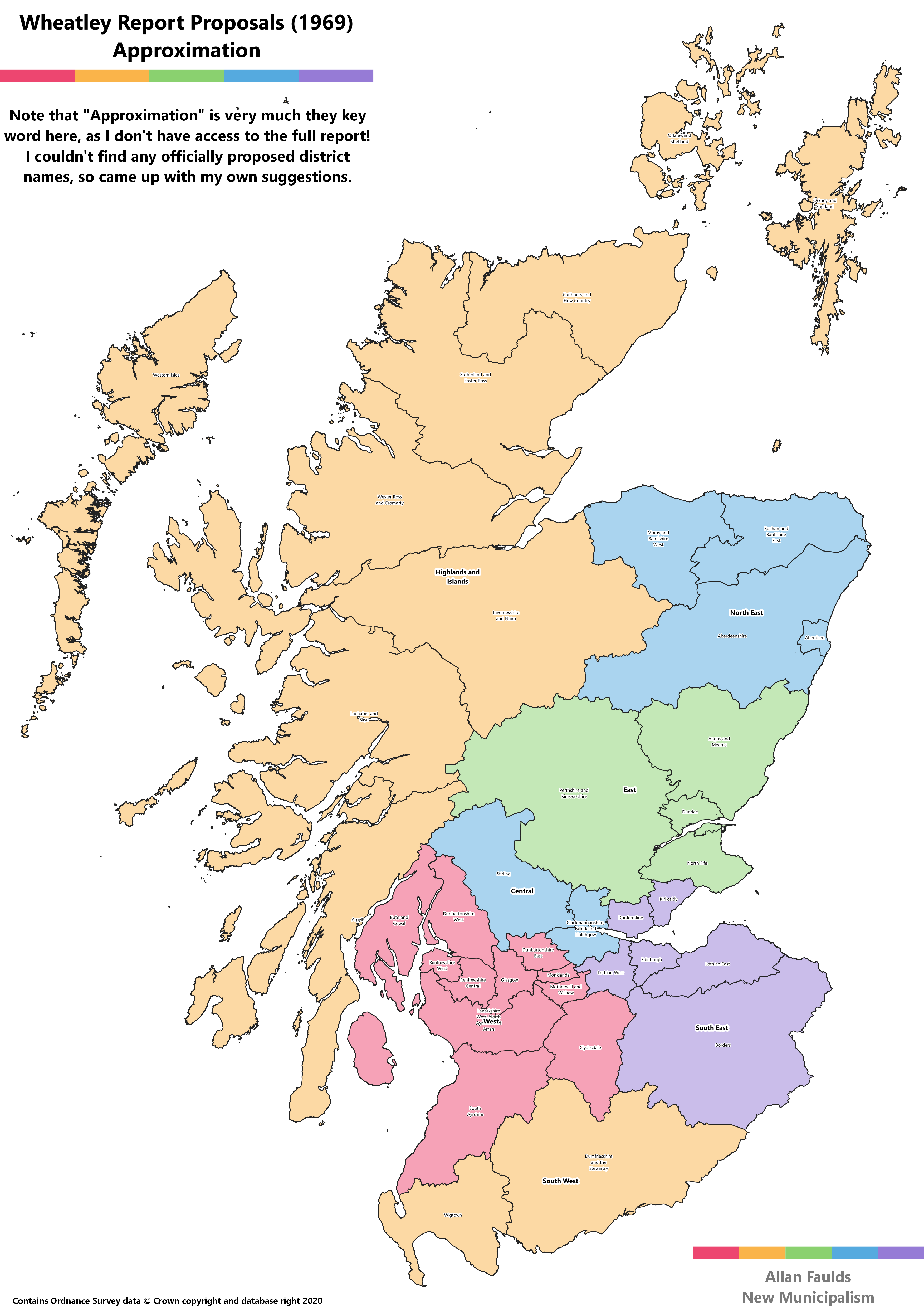
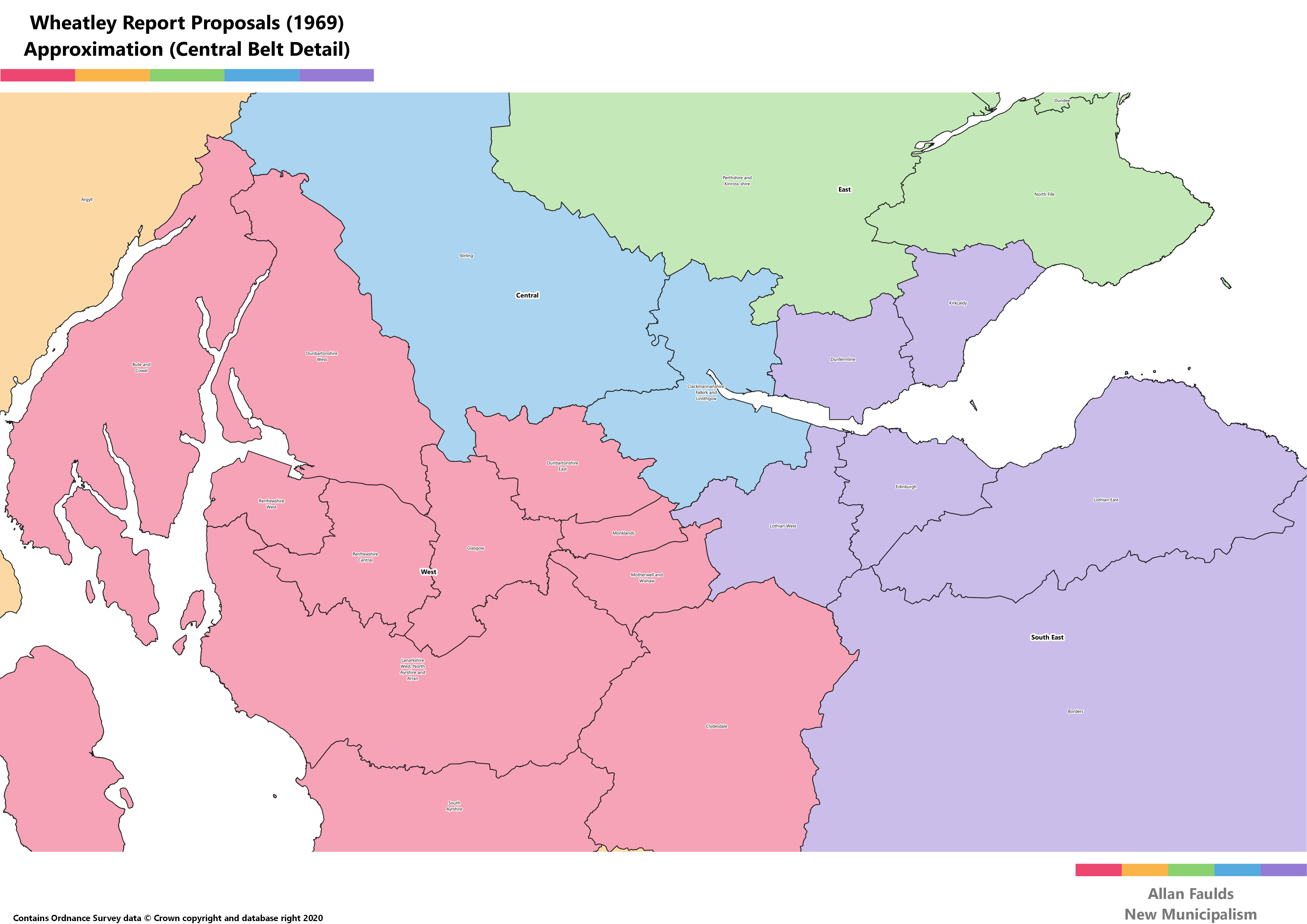
Wheatley Report Proposals (1969)
The Wheatley Commission preceded the 1973 Act, and formed the initial basis for it. It proposed a similar Region and Districts structure, but with far fewer of both. Many aspects of these plans were vigorously contested, which is how the 1973 Act ended up looking substantially different. Probably the most widely opposed proposal was that Fife be split between three regions.
I don’t have access to the full report, so the map below is an approximation based on descriptions of the proposed districts. Similarly, the names are my best suggestions rather than what may have been formally put forward by Wheatley.
Initial Proposals for the 1994 Act
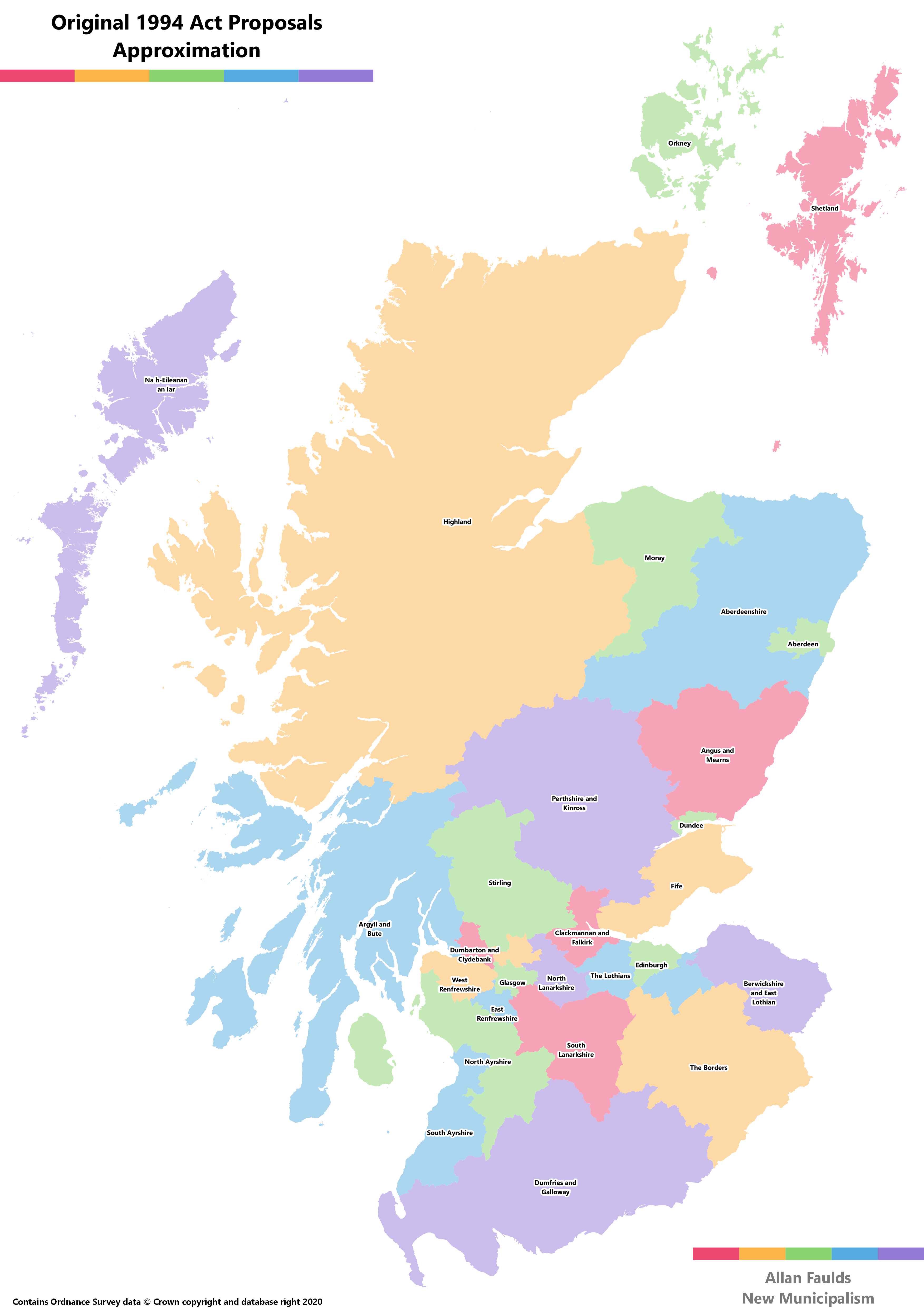
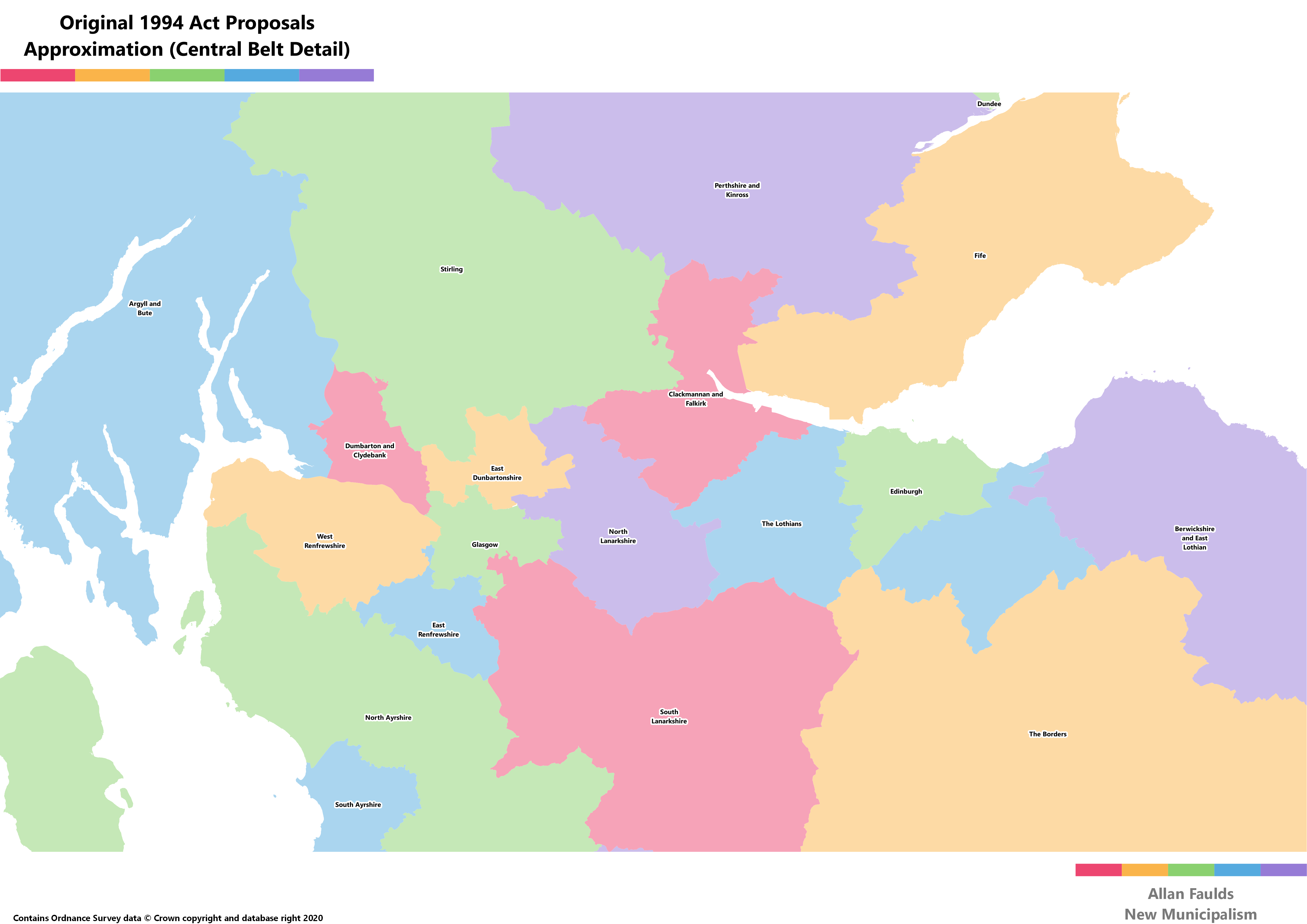
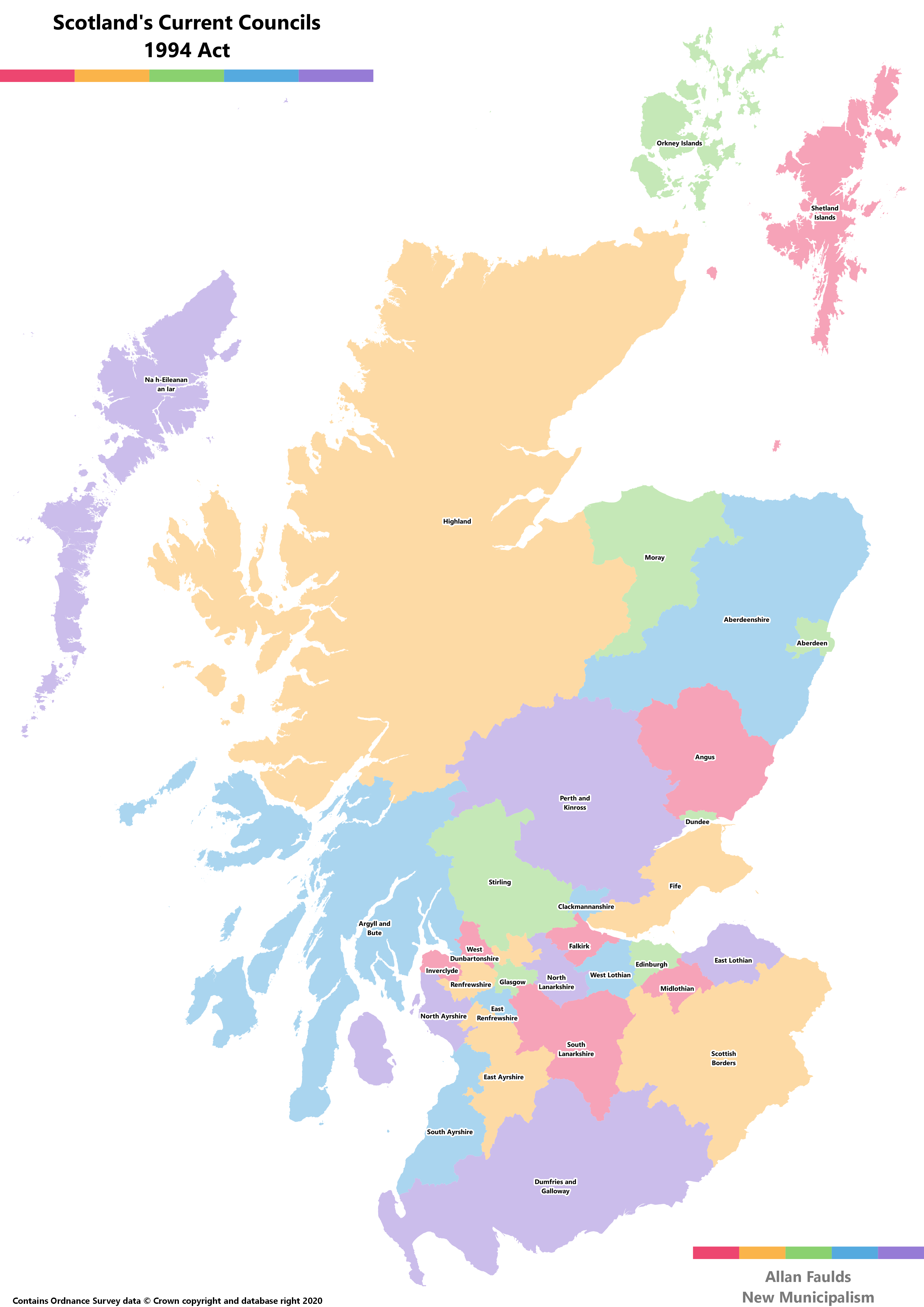
A first draft of the 1994 Act which introduced the current councils would have given 28 rather than 32 councils. Most notably odd about these plans was combining West and Midlothian into a single Council split in half by Edinburgh, and the Ralston Finger of East Renfrewshire which took just one suburb of Paisley into East Renfrewshire – noted, by opposition Labour MPs, to be a part of the town that elected Conservative councillors.
I’m not aware of there being a formal map of these plans kicking around anywhere these days, so the maps below are approximations based on descriptions.
