Lothian and Borders Region Overview
Key Statistics
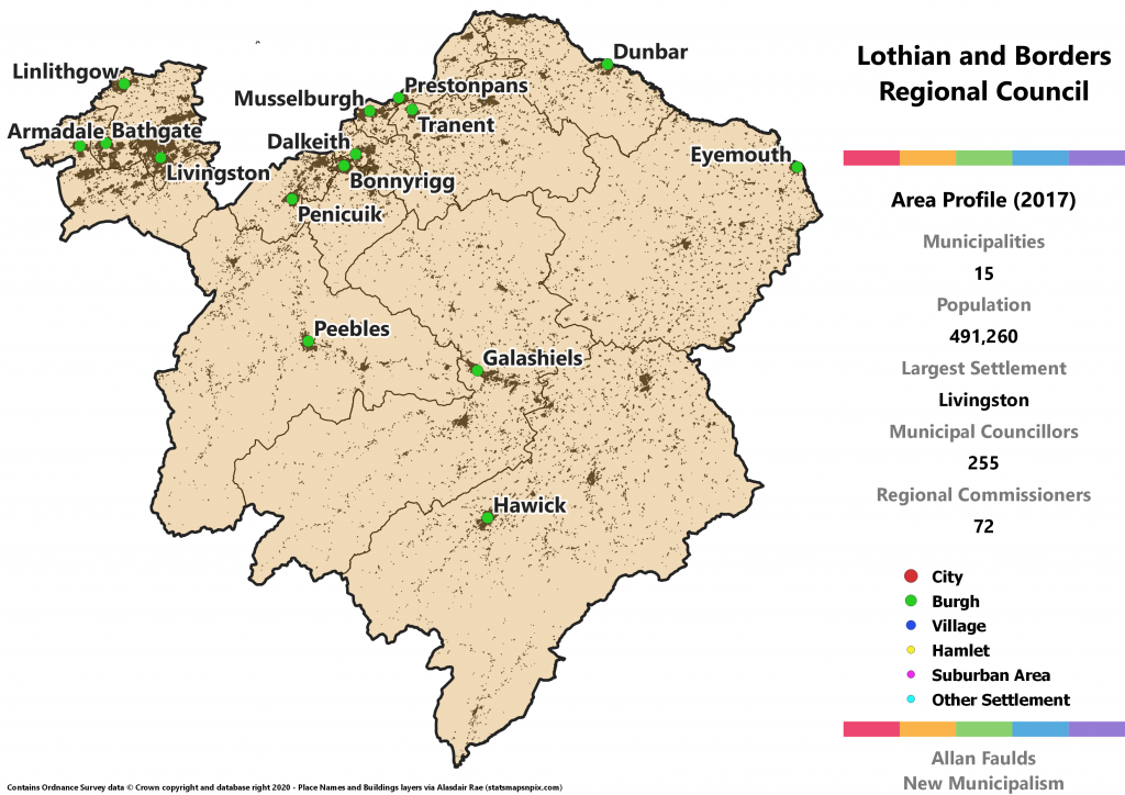
Municipalities: 15
Population: 491,260
Largest Settlement: Livingston
Municipal Councillors: 255
Regional Commissioners: 72
Region Description
Lothian and Borders pairs the current three Lothian Councils – West, Mid and East – with the Scottish Borders Council. It does not include Edinburgh which is in Lothian but has a population larger than the other areas put together and so would be overwhelming. Under the 1973 Act, Lothian (including Edinburgh) was one region and the Borders a separate one. I decided against that here as the Borders would have ended up the smallest mainland region, at three quarters the population of Dumfries & Galloway. Unlike D&G, the Borders strikes me as better connected to its neighbour, and there is precedent for a certain degree of shared service provision in the old Lothian and Borders Police and Fire Services.
As a consequence of not including Edinburgh, West Lothian is somewhat cut off from the other parts. There is geographic contiguity as there’s a point of contact between West Lothian and Tweeddale, but that’s in the middle of some hills so there’s no transport connection. In a previous iteration of this project I’d considered that reason enough to put West Lothian in the Forth Region instead. I’ve since decided that probably isn’t such a big deal in terms of actually delivering services and it’s better to preserve the historic connection.
Although not too dramatic in terms of population, the historic area of the Lothians was nibbled away at in the 1973 Act. The biggest population change would have been moving Bo’ness from West Lothian to Falkirk. From Midlothian, the area around the Heriot and Lugate Waters plus where they join to form the Gala Water was transferred into the Borders. Finally, a very small rural part of East Lothian also went into the Borders, establishing the latter’s current area.
The changes between the parts of the Lothians were much more impactful. Both West and Midlothian ceded areas to an expanded Edinburgh, and Midlothian also passed Musselburgh over to East Lothian. Those boundaries were maintained when the Lothian Districts became the current Councils, and are still traceable through the boundaries of this project’s proposed municipalities.
In political terms, Lothian and Borders is most finely balanced of Scotland’s regions. The SNP tend to be the strongest party in the West Lothian area, Labour in the rest of the Lothians, and the Conservatives in the Borders. The net effect according to 2017 results is for an SNP-Conservative tie in seats, with Labour close behind. Rounding out the council, both the Lib Dems and Greens would have reasonably sized groups. The political differences between the Lothian and Borders areas is evident in the municipality results as well, with Labour and the Greens not winning any in the Borders and the Lib Dems only one outside them.
Armadale, Whitburn and the Breich Valley District
Area Profile (2017)
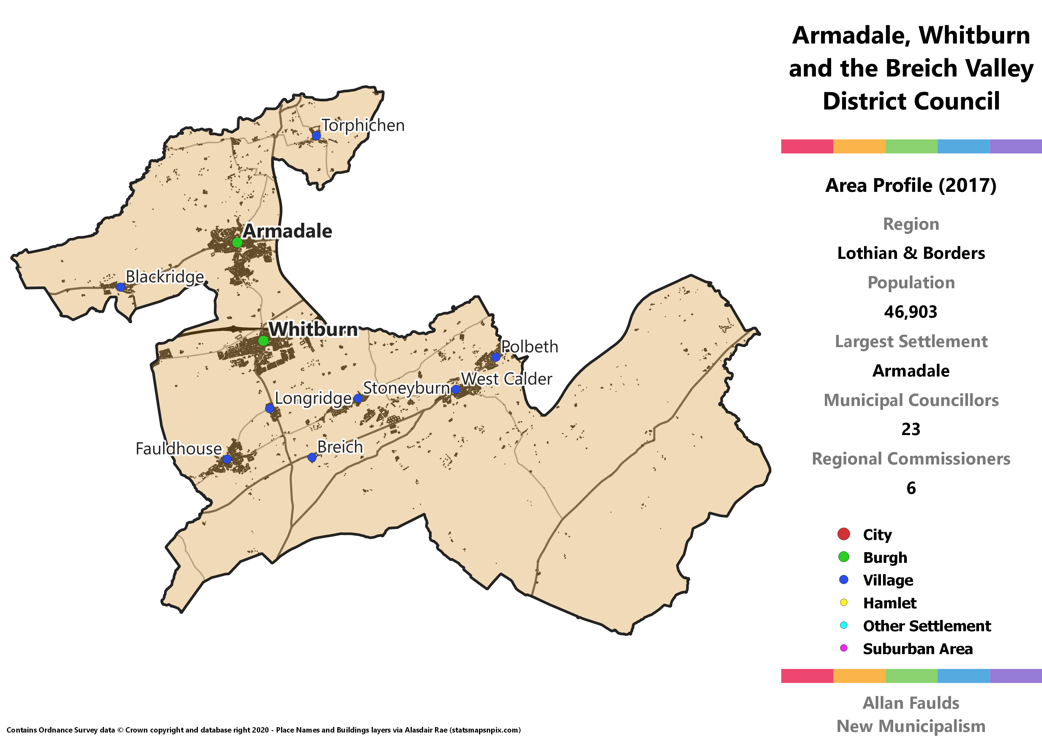
Population: 46,903
Largest Settlement: Armadale
Municipal Councillors: 23
Regional Commissioners: 6
Municipality Description
Armadale, Whitburn and the Breich Valley is basically what is left over when all of the other sensible municipalities are carved out of West Lothian. I find the shape awkward – big the ghost dog out Nightmare Before Christmas vibe – but most of that is sparsely populated countryside that had to go somewhere. The former Burghs of Whitburn and Armadale are placed in such a way it isn’t possible to split this area any other way and still keep to at least 20,000 residents per municipality.
Awkward as it may look, that string of former mining villages to the south of Whitburn are pretty well connected to Whitburn. At least, if the amount of time I spent being driven through them by an ex-boyfriend who lives in the area is anything to go by!
Bathgate Burgh
Area Profile (2017)
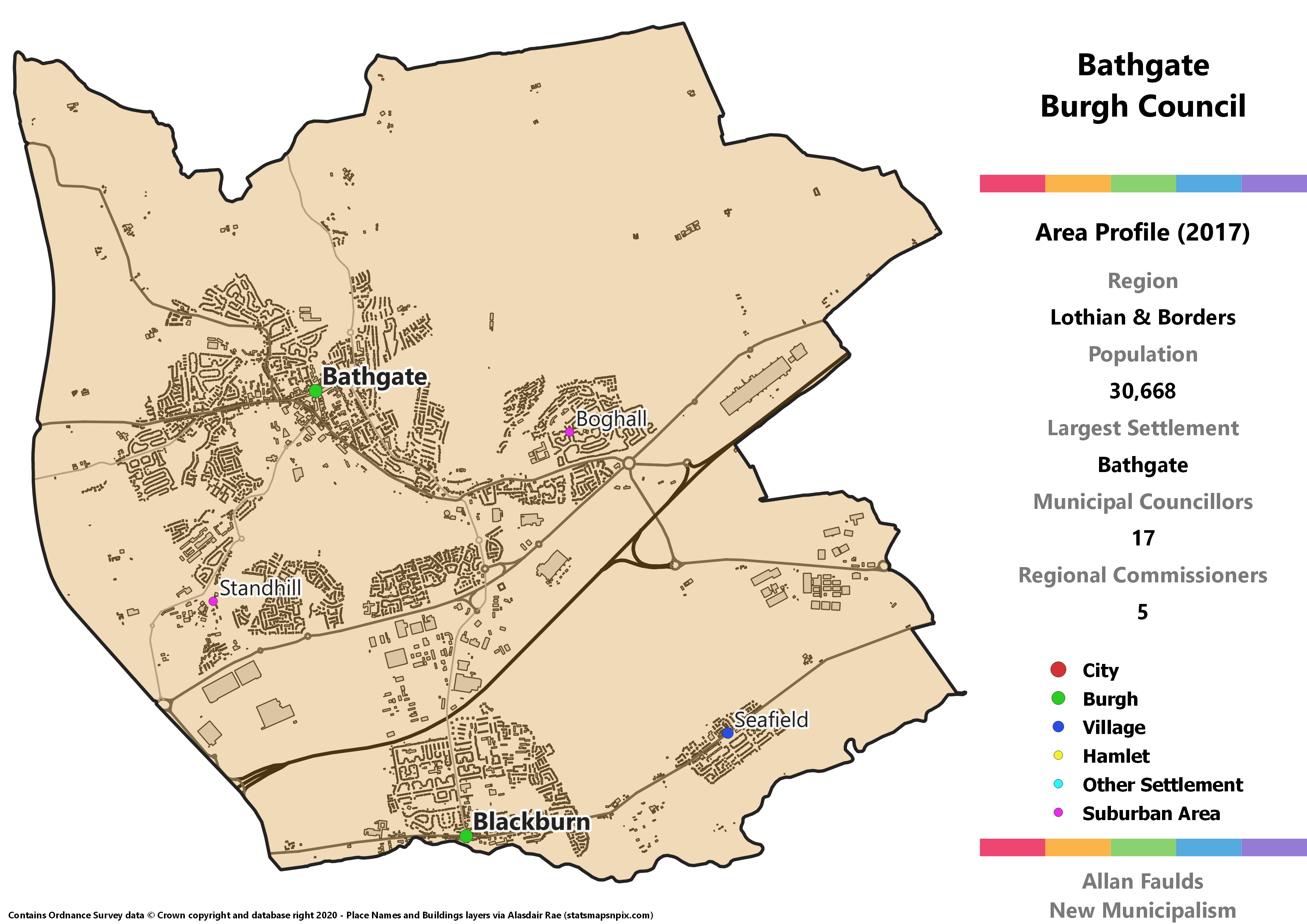
Population: 30,668
Largest Settlement: Bathgate
Municipal Councillors: 17
Regional Commissioners: 5
Municipality Description
This proposed Bathgate Burgh also includes Blackburn, formerly also a Burgh in its own right, and the neighbouring village of Seafield. Since Bathgate is well over two-thirds of the population of this Burgh, I figured it deserved sole reference in the name. In any case, this is a large urban area at the centre of the current West Lothian, which makes for a neat and easy possible municipality. A remaining area of reasonable strength for the party, this is the only municipality in West Lothian to lean towards Labour.
Berwickshire District
Area Profile (2017)
Population: 20,945
Largest Settlement: Eyemouth
Municipal Councillors: 13
Regional Commissioners: 4
Municipality Description
Berwickshire is a historic oddity, being the county associated with the town of Berwick(-upon-Tweed) which hasn’t been part of Scotland for over 500 years. The name stuck however, and the county continues today as the most rural part of the Borders. The former Burghs at Eyemouth, Duns and Coldstream are now all quite wee compared to major towns in the other Borders counties. In the 1973 Act, Berwickshire was one of the Borders Region’s Districts, though reduced in size for lack of the Lauderdale area. The 1973 form is mostly reinstated here, bar some minor differences where ward boundaries don’t line up identically.
Berwickshire has been very much at the heart of the Conservative’s recent revival in Scotland, winning well over half the vote in 2017. Extrapolating that to a full District would give them a very comfortable majority.
Bonnyrigg District
Area Profile (2017)
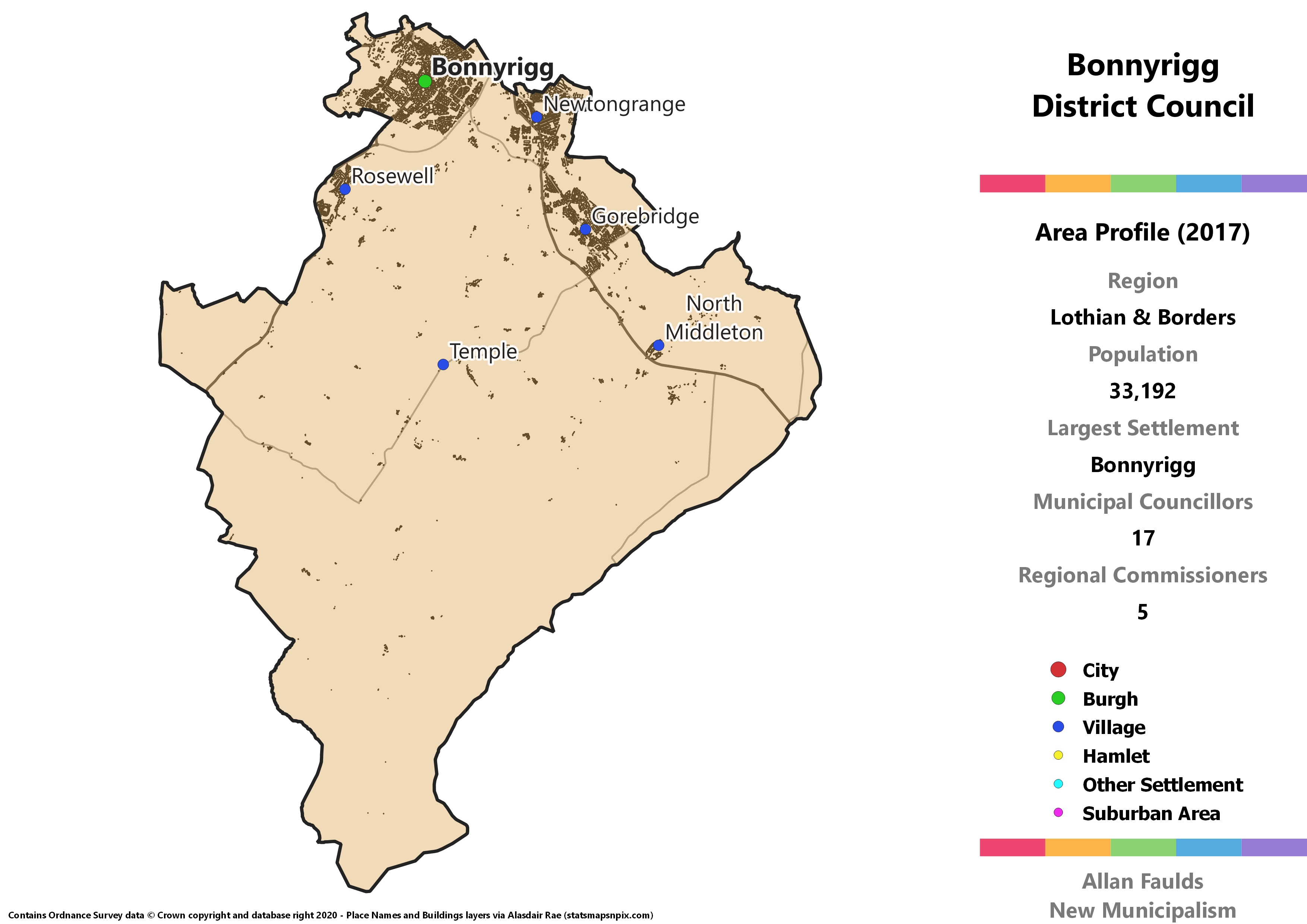
Population: 33,192
Largest Settlement: Bonnyrigg
Municipal Councillors: 17
Regional Commissioners: 5
Municipality Description
All of the Midlothian based Districts take the form of an urban core around a historic Burgh plus a large tract of sparsely populated countryside. In this case, it’s Bonnyrigg that provides the centre for the District, with other major towns at Newtongrange and Gorebridge. In 2012, the Bonnyrigg ward was one of the few in Scotland to elect a Green Councillor. They lost that seat in 2017, but are strong enough in the area that using those results as the basis for a larger district would have seen a Green safely through.
Dalkeith District
Area Profile (2017)
Population: 29,365
Largest Settlement: Dalkeith
Municipal Councillors: 15
Regional Commissioners: 4
Municipality Description
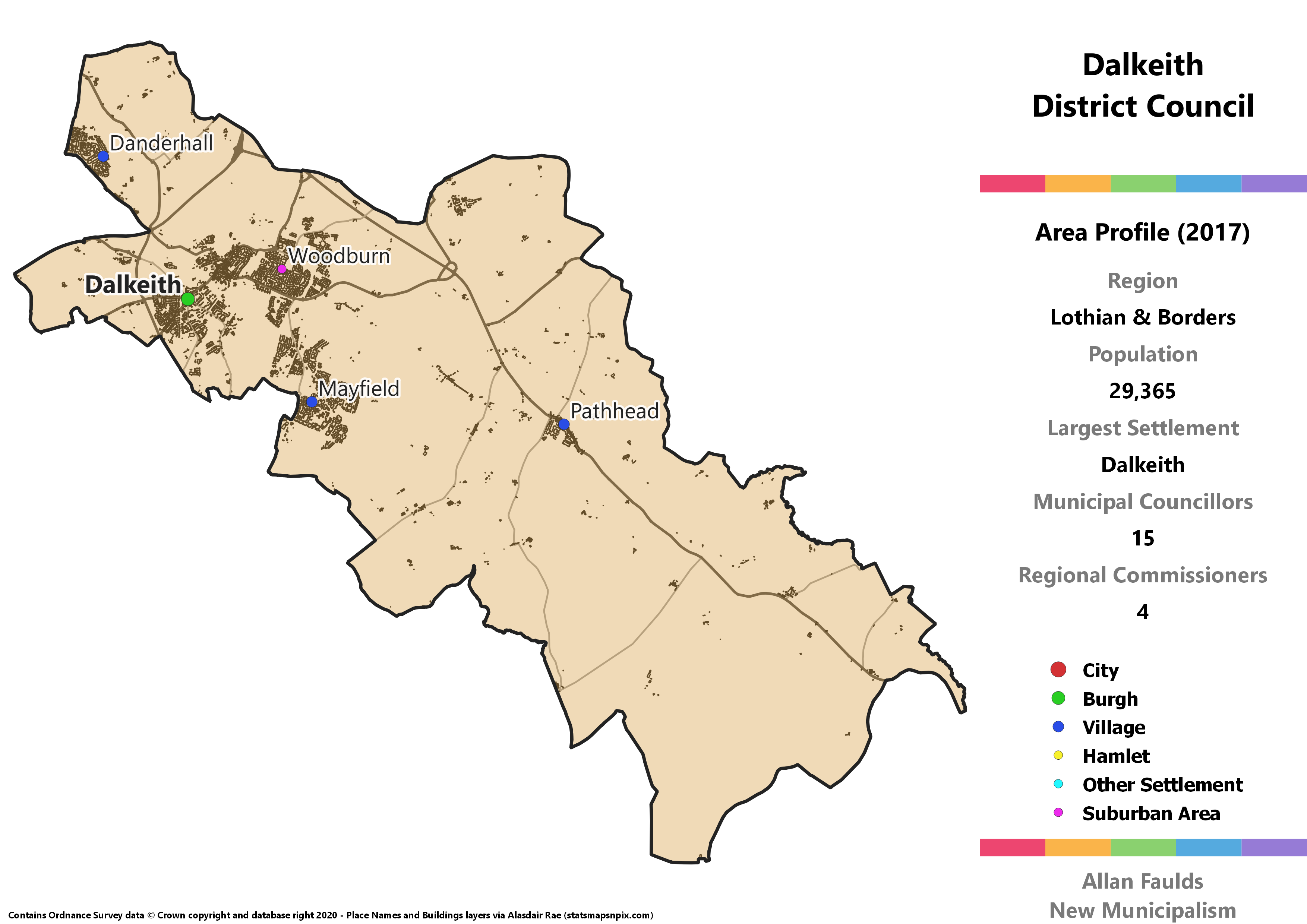
All of the Midlothian based Districts take the form of an urban core around a historic Burgh plus a large tract of sparsely populated countryside. Dalkeith is the hub for this one, alongside the neighbouring town of Mayfield, and flanked by the villages of Danderhall and Pathhead at either end of the District. In political terms, Dalkeith’s stand-out feature is being the only part of Midlothian to elect an Independent based on 2017 results.
Dunbar and North Berwick District
Area Profile (2017)
Population: 23,327
Largest Settlement: Dunbar
Municipal Councillors: 13
Regional Commissioners: 4
Municipality Description
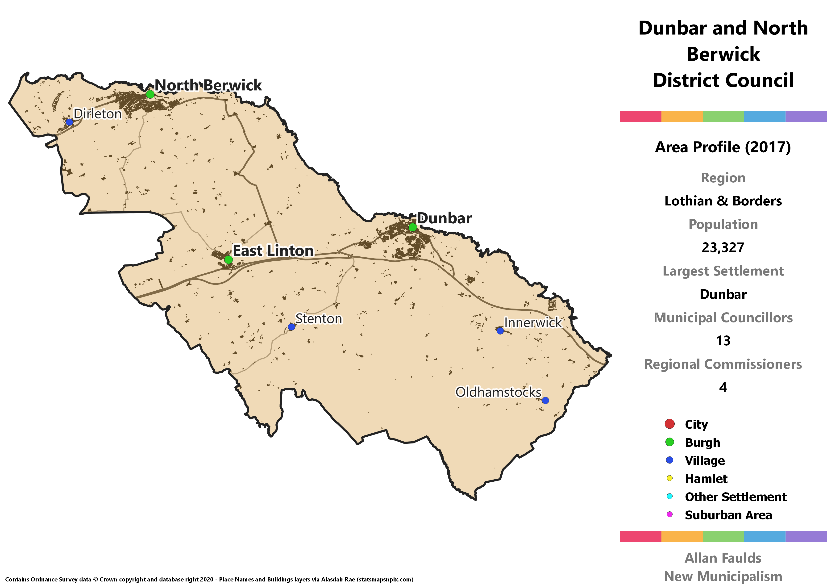
Neighbouring Berwickshire just isn’t allowed to have any towns called Berwick in it, as Dunbar and North Berwick makes up the eastern portion of the current East Lothian. In addition to those two major towns, East Linton also used to be a Burgh before the 1973 Act, but it’s very small by today’s standards.
This would be the only municipality in the Lothian part of the Region to give the Conservatives rather than the SNP or Labour the lead based on 2017 results. It’d also be one side of a Green councillor bookend in the East Lothian municipalities.
Ettrick and Lauderdale District
Area Profile (2017)
Population: 35,330
Largest Settlement: Galashiels
Municipal Councillors: 19
Regional Commissioners: 5
Municipality Description
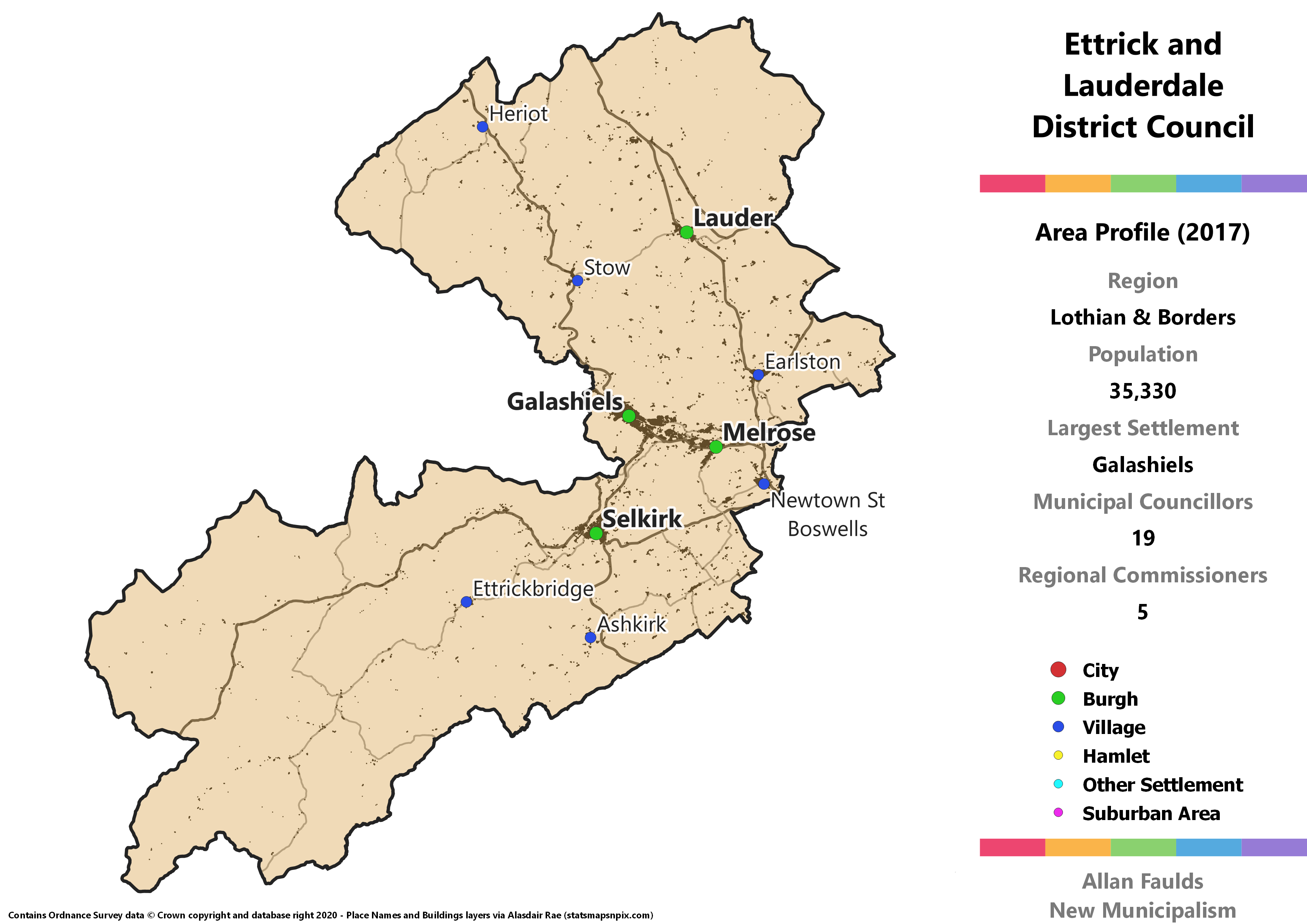
Something of a Frankenstein’s Monster, Ettrick and Lauderdale is pieced together with bits from no less than four historic counties. That’s partly why it has this slightly bizarre double-lobed shape, though some of that is also down to my having used wards as building blocks, which have narrowed the “neck” compared to the 1973 Act’s District of the same name.
The bulk of the population and the southern lobe come from Selkirkshire, including the former Burgh of Selkirk itself and the major town of Galashiels. Melrose and Newtown St Boswells in the south east come from Roxburghshire. The Lauderdale area in the north west, around the Leader Water (yes, the spelling is different) and the historic Burgh of Lauder are from Berwickshire. Finally, the north western component around Stow and Heriot is from Midlothian. Phew!
Linlithgow and Broxburn District
Area Profile (2017)
Population: 35,807
Largest Settlement: Linlithgow
Municipal Councillors: 19
Regional Commissioners: 5
Municipality Description
Covering the northern portion of the current West Lothian Council, the named towns of Linlithgow and Broxburn sit at opposite corners of the District, with some smaller villages in between. Linlithgow was its own Burgh before the 1973 Act, but although still a sizeable town it’s much to small to stand alone in this project.
Once 2017 results in the area are extrapolated out to the District, this would be the only West Lothian municipality that would elect a Green councillor.
Livingston Burgh
Area Profile (2017)
Population: 67,932
Largest Settlement: Livingston
Municipal Councillors: 27
Regional Commissioners: 8
Municipality Description
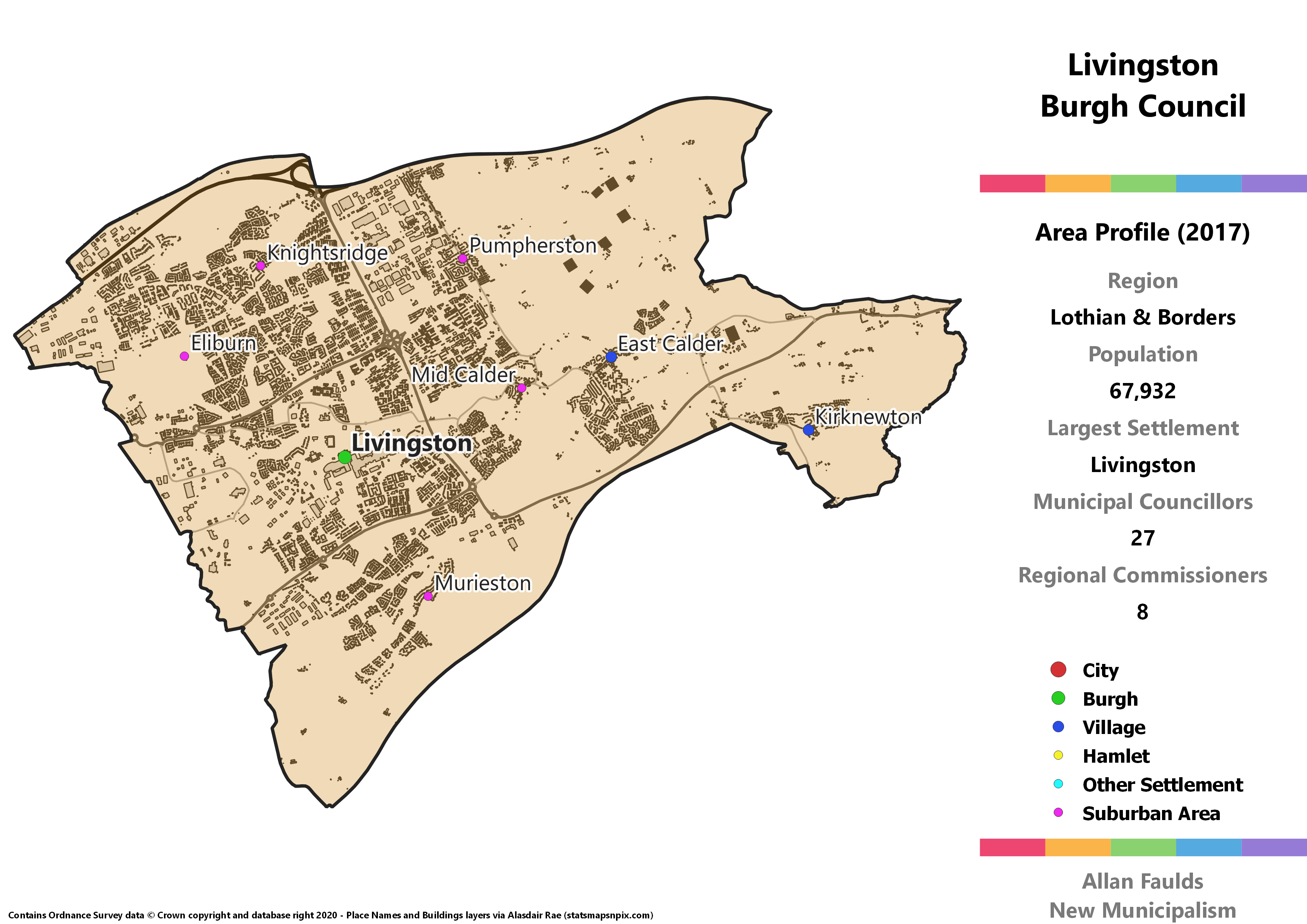
Formerly a very small village, Livingston was one of the post-war New Towns that expanded rapidly over the course of a couple of decades. Now one of the 10 largest settlements in Scotland, it wasn’t until the late 60’s that it was formally established and saw its first residents. That means despite the size it is now, it never qualified for its own Burgh before the 1973 Act did away with them. In this project it’d more than qualify for the status.
In addition to Livingston itself, the Burgh includes the villages of Mid Calder, East Calder and Kirknewton, which would otherwise have been a bit orphaned. Livingston straddles the historic boundary between West and Midlothian, which (largely) followed the course of the River Almond, so if nothing else is said about the 1973 Act it at least ensured this town was all in one county.
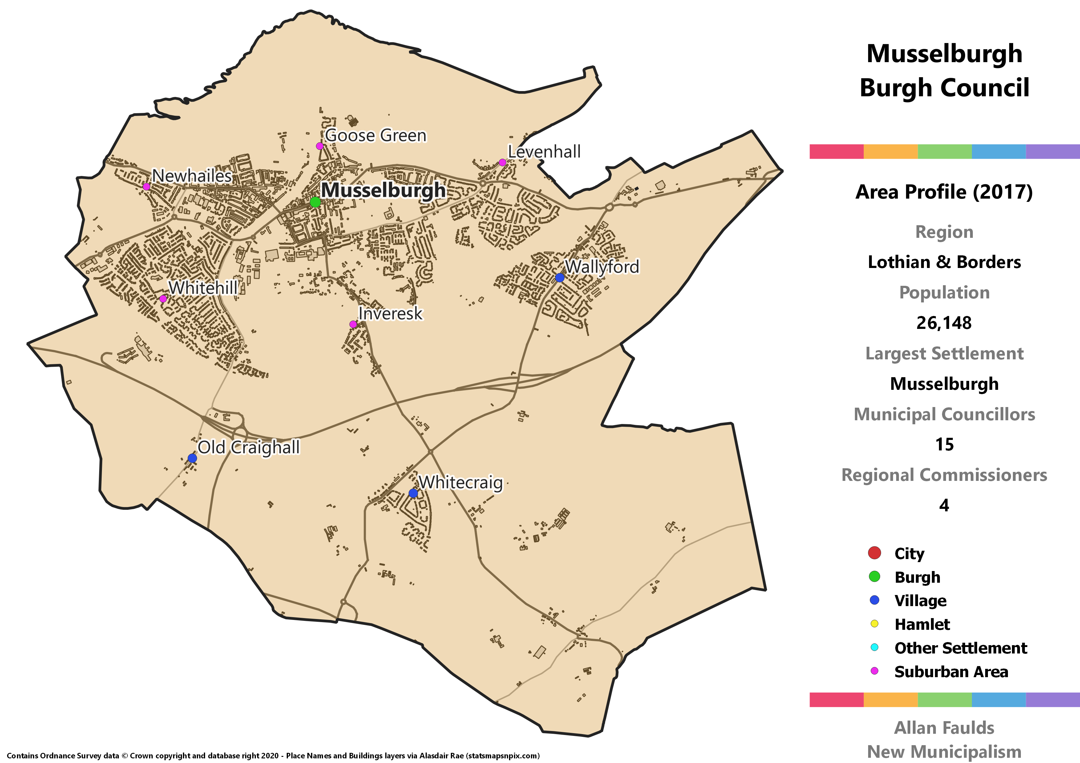
Musselburgh Burgh
Area Profile (2017)
Population: 26,148
Largest Settlement: Musselburgh
Municipal Councillors: 15
Regional Commissioners: 4
Municipality Description
Okay so it might be faintly silly to say “Musselburgh Burgh” but convention, see? Anyway, this is an easy Burgh to justify given the solid size of the town, though it has now grown to be contiguous with Edinburgh. In addition to Musselburgh itself, the Burgh covers the smaller villages of Wallyford and Whitecraig. This whole area was part of Midlothian before the 1973 Act transferred it to East Lothian. With the kind of setup this project envisions, that distinction mostly ceases to matter.
Politically, Musselburgh is distinguished by being the only part of current East Lothian to have the SNP as the largest party when extrapolating from 2017 results. A Green councillor that bookends the party’s representation in East Lothian is also present.
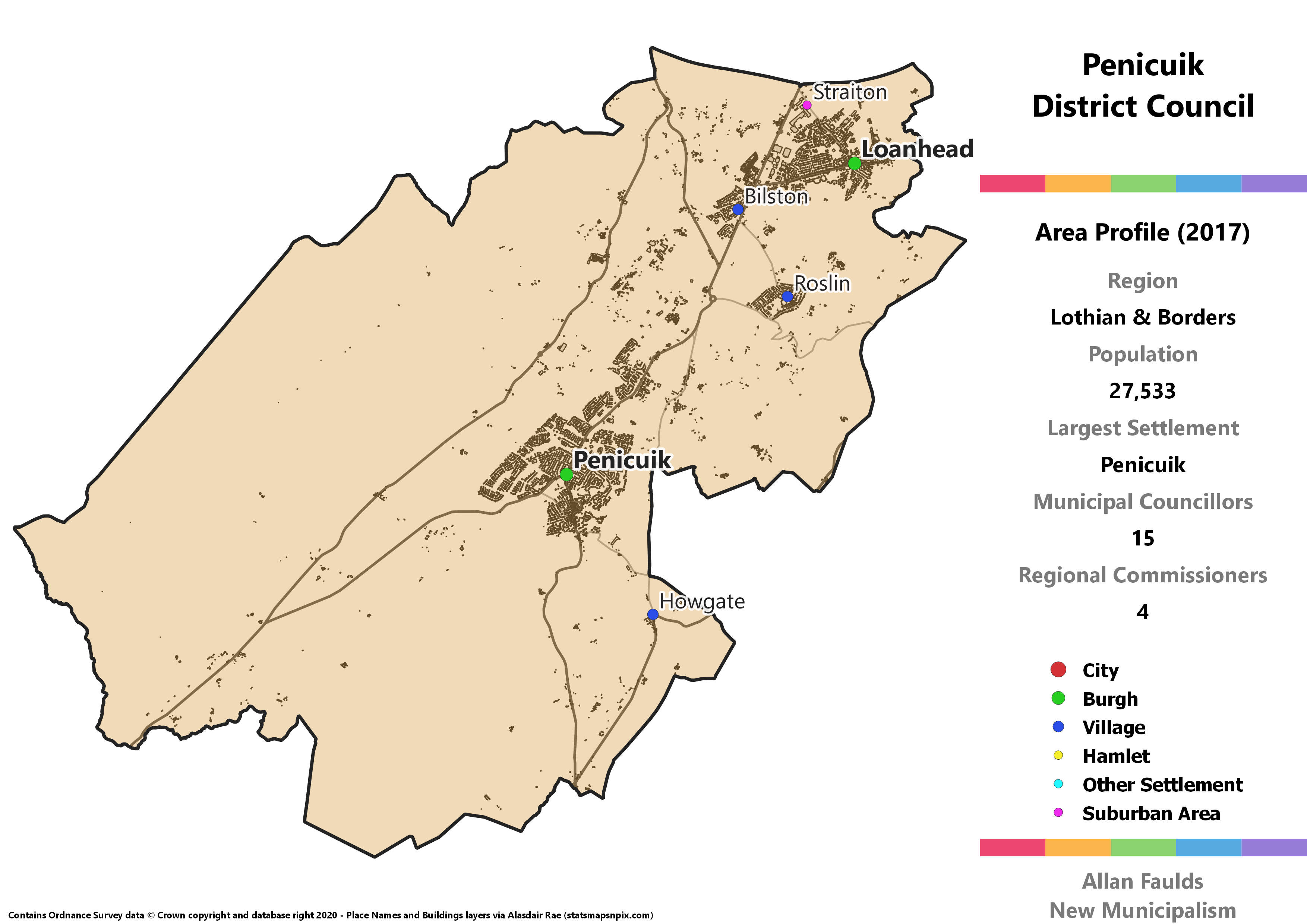
Penicuik District
Area Profile (2017)
Population: 27,533
Largest Settlement: Penicuik
Municipal Councillors: 15
Regional Commissioners: 4
Municipality Description
All of the Midlothian based Districts take the form of an urban core around a historic Burgh plus a large tract of sparsely populated countryside. Penicuik is the only one of those where that central Burgh isn’t part of the northernmost cluster of towns. However, it is the only one to contain a second old Burgh at Loanhead which is. In between the two is the notable village of Roslin, where Rosslyn Chapel has become something of a draw for silly Knights Templar conspiracies (and less silly tourism, it is very pretty) since the publication of The Da Vinci Code.
Whereas the other two Midlothian municipalities favour Labour, Penicuik would have seen the SNP as the largest party based on 2017 results. It’s a remarkably diverse District for its size and placement, notionally electing both a Green and the only Lib Dem in the Region outside of the Borders, giving all five major parties representation.
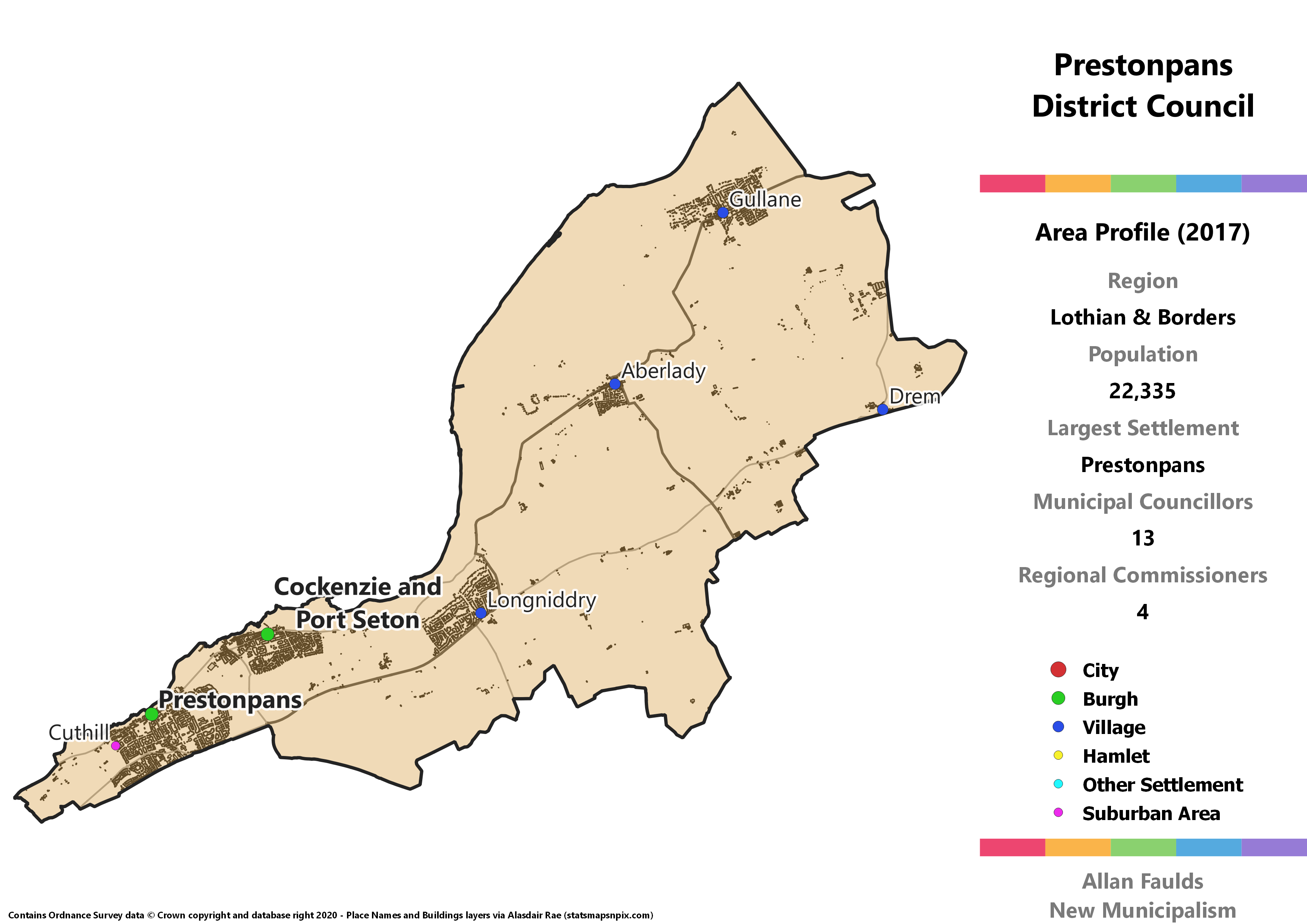
Prestonpans District
Area Profile (2017)
Population: 22,335
Largest Settlement: Prestonpans
Municipal Councillors: 13
Regional Commissioners: 4
Municipality Description
This District covers the eastern coastal stretch of the current East Lothian Council, starting at the major town and former Burgh of Prestonpans, passing another old Burgh at Cockenzie and Port Seton, then through Longniddry, Aberlady and Gullane. Much like how scone can be pronounced “scone” or “scone”, Gullane is confusing as it can be pronounced “Gullane” or “Gullane” (apologies to those whose brains haven’t previously been rotted by this ancient Scottish Twitter gag).
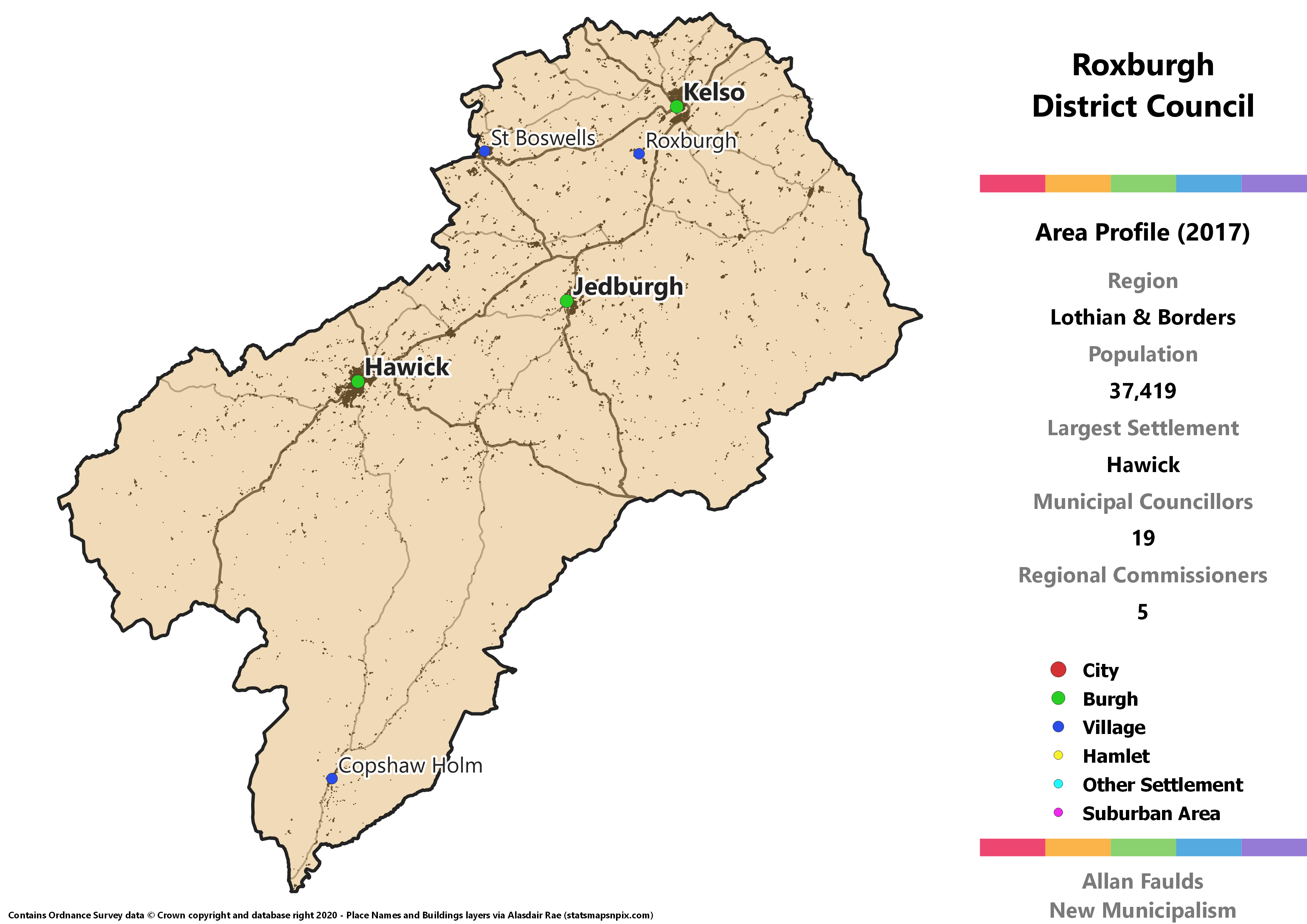
Roxburgh District
Area Profile (2017)
Population: 37,419
Largest Settlement: Hawick
Municipal Councillors: 19
Regional Commissioners: 5
Municipality Description
Whereas the rest of Scotland is content just to have its historic County Towns outgrown by other places in the same county, the Borders likes to take things to the extreme. If Berwickshire’s “isn’t even in the same country” wasn’t enough for you, how about Roxburghshire’s “doesn’t even exist anymore?” Strictly speaking, there is still a place called Roxburgh, and it’s highlighted on the map above. But it’s just a small village located some distance away from what was historically the major Burgh of Roxburgh, which disappeared hundreds of years ago. Now the major towns are at Hawick, Kelso and Jedburgh, with the latter now typically serving as the country town.
Compared to historic Roxburghshire, this District has the addition of a very small portion of Berwickshire just to the north west of Kelso. That came in the 1973 Act, which removed the Melrose and St Boswells areas into Ettrick and Lauderdale when creating the then-District. The ward boundaries I used here means a small portion of that area is reclaimed in the form of St Boswells, although the Newtown is not.
Although 2017 results indicate a Conservative majority on the Council, that’s very much driven by there being so many wasted votes for popular Independent candidates. I’d expect in an actual implementation there’d be a better spread of votes.
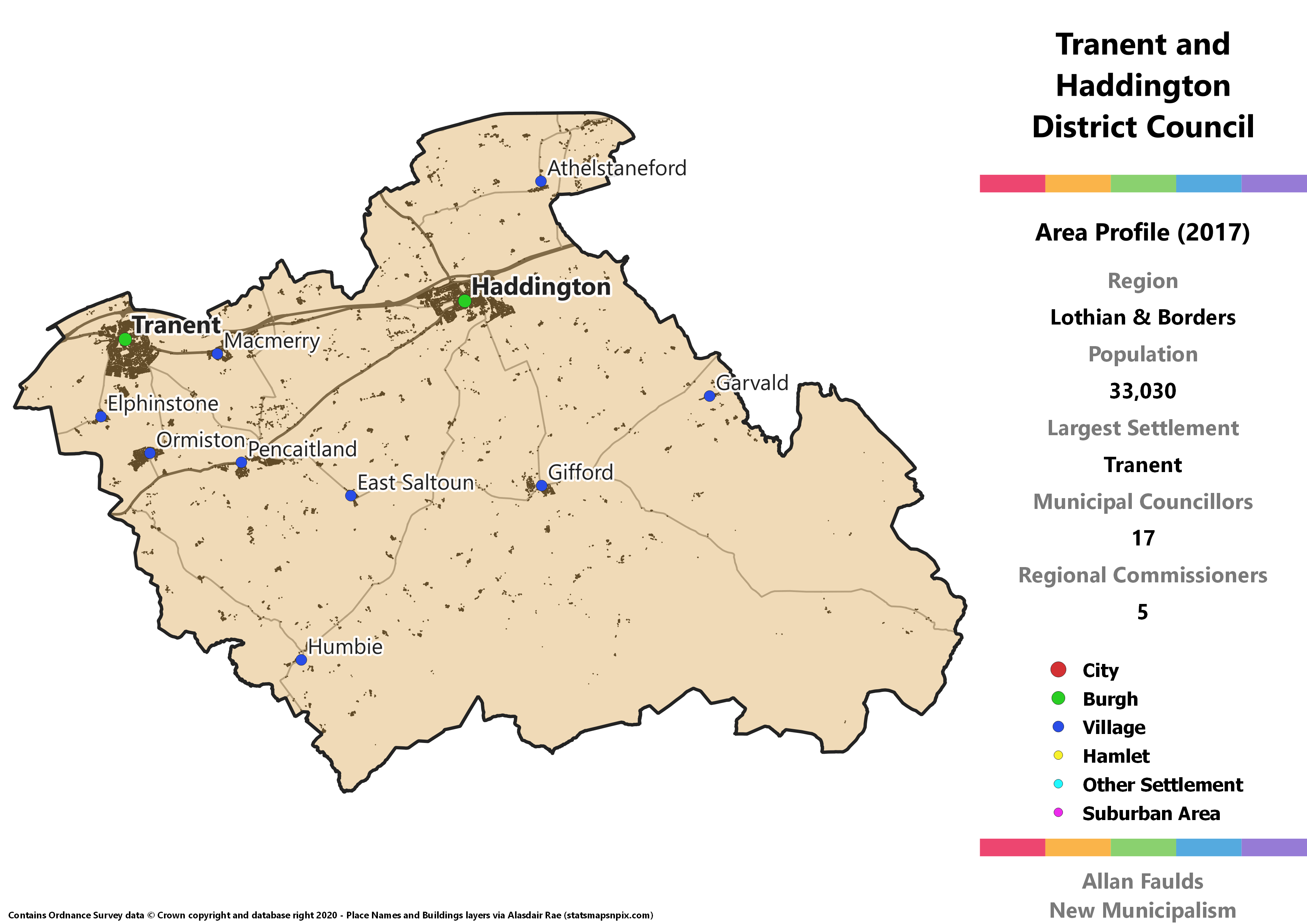
Tranent and Haddington District
Area Profile (2017)
Population: 33,030
Largest Settlement: Tranent
Municipal Councillors: 17
Regional Commissioners: 5
Municipality Description
Consisting of the inland portion of East Lothian, most of the population live in north and west of the District, especially the largest town at Tranent or the county town of Haddington. Apart from Gifford there aren’t many large villages to the south and east, which is mostly the Lammermuir Hills.
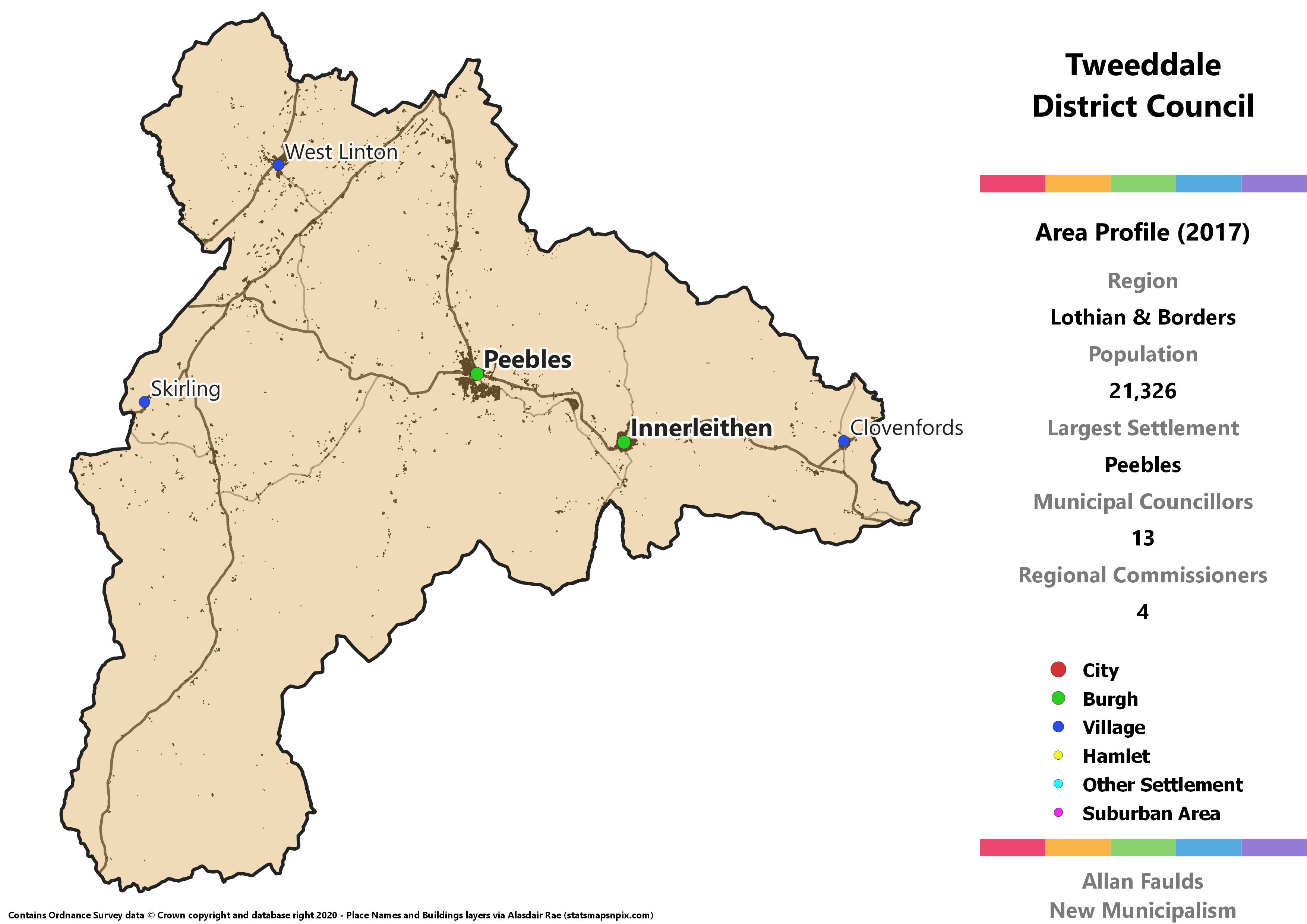
Tweeddale District
Area Profile (2017)
Population: 21,326
Largest Settlement: Peebles
Municipal Councillors: 13
Regional Commissioners: 4
Municipality Description
Of the three historic Borders counties, Tweeddale was the least affected by the 1973 Act – all it got was a name change away from Peeblesshire. That District was identical to the old county, bar the loss of Burgh status for Peebles and Innerleithen. This version though is slightly expanded with the area around Clovenfords, which is historically Selkirkshire and was in the Ettrick and Lauderdale District in 1973. It’s only ended up in this form of Tweeddale because I was using wards as my basis and by the time I’d realised the difference, it was a bit late to go back and excise a small area’s worth of votes. One for a future update, perhaps!
