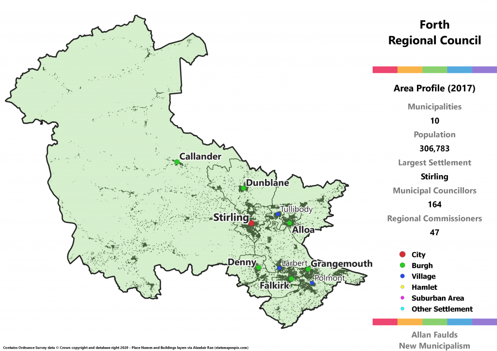
Forth Region Overview
Key Statistics
Municipalities: 10
Population: 306,783
Largest Settlement: Stirling
Municipal Councillors: 164
Regional Commissioners: 47
Region Description
The Forth Region is a combination of the current Stirling, Falkirk and Clackmannanshire Councils, plus a very small portion of West Dunbartonshire around Gartocharn. That makes the overall region an almost exact recreation of the 1973 Act’s Central Region which used those three fully included Council as its Districts. “Central” is a particularly bland name which is hard to connect with, so in the style of two other regions I opted to name this version after the major river that defines the area. The overlapping NHS Board already does so, going by “Forth Valley”.
Historically speaking, the bulk of the population of this region would have been in the counties of Stirling and Clackmannanshire. What is now Falkirk was traditionally part of Stirling, having grown enough over the 20th Century to begin being treated as standalone area. A large portion of Perthshire was transferred to Stirling under the 1973 Act, and accounts for much of the area of the region. A smaller portion was also transferred to Clackmannanshire. Presaging my eventual inclusion of Gartocharn, a very small portion of Dunbartonshire around the hamlet of Croftamie was also added in that Act.
Extrapolating from the 2017 results, Forth is expected to have representation from all five major parties in Scotland. As with much of the Central Belt, the SNP have displaced Labour as the leading party here. The Conservatives have also moved upwards into second, having managed to grow substantially beyond what would be their traditional base here in the rural part of what is now Stirling.
Alloa Burgh
Area Profile (2017)
Population: 20,738
Largest Settlement: Alloa
Municipal Councillors: 13
Regional Commissioners: 4
Municipality Description
Clackmannanshire may be the smallest of the current Council areas by population, but that doesn’t mean it goes un-split here. Alloa is just the right size to once again have its own Burgh council, when you consider it has mostly absorbed neighbouring Sauchie and Fishcross.
In the actual local elections in 2017, the Greens very narrowly missed out on a councillor in one of the wards covering Alloa. Extrapolating out to the full Burgh council here and they’d have easily picked up a seat.
Braes District
Area Profile (2017)
Population: 32,017
Largest Settlement: Polmont
Municipal Councillors: 17
Regional Commissioners: 5
Municipality Description
The overwhelming majority of the population of the proposed Braes district can be found in the tight cluster of villages to the east of Falkirk. Although Falkirk’s boundaries now run right up against them, it’s a big enough town I didn’t want to add to it. This does also cover the countryside to the south of Falkirk, where the only major settlements are the villages of Slamannan and Avonbridge.
Although some of these villages suffer from high levels of deprivation, for the most part the area is relatively affluent. It’s not too surprising then that this would be the only part of the current Falkirk council where extrapolating from 2017 results shows a Conservative lead. It’s a very narrow lead however, that has them tied for seats with the SNP.
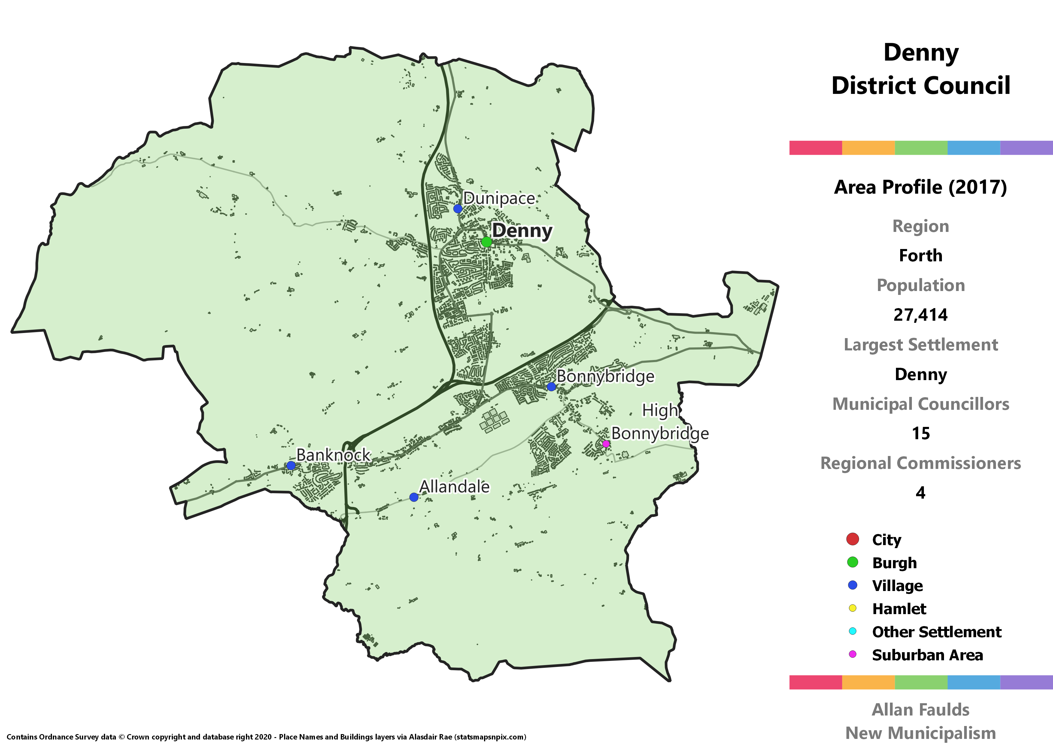
Denny District
Area Profile (2017)
Population: 27,414
Largest Settlement: Denny
Municipal Councillors: 15
Regional Commissioners: 4
Municipality Description
Centred on the former Burgh of Denny (and Dunipace), this district basically covers all the towns and villages to the west of Falkirk. This one is otherwise quite unremarkable – it’s the right size and shape to be its own municipality, but no distinguishing features.
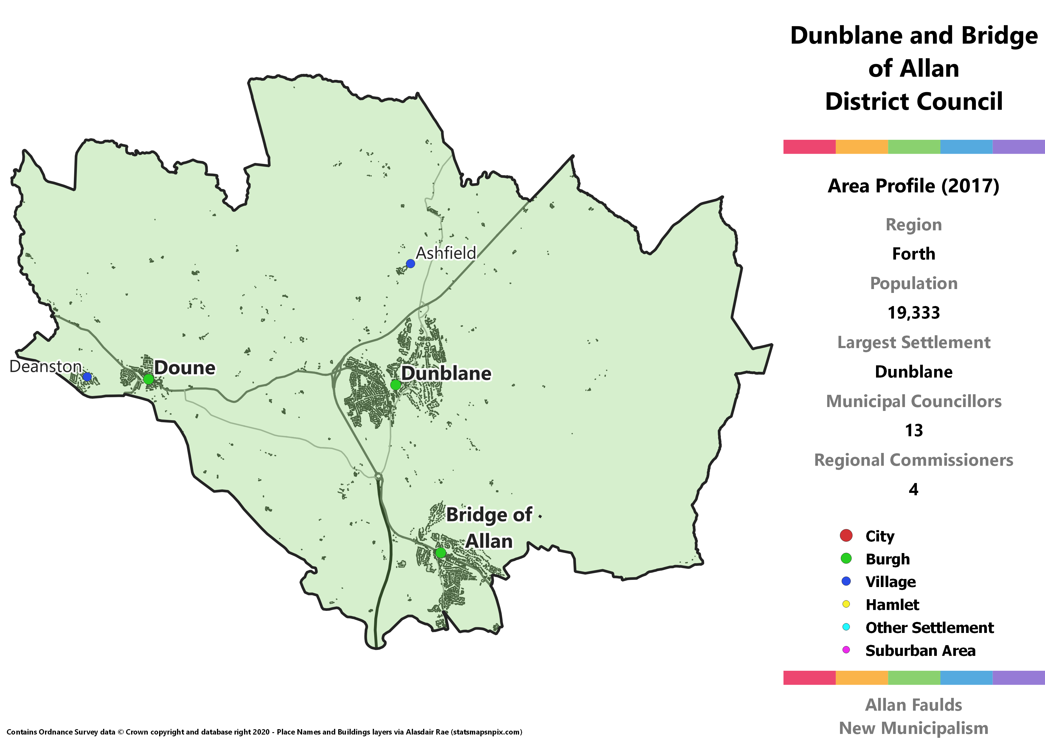
Dunblane and Bridge of Allan District
Area Profile (2017)
Population: 19,333
Largest Settlement: Dunblane
Municipal Councillors: 13
Regional Commissioners: 4
Municipality Description
Dunblane and Bridge of Allan comes in slightly below the 20,000 target, but it’s reasonable to let that slide here. Incorporating no less than three historic Burghs, the two in the name plus Doune, this makes for a pretty sensible municipality I think. Apart from Bridge of Allan, this area is all part of that chunk of Perthshire that was transferred into Stirling under the 1973 Act.
This would be the most diverse municipality in the Forth region according to an extrapolation of 2017 results. Each of the five Holyrood parties would have at least one councillor here. The Green would be representative of reality as this is where their one existing Stirling councillor is, whilst this would be the only place in the region with a Lib Dem councillor.
Endrick and the Trossachs District
Area Profile (2017)
Population: 23,313
Largest Settlement: Callander
Municipal Councillors: 13
Regional Commissioners: 4
Municipality Description
Whereas the rest of the Forth region is highly urbanised and/or formerly industrial, Endrick and the Trossachs is a massive rural district covering a larger area than the rest of the region put together. It accounts for the bulk of the former Stirling county as well as most of the area of Perthshire that was transferred into Stirling in 1973. This is also where the River Forth rises, with most of its length having formerly been the boundary between those two counties.
Callander, in the formerly Perthshire end, is the most populous individual town, but the continuously Stirling bit at the south is home to a large number of reasonably populous villages. It’s also absorbed the area around Garocharn from the current West Dunbartonshire, which adds to a small chunk at Croftamie that was also Dunbartonshire before 1973.
Politically the Conservatives are extremely strong in this area, to the extent that they won a hair over half the vote here in 2017, which naturally translates to a majority of seats on the hypothetical council.
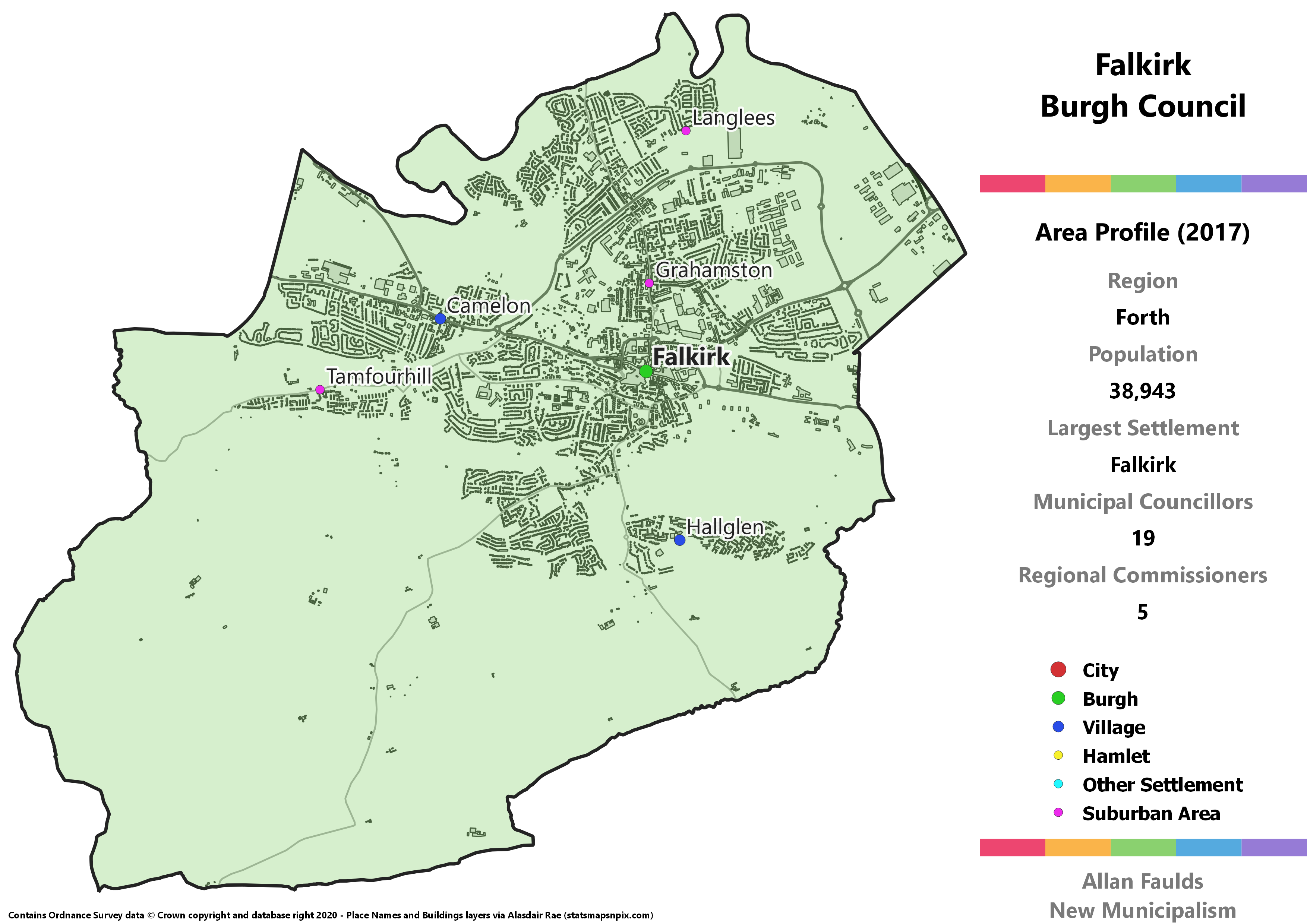
Falkirk Burgh
Area Profile (2017)
Population: 38,943
Largest Settlement: Falkirk
Municipal Councillors: 19
Regional Commissioners: 5
Municipality Description
Falkirk is your standard large town that used to have it’s own Burgh council, before the 1973 Act went a bit overboard with its reforms. Like many parts of the Central Belt, it forms a continuous urban area with surrounding towns and villages, but it’s quite neatly defined by roads and the River Carron so is easy to pick back out. Compared to the historic Burgh, this version has a standard additional chunk of rural area just because it has to go somewhere and wards were used as building blocks.
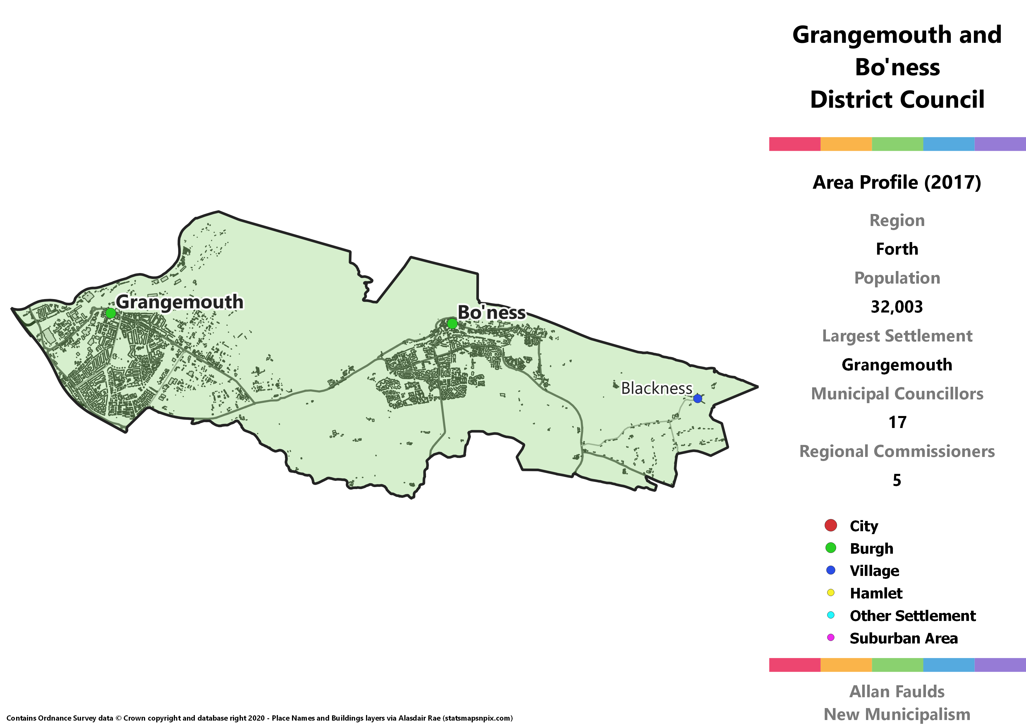
Grangemouth and Bo'ness District
Area Profile (2017)
Population: 32,003
Largest Settlement: Grangemouth
Municipal Councillors: 17
Regional Commissioners: 5
Municipality Description
This district combines the former Burghs of Grangemouth and Bo’ness with the small village of Blackness and associated communities. This whole area is part of the current Falkirk Council, but historically the River Avon was the dividing line between the counties of Stirling and West Lothian. Bo’ness was shifted out of West Lothian as a result of the 1973 Act for whatever reason, and I’ve let that change lie here.
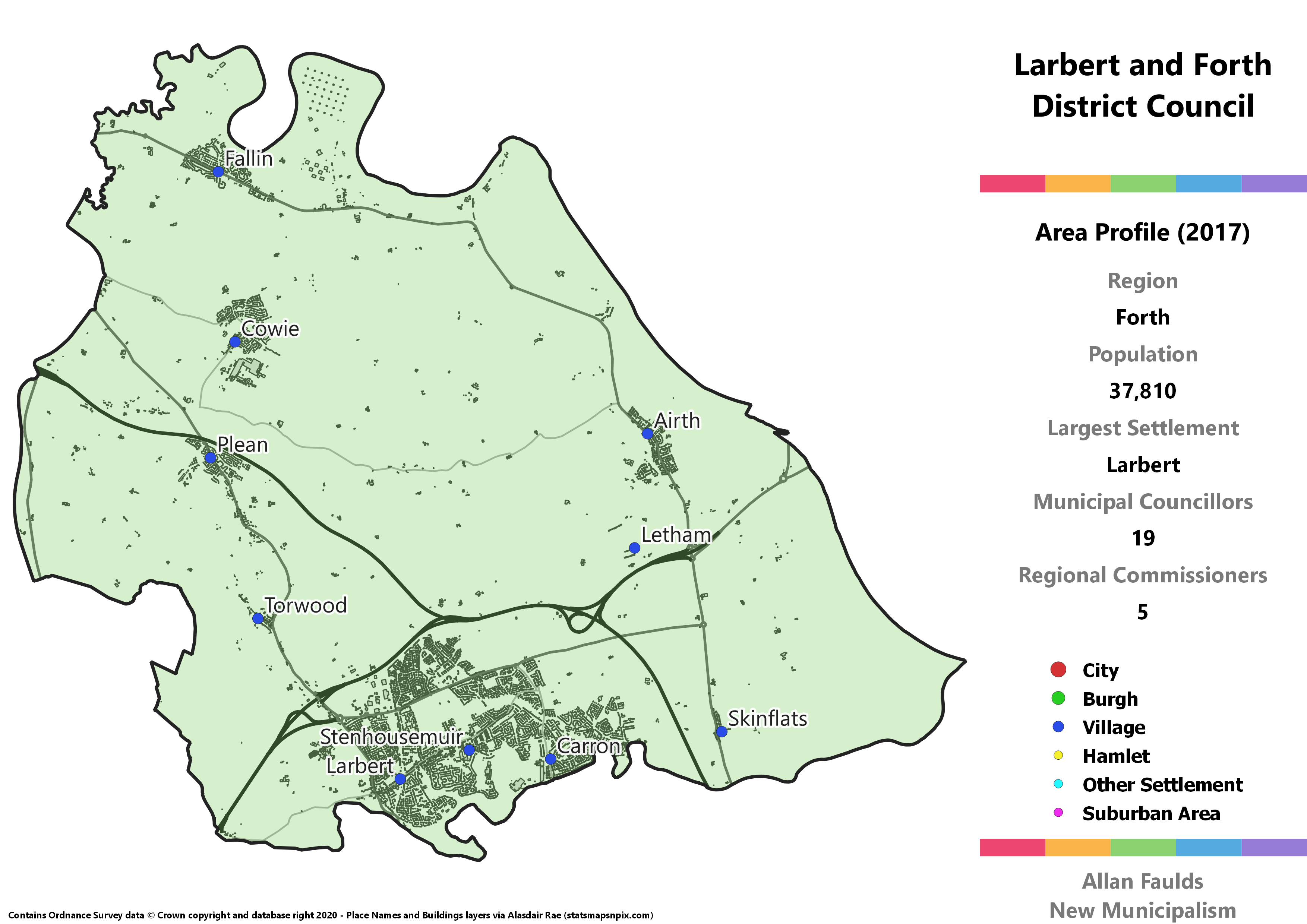
Larbert and Forth District
Area Profile (2017)
Population: 37,810
Largest Settlement: Larbert
Municipal Councillors: 19
Regional Commissioners: 5
Municipality Description
Larbert and Forth encompasses all the towns and villages in between Stirling and Falkirk. The area around Larbert, which includes Stenhousemuir, Carron and Carronshire is these days effectively the urban extension of Falkirk north of the River Carron. In this project however that’s no reason not to separate the two. Some other villages from the current Falkirk council, most notably Airth, are combined with the large Stirling villages of Fallin, Cowie and Plean and are what contribute the “Forth” part of the name.
Of the municipalities that break existing Council boundaries, this is probably the neatest. This was all historically in the county of Stirling anyway, and the boundary which kept most of the villages in Stirling but put Airth in Falkirk seems highly arbitrary anyway.
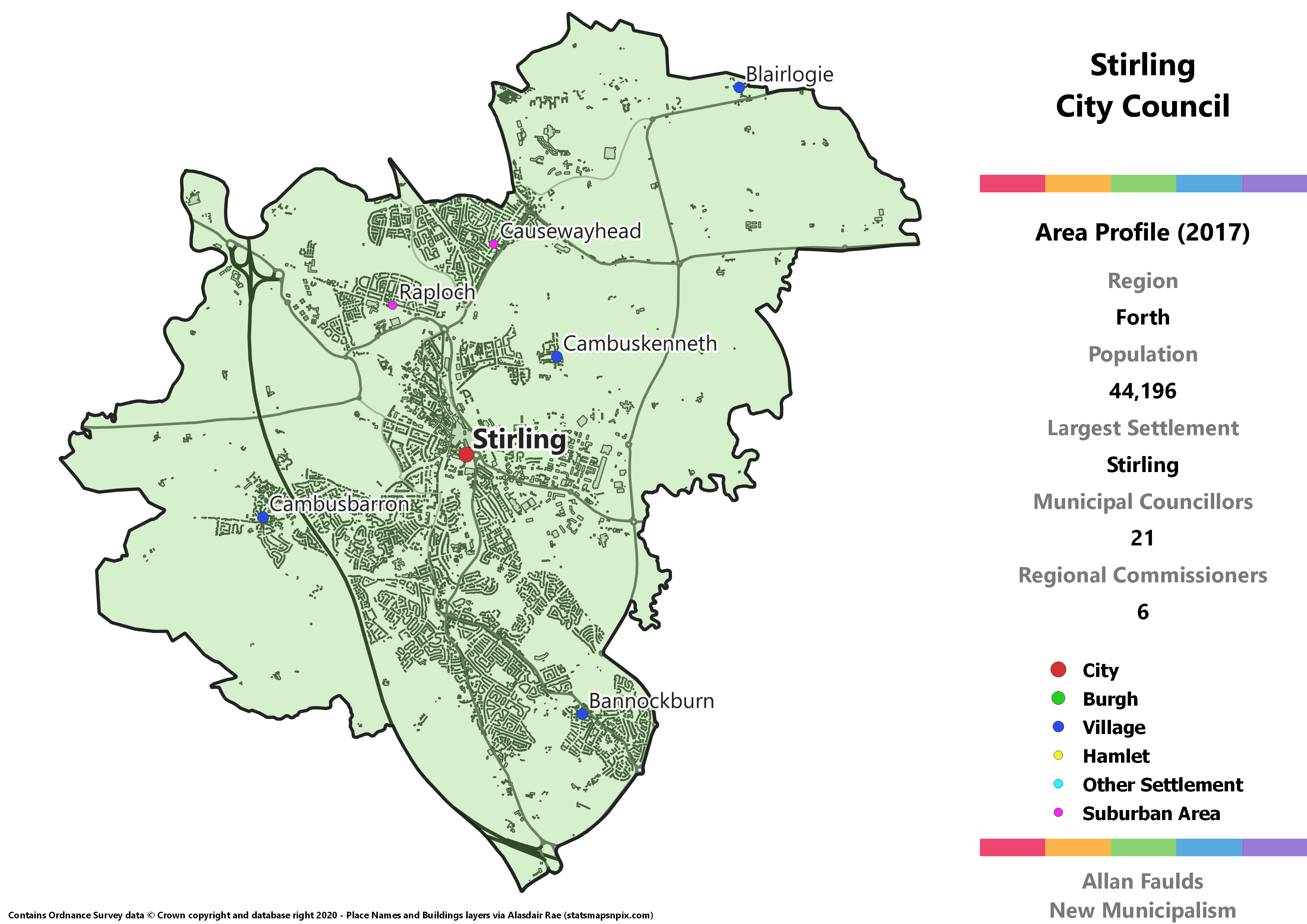
Stirling City
Area Profile (2017)
Population: 44,196
Largest Settlement: Stirling
Municipal Councillors: 21
Regional Commissioners: 6
Municipality Description
Scotland’s smallest (current) City, Stirling makes up for in history what it lacks in population. Basically everyone in Scotland will at some point have been taught about the Wars of Independence, including the battles of Stirling Bridge and Bannockburn, the latter now being a village that has merged into Stirling. It’s one of the most bizarre features of local government in Scotland that we have places that are formally and legally cities, but which don’t have a City Council to bear that status. That’s a silliness this project rectifies.
Alongside Bannockburn, this proposal has the city absorb a few other surrounding villages – Cambusbarron, Cambuskenneth, and (not-Cambus) Blairlogie. The latter in particular adds a rural stretch that had to go somewhere, and I didn’t feel was large enough to justify breaking historic county lines to put in with a bit of Clackmannanshire.
Like most Scottish cities, Stirling has a reasonable degree of political diversity, which means its one of those relatively rare municipalities estimated to have a Green councillor. On the other hand, it’s the only City Council not to have any Lib Dems.
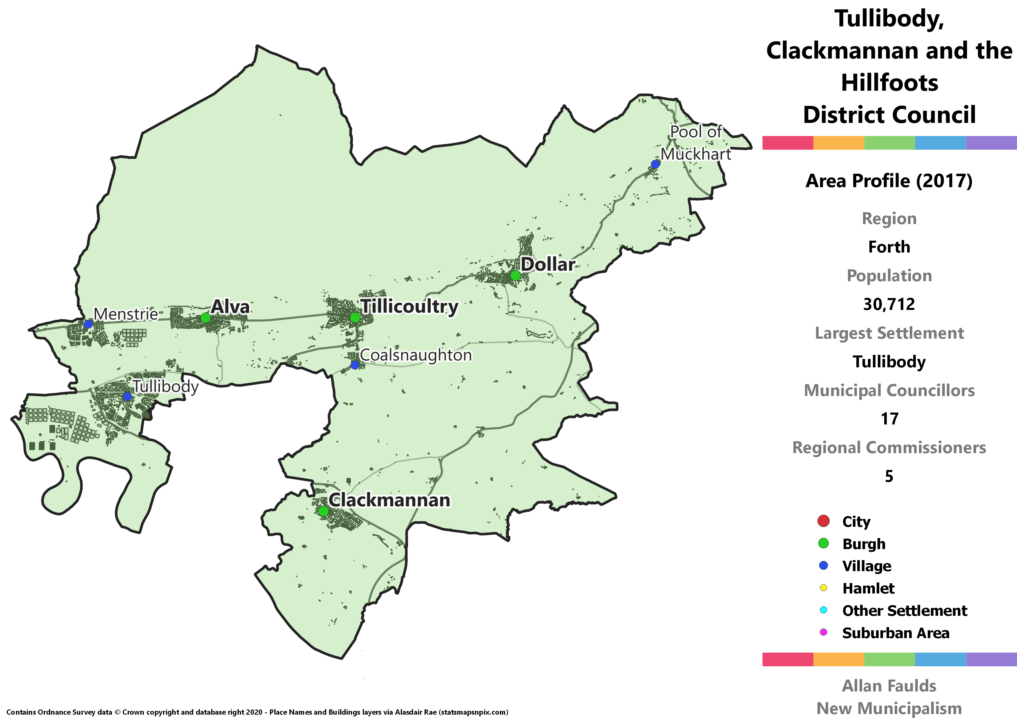
Tullibody, Clackmannan and the Hillfoots District
Area Profile (2017)
Population: 30,712
Largest Settlement: Tullibody
Municipal Councillors: 17
Regional Commissioners: 5
Municipality Description
Although I think giving Alloa it’s own Burgh is the sensible thing to do, it does leave the rest of the Wee County a bit strange. The remaining district effectively consists of an arm either side of Alloa containing Tullibody and Clackmannan, plus the string of Hillfoots villages in the North. That’s also what gave this district its unwieldy name as it didn’t feel right to leave any particular bit out. The only other particularly notable thing about this District is that the corner containing Pool of Muckhart was a transfer from Perthshire under the 1973 Act.
