Region Overview
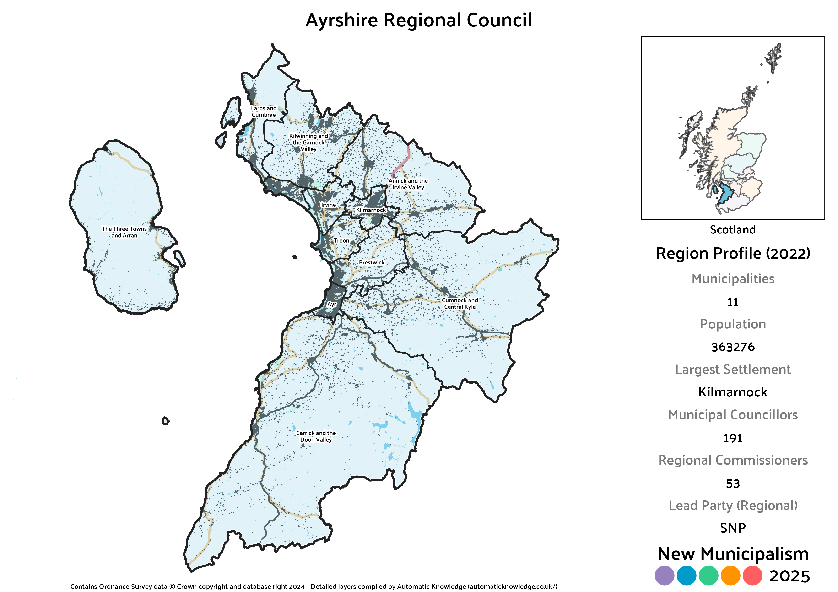
Key Statistics
Municipalities: 11
Population: 363,276
Largest Settlement: Kilmarnock
Municipal Councillors: 191
Regional Commissioners: 53
Description
On the face of it, Ayrshire is a very neat region, largely mapping to the historic county. It does have some very slight changes however. Some of those are reflective of reality, as both Arran and the Cumbraes have been associated with Ayrshire since Buteshire was dissolved entirely in the 1973 Act. One is an additional change, though one I made in the 2020 version of the project too, which is to snip Skelmorlie off and give it to the Clyde region. Compared to the previous version of this project, there are also some reasonably big changes to the proposed municipal boundaries.
The fact that Ayrshire was included as part of the Strathclyde region in the 1973 model was a big part of why that region was so oversized. Given the county’s significant population and geographic separation from Glasgow, I don’t think there was any real sense to absorbing it into a Glasgow-centric region. In addition, Ayrshire probably has one of the strongest regional identities in Scotland – if someone is from Ayrshire, they’ll usually let you know it. It therefore makes much more sense as a standalone region in its own right than attached to anywhere else. Unlike many other historic counties, Ayr itself hasn’t been clearly eclipsed by any other town, with Kilmarnock only pipping it to the largest settlement post by under 1,000 residents.
Mixing as it does some of Scotland’s big, traditionally industrial towns like Irvine and Kilmarnock with their affluent counterparts in Ayr and Largs, plus a significant rural component home to both farming and mining communities, there’s an almost dead heat between the Conservatives and Labour for second place behind the SNP. That tilts very slightly in the Conservatives favour, and indeed they are the only party to take any leads over the SNP in this region.
What really distinguishes Ayrshire from the rest of Scotland however is just how weak the Greens and Lib Dems are here. For both parties this is the proposed region that in the real 2022 elections they had the most candidate gaps in, especially the Greens. That ends up reflected in the fact they both only win seats in a handful of municipalities here, though my instinct is that had the Greens in particular been able to stand in a few more places (particularly Ayr itself) they’d have gotten in. Nonetheless, both are projected to win seats on the regional council.
Projected Overall Municipal Election Results (2022)
Votes
Seats
Projected Overall Regional Election Results (2022)
Votes
Seats
Note: Bear in mind that for the regional results on an individual municipality basis below, the final seat is allocated from a region-wide levelling process. This means that whilst the distribution of seats is correctly proportional across the whole region, that is not necessarily the case in an individual municipality. The party that won each municipality’s levelling seat is marked by an asterisk * next to their name on the Votes chart.
Annick and the Irvine Valley District
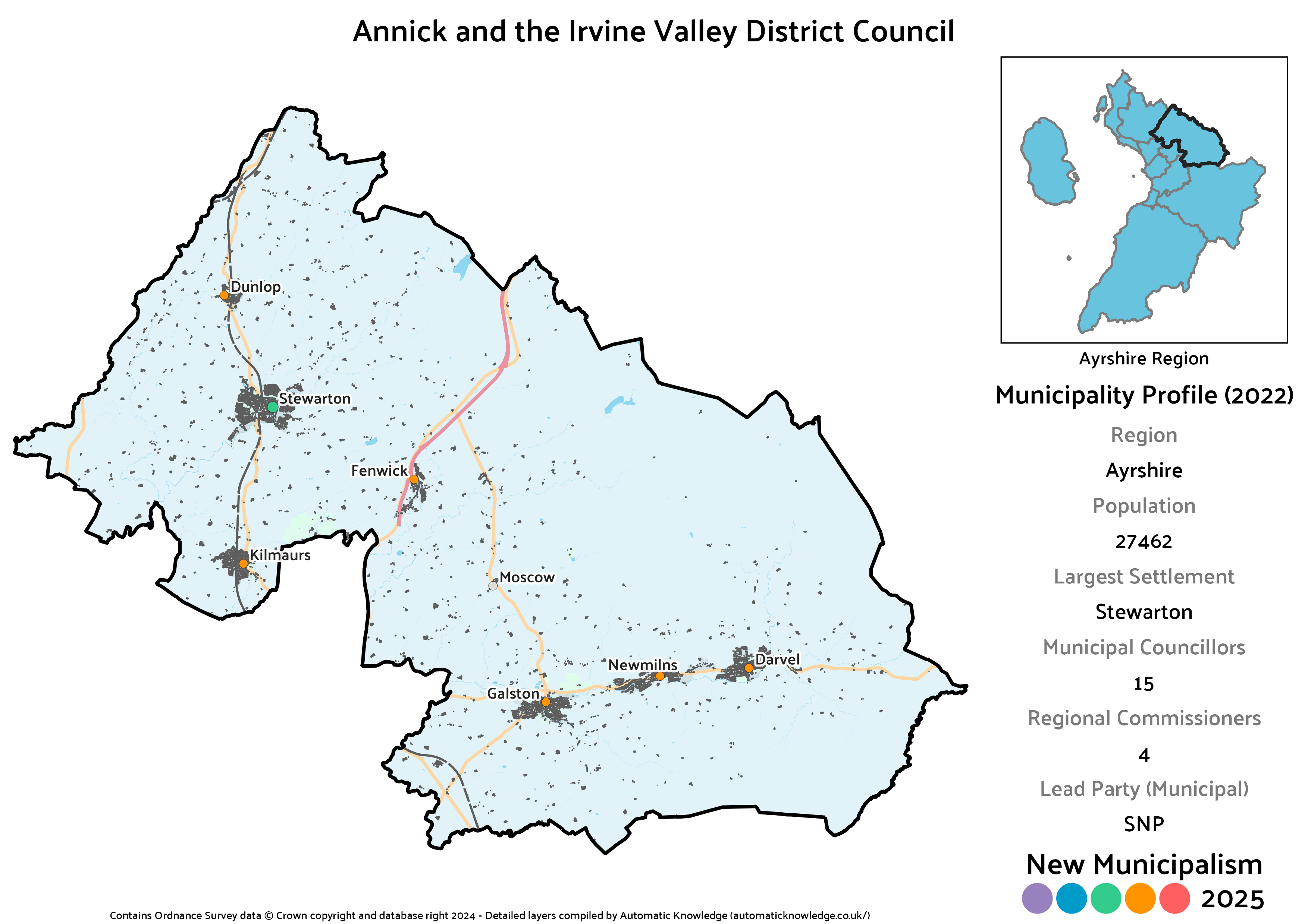
Key Statistics
Population: 27,462
Largest Settlement: Stewarton
Municipal Councillors: 15
Regional Commissioners: 4
Description
Annick and the Irvine Valley basically covers all the towns and villages surrounding Kilmarnock. The largest of these, Stewarton, lies to the north on the Annick Water that supplies part of the district name. Irvine Valley is the eastern portion, with the small historic burghs of Galston, Newmilns and Darvel. There isn’t necessarily brilliant integration between the two ends as it stands, but similarly neither portion would particularly benefit from their issues being secondary to those of Kilmarnock.
Echoing the regional level somewhat, this district ends up with a clear SNP lead then basically a tie between the Conservatives and Labour. They each win the same number of councillors, though the Conservatives have a slight vote advantage at the municipal level and Labour a slightly stronger one regionally. Two Independents, Ellen Freel (who was actually elected in the Annick ward) and John Cairns (unsuccessful in the same ward) would round out the council alongside the quirkily named Rubbish Party. That’s a one-woman outfit for Sally Cogley, who was successfully elected in the Irvine Valley in both 2017 and 2022. She had the joy of providing some comedic relief in the 2017 election, as her success meant the Rubbish Party elected as many councillors across the UK that day as UKIP, in the early days of their collapse, did.
Projected Municipal Election Results (2022)
Votes
Seats
Projected Regional Election Results (2022)
Votes
Seats
Ayr Burgh
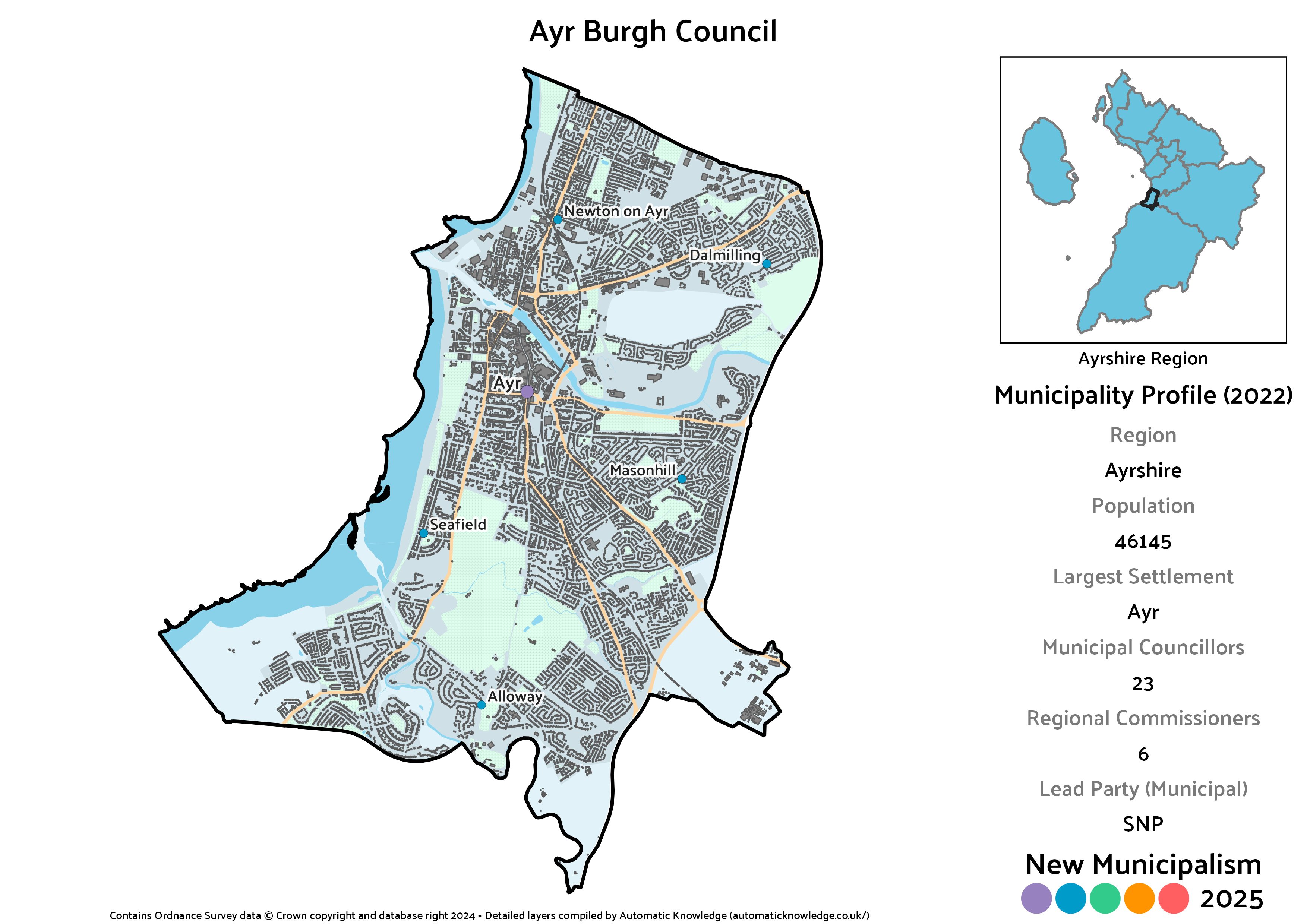
Key Statistics
Population: 46,145
Largest Settlement: Ayr
Municipal Councillors: 23
Regional Commissioners: 6
Description
Ayr is a very substantially sized town by Scottish standards, and is thus an obvious recipient of Burgh status in this project. Compared to some county towns, such as Renfrew and Lanark, Ayr has faired a little better and although it’s in competition with Kilmarnock for status as Ayrshire’s largest town, given it hasn’t suffered the indignity of being left behind in the population stakes. Although Ayr generally has a reputation as an affluent area, it is actually quite starkly divided, with areas in the north amongst the most deprived in Scotland and those in the south the most affluent.
That is reflected in the projected makeup of the municipal council, which effectively has two near-ties. The first is the SNP squeaking a narrow vote lead over the Conservatives, though they win as many councillors as one another. Labour and the sum and total for Independents is likewise a tie, though only Bob Shields (Ayr West, who accounts for 10% of the vote just by himself) would be elected from the latter group, as he was in reality. The Lib Dems fall very slightly below the threshold to win seats, whereas had the Greens stood I’m relatively confident based on 2021 results they’d have scraped by.
Despite not making it onto the municipal council, the Lib Dems do take the levelling seat for the regional commissioners, in part due to benefitting quite significantly from Independent transfers in my reallocation process. Those transfers most strongly benefit the Conservatives however, which gives them an actually quite comfortable lead in vote terms over the SNP on that side of results.
Projected Municipal Election Results (2022)
Votes
Seats
Projected Regional Election Results (2022)
Votes
Seats
Carrick and the Doon Valley District
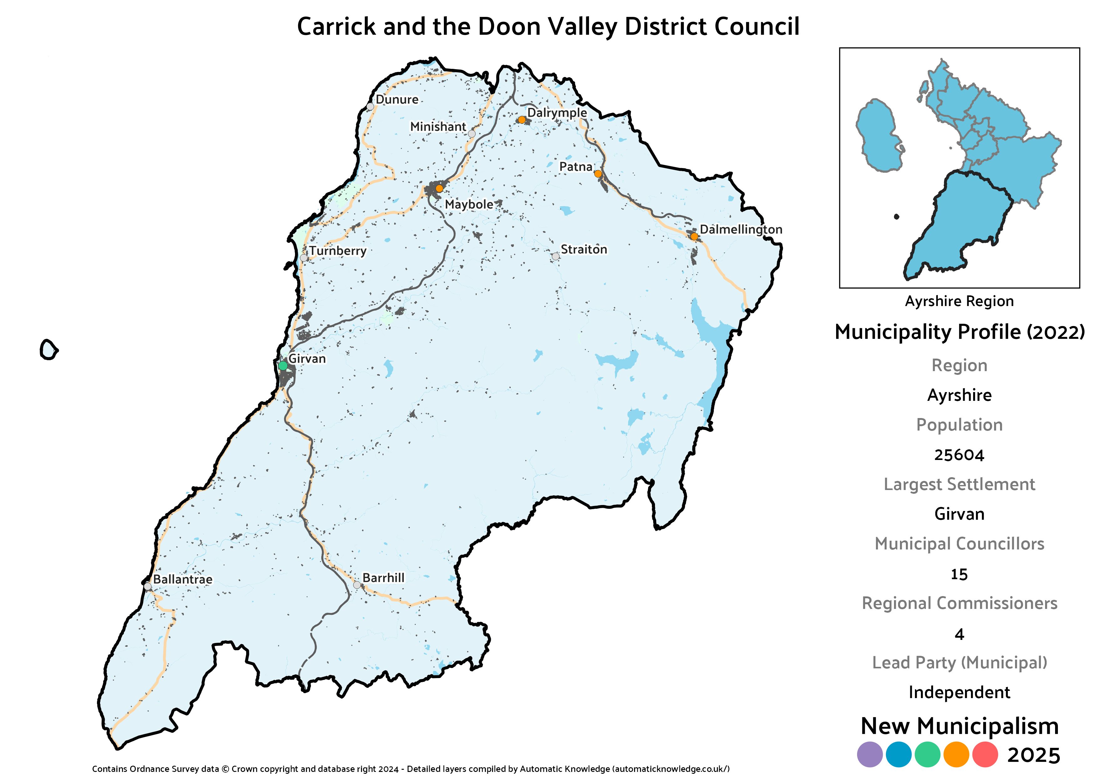
Key Statistics
Population: 25,604
Largest Settlement: Girvan
Municipal Councillors: 15
Regional Commissioners: 4
Description
Carrick and the Doon Valley replaces the district I’d simply titled Carrick in the 2020 version. In truth, that extended slightly beyond Carrick, traditionally defined as the portion of Ayrshire south of the Doon, by including an awkward lobe to the east of Ayr. That’s been snipped off here, but in its place the whole Doon Valley has been brought in. It wouldn’t make sense these days to use the river itself as a sharp boundary, so instead communities that lie on or to the north of it such as Dalmellington, Patna and Dalrymple are combined with Carrick itself to make what should still be a relatively cohesive unit.
Each of the areas making up this district was home to a strong Independent candidate in 2022 (Alec Clark in Girvan and South Carrick; Drew Filson in Doon Valley; and Brian Connolly in Maybole, North Carrick and Coylton, in order of total vote), meaning that their combined vote tally is higher than any of the political parties. Obviously they can’t fill all of the resulting seats, with the SNP and Conservatives instead placing as joint leaders – in terms of votes, the SNP squeak ahead on the municipal vote but the Conservatives on the regional. Labour pick up what remains, with what seems like one of their weakest municipalities in the region actually looking relatively strong once Independent votes are redistributed.
Projected Municipal Election Results (2022)
Votes
Seats
Projected Regional Election Results (2022)
Votes
Seats
Cumnock and Central Kyle District

Key Statistics
Population: 34,708
Largest Settlement: Cumnock
Municipal Councillors: 17
Regional Commissioners: 5
Description
Cumnock and Central Kyle quite neatly sums up what this one covers, an inland stretch of Ayrshire that doesn’t quite touch either of the rivers Doon or Irvine with Cumnock as the largest settlement. In the 2020 version of this project, most of this area had been tied to the Doon Valley whilst Coylton was an awkward chunk attached to Carrick. This would be a more sensible arrangement, with other towns and villages including Mauchline, Auchinleck, Drongan, Ochiltree, Muirkirk and New Cumnock lying along a cross radiating from Cumnock itself.
Cumnock in particular has remained a strong area for Labour, which is why they would be estimated to be nipping at the SNP’s heels here in vote terms, and tied with them on seats. Indeed, this would be Labour’s strongest municipality in the region. The Conservatives would be the only other party bloc, joined by a single Independent in the form of David Shaw, who fell short in the Ballochmyle ward in the actual election.
Projected Municipal Election Results (2022)
Votes
Seats
Projected Regional Election Results (2022)
Votes
Seats
Irvine Burgh
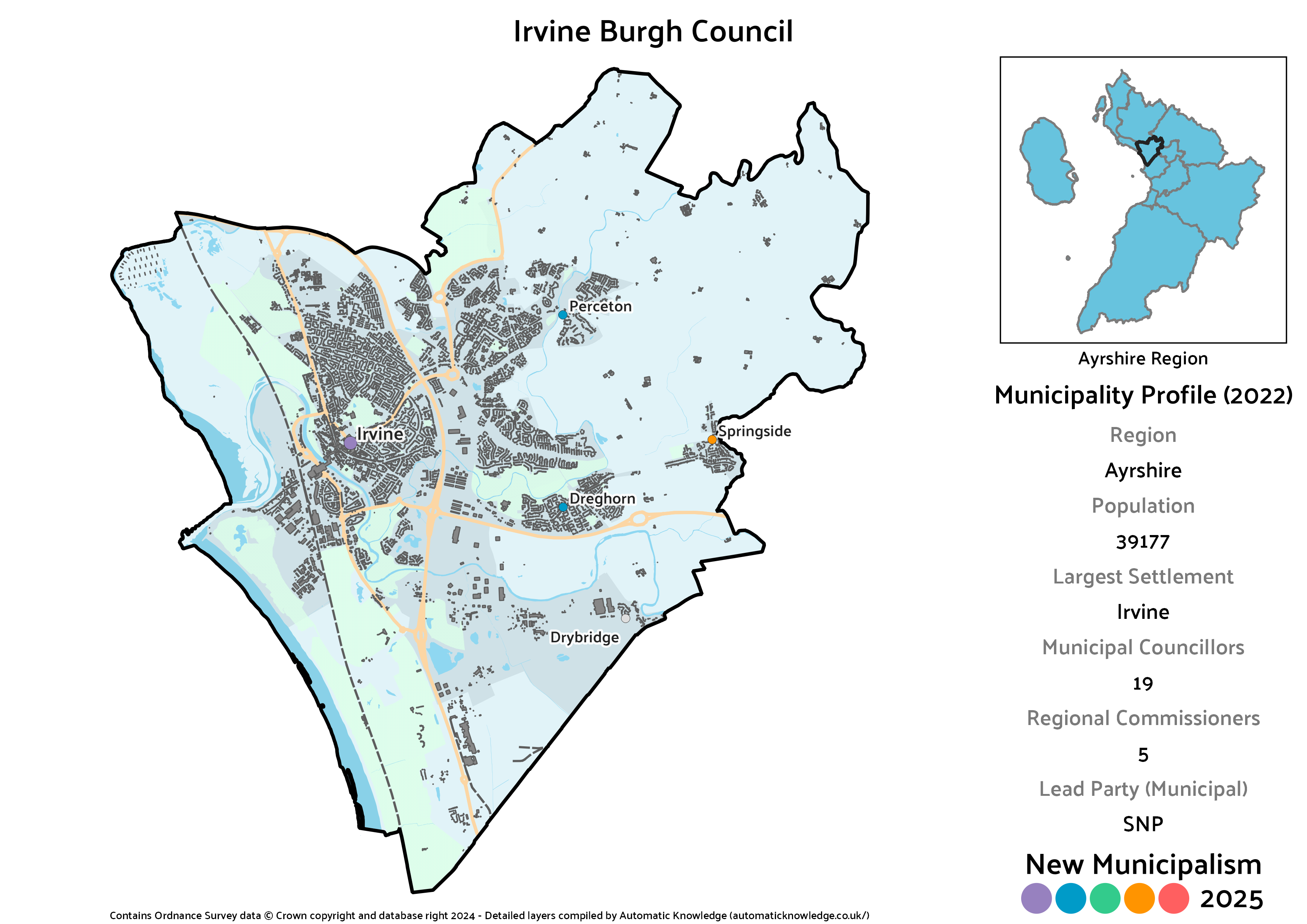
Key Statistics
Population: 39,177
Largest Settlement: Irvine
Municipal Councillors: 19
Regional Commissioners: 5
Description
The current administrative centre of North Ayrshire, Irvine is a good sized town that makes for an obvious burgh. Although it’s formed around a long-standing and long-established core, Irvine expanded rapidly in the mid-20th century when it was designated one of Scotland’s New Towns. The urban area extends to include the village of Dreghorn, the birthplace of former First Minister Nicola Sturgeon, and the municipality also takes in less firmly attached villages at Springside and Dreghorn.
The SNP would be the largest party on the burgh council, and as one of very few places in Ayrshire the Greens stood any candidates in 2022, they also project to a single seat by virtue of there being so many up for grabs. Their combined tally would be one short of the total won by the somewhat more evenly balanced Labour and Conservative blocs.
Projected Municipal Election Results (2022)
Votes
Seats
Projected Regional Election Results (2022)
Votes
Seats
Kilmarnock Burgh
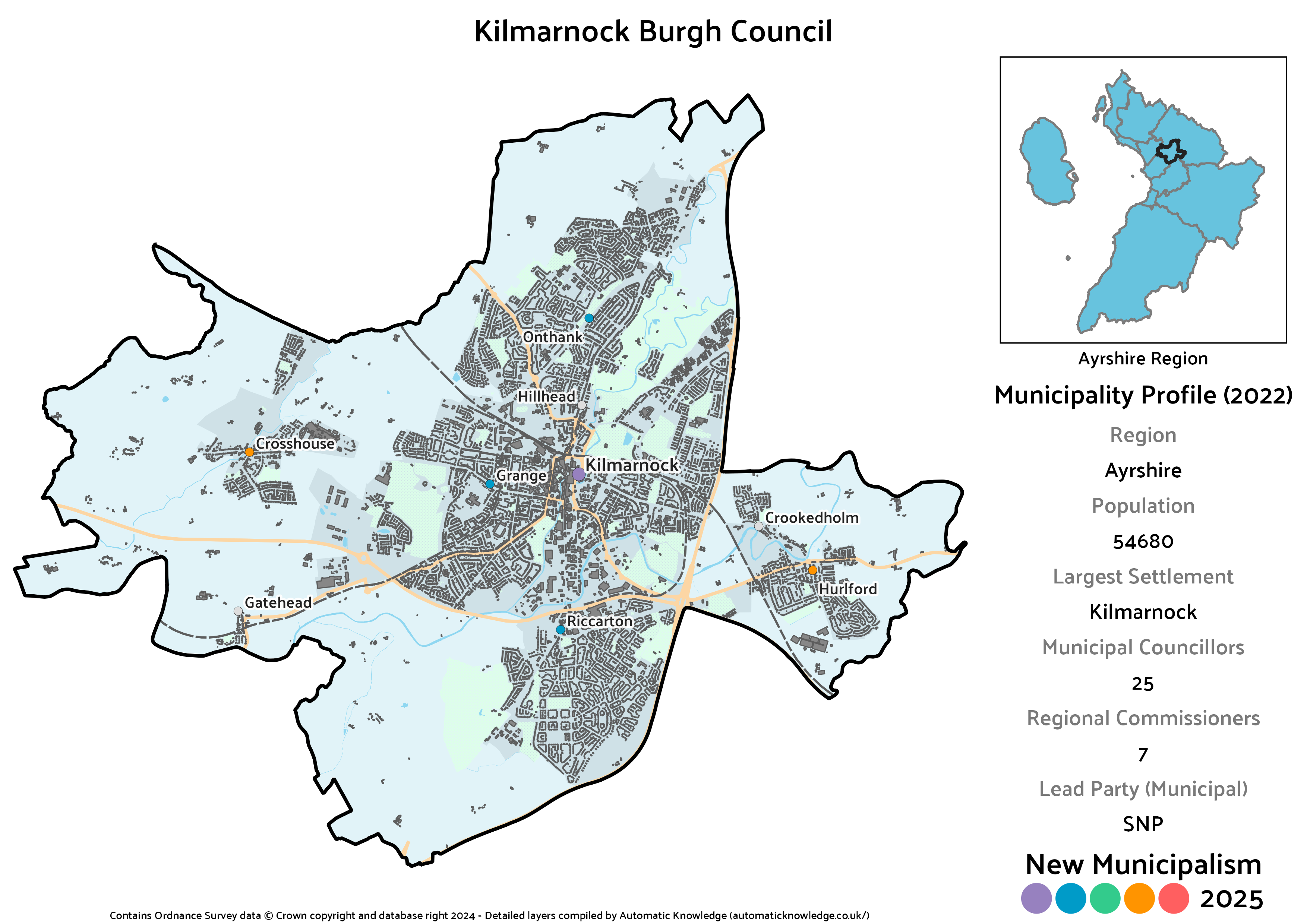
Key Statistics
Population: 54,680
Largest Settlement: Kilmarnock
Municipal Councillors: 25
Regional Commissioners: 7
Description
The final one of the Big Three Ayrshire towns (not to be confused with the Three Towns, which we’ll get onto), Kilmarnock is currently the centre of East Ayrshire Council, and would be the most populous municipality in the region. That does however include outlying villages in the form of Crosshouse and Hurlford, which means the core town is about on a par with Ayr rather than totally eclipsing it. Given its size, it’s another one of the many towns it’s genuinely laughable that it doesn’t currently have its own burgh council, which this project rectifies.
In political terms this follows the big town norm of having the SNP in the lead, with Labour then their closest competitors. Though there’s still a sizeable Conservative bloc projected for the municipal council, this would be their weakest municipality in the region. Rounding out the final two seats are a Green, again arising from the simple fact that they actually contested a ward here in 2022, and Graham Boyd, who was in reality successfully elected for Kilmarnock East and Hurlford. Given the 12-12 split between constitutional blocs, it’s possible Boyd would be the local kingmaker in this scenario. The number of regional seats up for grabs is also why this is where one of the two Green commissioners ends up.
Projected Municipal Election Results (2022)
Votes
Seats
Projected Regional Election Results (2022)
Votes
Seats
Kilwinning and the Garnock Valley District
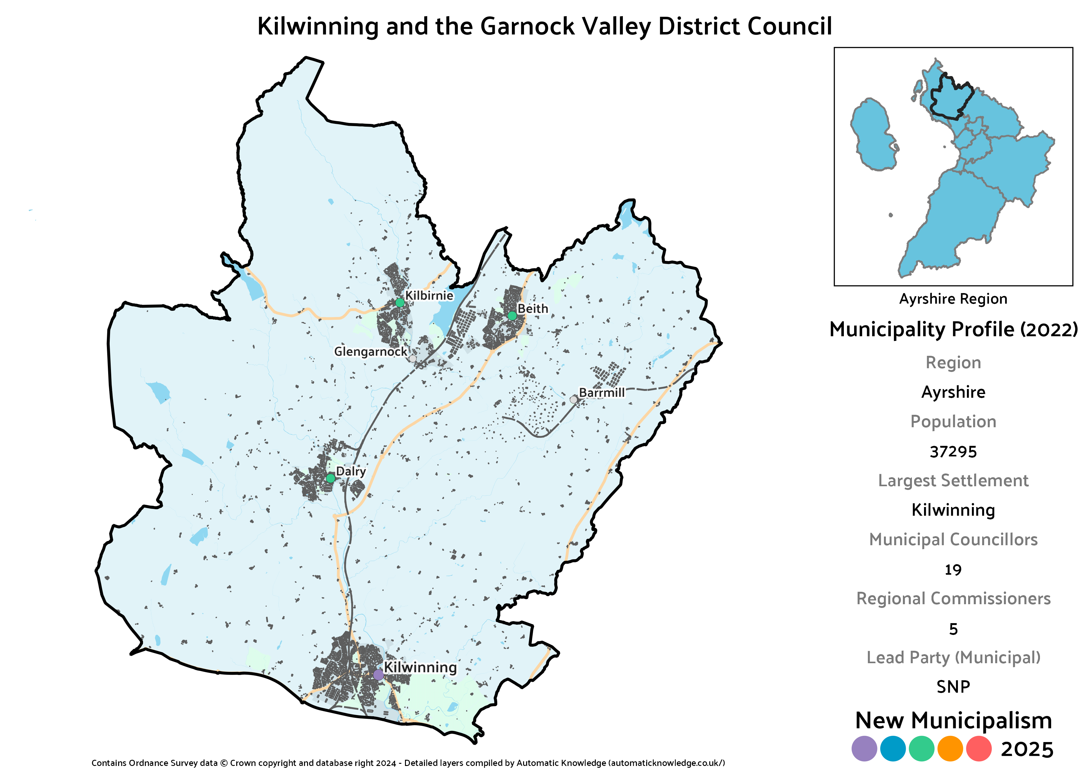
Key Statistics
Population: 37,295
Largest Settlement: Kilwinning
Municipal Councillors: 19
Regional Commissioners: 5
Description
Kilwinning and the Garnock Valley is effectively the inland portion of the current North Ayrshire. Relative to my previous version, it effectively merges what were two separate municipalities into one. At the time I’d let Kilwinning have its own burgh given its historic ties to Irvine rather than the Garnock Valley villages around Dalry, Kilbirnie and Beith, despite it being significantly undersized. Especially given this is still in the Central Belt, this time I took a harder line that since it was so far out of tolerance I’ve merged the two.
Politically, that leads to something of a diluting effect. The SNP were decently strong in 2022 in both of the wards this covers (by helpful coincidence, boundary changes ahead of the election neatened things up here), whereas Labour were dominant in Kilwinning and the Conservatives strong in the Garnock Valley. That gives the SNP the lead in the overall district, with Labour not far behind and a big Conservative bloc. Two Independents, Donald Reid and Robert Barr, would also be elected. In the actual elections both stood in the Garnock Valley ward, with Reid successfully making the transition from the previous Kilbirnie and Beith, whereas Barr lost the seat he’d held under the old Dalry and West Kilbride.
Projected Municipal Election Results (2022)
Votes
Seats
Projected Regional Election Results (2022)
Votes
Seats
Largs and Cumbrae District
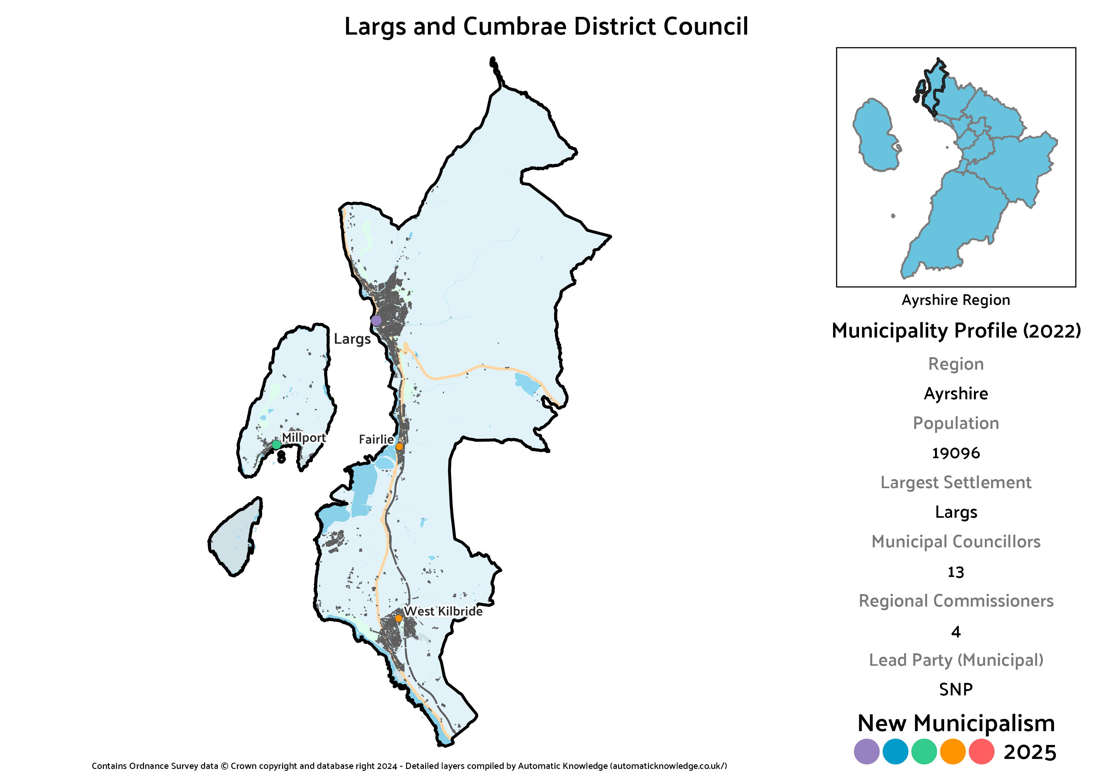
Key Statistics
Population: 19,096
Largest Settlement: Largs
Municipal Councillors: 13
Regional Commissioners: 4
Description
The one district that does make it below the 20,000 threshold is Largs and the Cumbraes – a consequence of the fact I throw Skelmorlie out of it into a Gourock-centred district in the Clyde region. It’s just within tolerance however and I still think this makes for a pretty sensible district. In addition to Largs and the neighbouring island of (Great) Cumbrae, this also takes in the stretch of the coast down through Fairlie and into West Kilbride.
Another helpful boundary change means this district is almost coterminous with the new North Coast ward, so it’s not hard to work out notional results here. This would have been a very close run between the SNP and Conservatives, being the former’s weakest and latter’s strongest district in the region outside of the current South Ayrshire area. However, the SNP scrape ahead by just enough to take a seat advantage at the municipal level, whilst the Conservatives benefit from the levelling seat and come ahead in regional seats.
Labour did so poorly here that not only is it their worst result in the region, but at the actual election they lost their seat. Meanwhile, it’s another rare Ayrshire municipality where the Greens win a seat just by virtue of having actually stood in 2022. It also ends up being their strongest municipality in the region in terms of their projected regional vote share because of very popular Independent Ian Murdoch. Easily elected to the real ward, he has 17% of the vote just to himself, enough to be elected multiple times over, and thus most of it going spare. As the combined SNP-Green and Conservative-Labour totals are tied, it’d also possible Murdoch would be decisive as to what administration was formed.
Projected Municipal Election Results (2022)
Votes
Seats
Projected Regional Election Results (2022)
Votes
Seats
Prestwick District
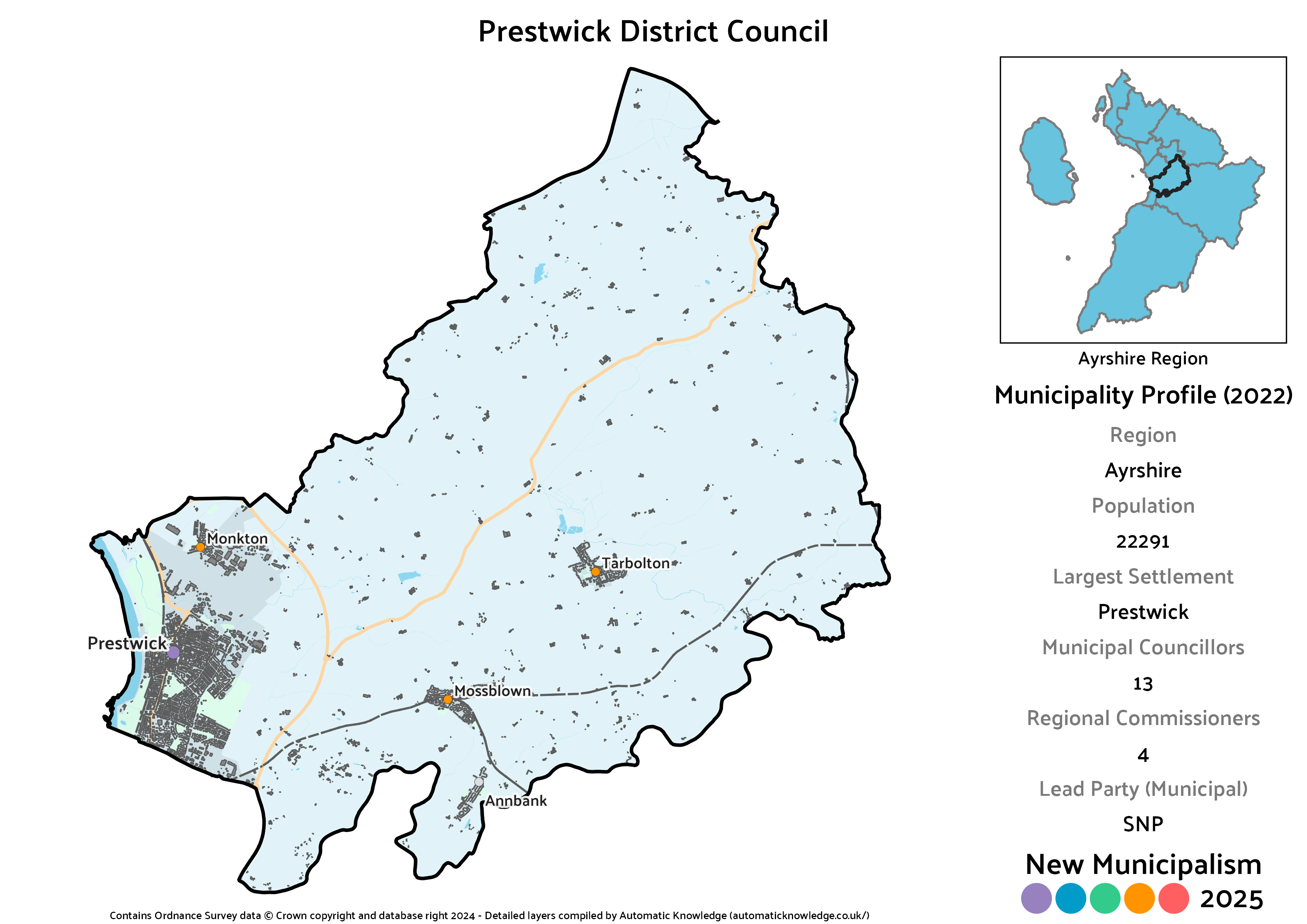
Key Statistics
Population: 22,291
Largest Settlement: Prestwick
Municipal Councillors: 13
Regional Commissioners: 4
Description
Although Prestwick has grown to become contiguous with Ayr, it’s big enough in its own right that I feel it continues to make sense to carve it off to give both towns some breathing space. Prestwick itself makes up the bulk of this area, but there is a significant chunk of countryside that includes Monkton, Mossblown, Annbank and Tarbolton that led me to designate this as a wider district rather than a burgh.
Of the three municipalities centred on substantial towns in the current South Ayrshire, Prestwick ends up as the weakest for the Conservatives. That’s in large part due to the fact that ahead of the real 2022 elections, they opted not to re-select one of their long serving councillors for Prestwick. Rather stung by that, Hugh Hunter chose to stand as an Independent and was very comfortably elected. The chunky vote he attracted is partly how the SNP end up with a relatively wide lead. Although like the rest of South Ayrshire this is a comparatively weak area for Labour it’s enough for a pair of councillors. A relatively strong area for the Lib Dems by Ayrshire standards, it ends up being one of only two municipalities where they would have a councillor, and the only one where they’d have both a councillor and a regional commissioner.
Projected Municipal Election Results (2022)
Votes
Seats
Projected Regional Election Results (2022)
Votes
Seats
The Three Towns and Arran District
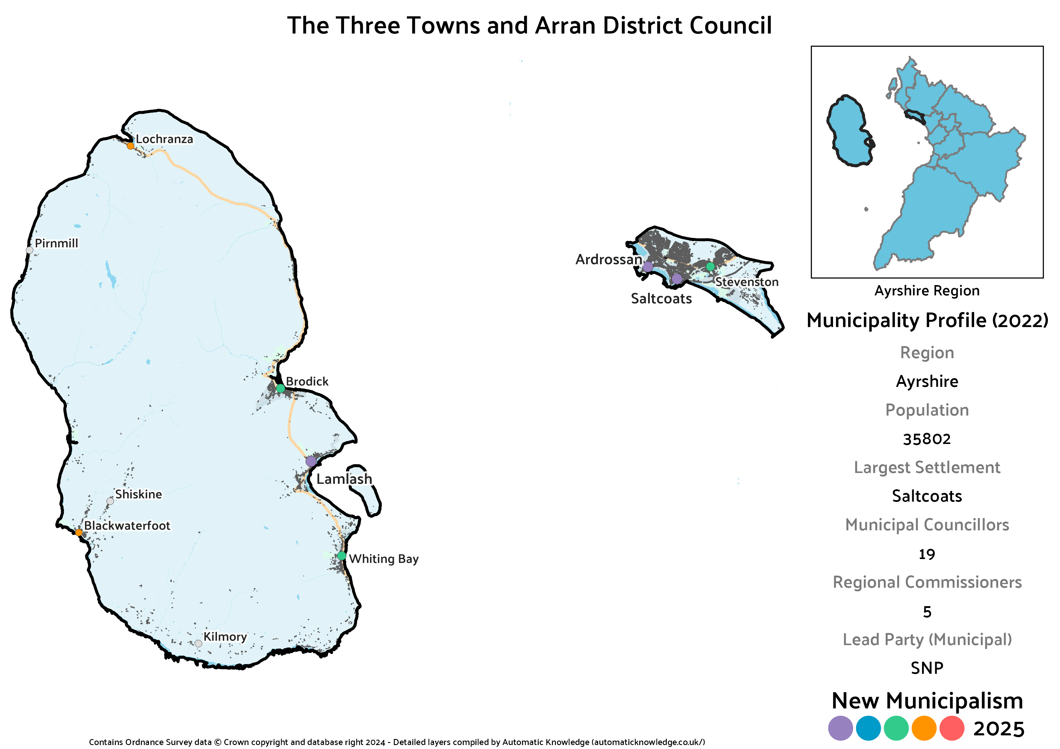
Key Statistics
Population: 35,802
Largest Settlement: Saltcoats
Municipal Councillors: 19
Regional Commissioners: 5
Description
If you’re not familiar with the area, you might think “the Three Towns” is either laziness or an unwillingness to privilege one over the others on my part. In fact, that is a well recognised title for the combined urban area that runs between Ardrossan, Saltcoats and Stevenston. Although Arran is significantly different in character, given that it only has a population of around 5,000 and that the primary connecting ferry terminal is at Ardrossan, this is where it most makes sense to tie in. That does create a slightly odd pairing where urban and island interests both need met within a single council, but relative to the existing North Ayrshire, Arran would have much greater political heft.
As a result of that mix, the SNP have a decent but not huge lead in terms of votes, whereas the Three Towns alone is a near tie with Labour and Arran is a Conservative lead. Had Arran not been included, the Three Towns would have been the worst district for the Conservatives in the region – instead it’s the second worst. By contrast the inclusion of Arran, where they were a handful of votes behind Labour and 10%, is what gives the Greens their best estimated result in the region and a seat at both levels. Although Independents collectively garner 10% of the vote, none of them are individually strong enough to be elected.
Projected Municipal Election Results (2022)
Votes
Seats
Projected Regional Election Results (2022)
Votes
Seats
Troon District
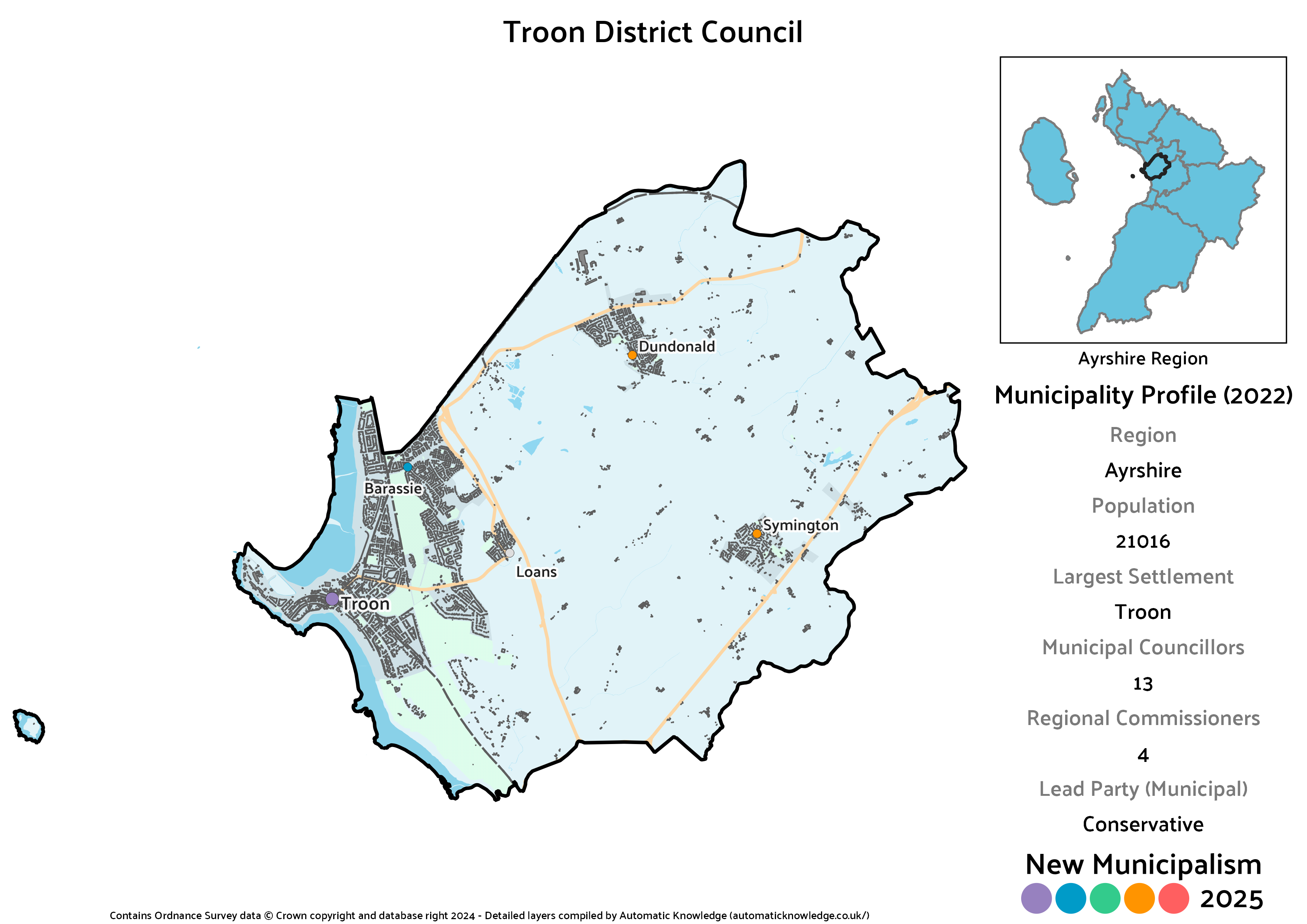
Key Statistics
Population: 21,016
Largest Settlement: Troon
Municipal Councillors: 13
Regional Commissioners: 4
Description
A classic seaside town, Troon isn’t quite big enough for its own burgh, but with the addition of neighbouring Loans, Symington and Dundonald, does justify being the centre of a wider district. This covers the northernmost portion of current South Ayrshire council area.
Troon stands out as the one municipality in the region where the Conservatives are the most popular party at both levels, though not so much that they avoid a tie in seats with the SNP on the municipal council. It’s also the only part of the current South Ayrshire not to have had any popular Independents in the 2022 elections, meaning it’s the best municipality in that part of the region for Labour, and the region overall for the Lib Dems, who pick up the remaining seat on the council. Though the Greens were entirely absent from South Ayrshire in 2022 and thus don’t appear here, they did stand in Troon in 2017 and won enough votes I’d expect they’d similarly have made it onto the (imaginary) district council had they stood this time.