Highland Region Overview
Key Statistics
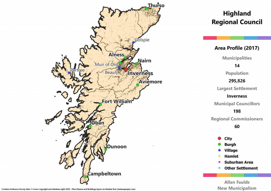
Municipalities: 14
Population: 295,826
Largest Settlement: Inverness
Municipal Councillors: 198
Regional Commissioners: 60
Region Description
Despite covering a truly enormous area, the proposed Highland region currently only consists of two councils – the entirety of Highland, and most of Argyll and Bute. Highland Council in particular is without a doubt the biggest mockery in Scottish local government. The idea you can put Inverness, Fort William, Portree, Ullapool and Thurso in the same most local unit of government and call that “local” is laughable.
Under the 1973 Act, the Highland Region was coterminous with what became Highland Council in 1994. Argyll and Bute on the other hand formed part of Strathclyde. From a transport links perspective, I can see the logic there. Argyll and Bute is more directly connected to the West Central Belt than to the rest of the Highlands, especially at the southern end where Bute and Dunoon have direct ferry links to Inverclyde. Demographically speaking however it’s much more like the Highlands.
Given I think that there are always certain aspects of governance that are going to need cross-body co-operation, I went with the demographic rather than infrastructure fit, and assumed a continuing SPT that the Argyll municipalities could remain part of. Apart from the Helensburgh and Lomond area, which was historically Dunbartonshire and thus sensible to break off, it wouldn’t really have fit to stick Argyll and Bute onto the Clyde region anyway, even if you could have argued Bute into a “Gourock and Bute District” given the direct ferry connection.
In historic terms, this region covers the counties of Argyll, Caithness, Sutherland, Nairn in full, plus the bulk of the Inverness and Ross & Cromarty counties, excluding only the Western Isles. There’s also a small section of what was traditionally Moray, which was transferred by the 1973 Act.
For this region as a whole, there are two important things to bear in mind. The first is that due to the enormous geographic extent of the area, many of the municipalities here come in substantially below the 20,000 resident target. This is precisely where flexibility is most required to achieve genuinely local government, so the threshold has actually been mostly sidelined here.
The second is that politically speaking, the Highlands have a notably strong Independent streak at local government level. Given the electoral system suggested is a simple municipality-wide list, it’s not brilliantly easy to translate 2017 results. There are municipalities where huge amounts of the Independent vote goes to waste as candidates win far more votes than they need to be elected, which also then means parties end up over-represented. I’d expect this to be far less of a problem in reality, as a District electing twice as many councillors as the current wards do is likely to have more Independent candidates and a better split of votes between them.
The Highlands have long been an area of more political diversity than Westminster elections have let on, and based on 2017 results the Regional Council would be expected to have sizeable groups from all five Holyrood parties, including the largest Green group on a regional council. Historically very favourable to the Lib Dems, the SNP are now well out in front as the leading party in this region, with the Conservatives in second. However, for the District level, bear in mind that caveat above about Independent candidates.
Aird and Loch Ness District
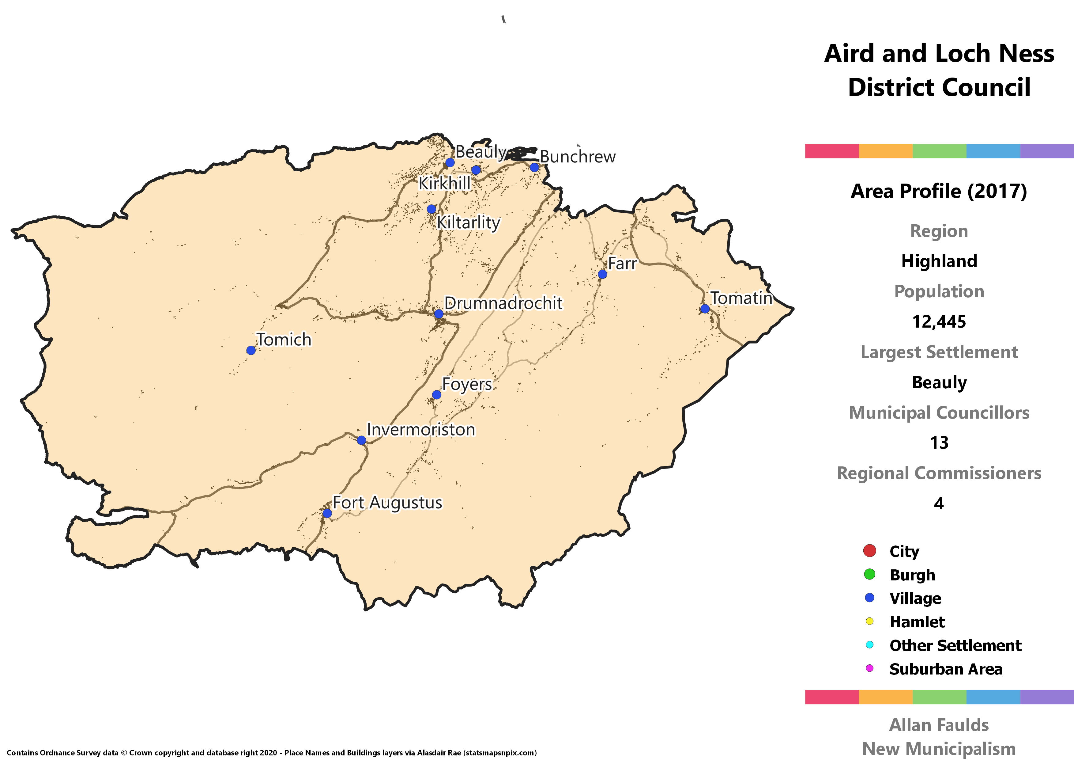
Area Profile (2017)
Population: 12,445
Largest Settlement: Beauly
Municipal Councillors: 13
Regional Commissioners: 4
Municipality Description
Aird and Loch Ness is effectively what you end up left with when the rest of traditional Inverness-shire is divided up into its obvious component parts. This makes for a slightly awkward district divided most prominently by Loch Ness running down the middle, and with most of the population living along the various rivers in the area. In all honesty I’m not a huge fan of this one but it is what it is.
Extrapolating from 2017 results, this District would have seen a Green councillor. They are a bit more common in this region than elsewhere, but still not quite at the point of being on most councils.
Badenoch and Strathspey District
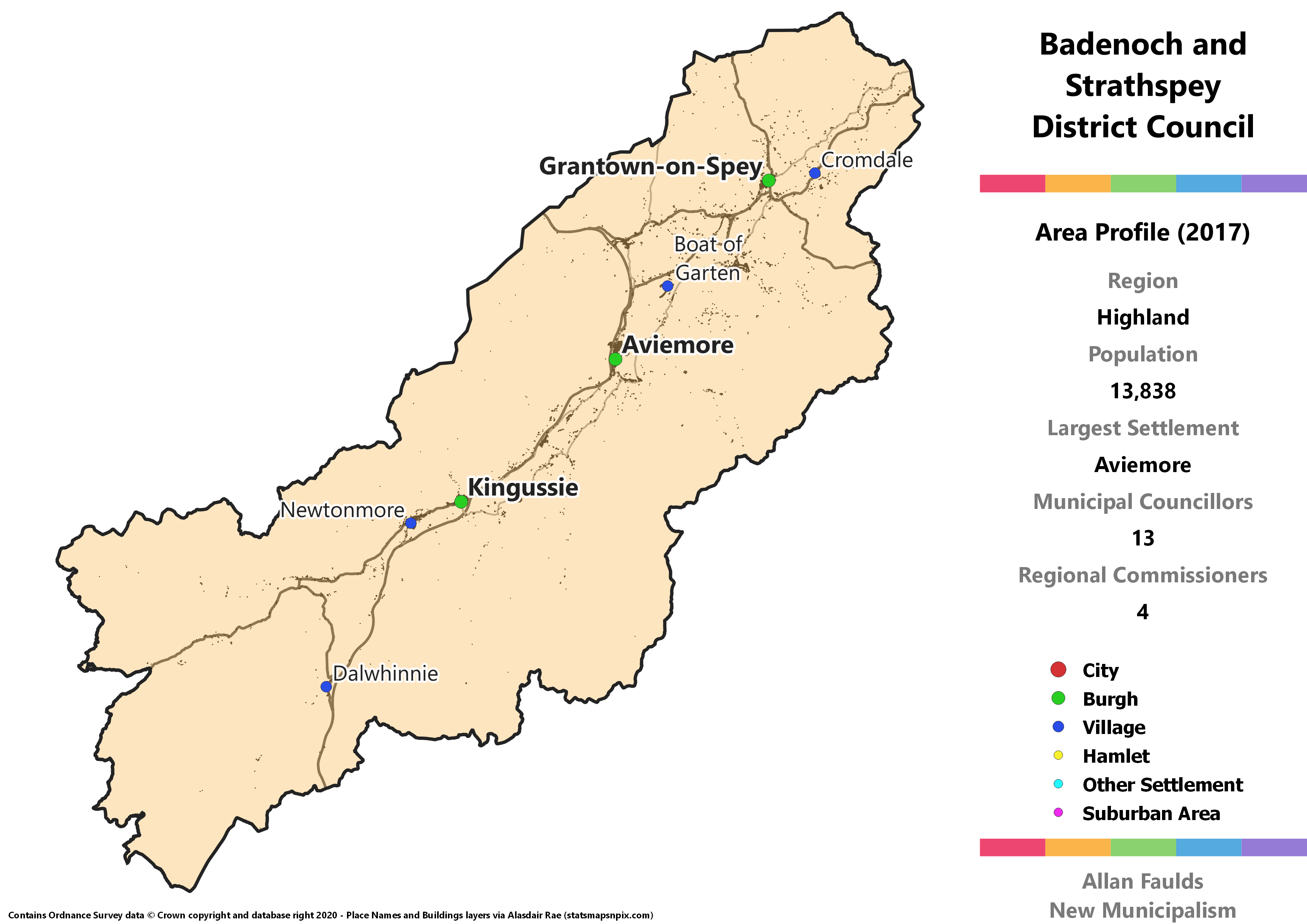
Area Profile (2017)
Population: 13,838
Largest Settlement: Aviemore
Municipal Councillors: 13
Regional Commissioners: 4
Municipality Description
Apart from some extremely minor differences in boundaries, Badenoch and Strathspey recreates the identically named District from the 1973 Act. It covers the south eastern portion of what was traditionally Inverness-shire, including the former Burgh of Kingussie, plus the south of historic Moray centred on the burgh of Grantown-on-Spey. Given this was previously its own District, I think it makes perfect sense to revive it for this project.
In political terms, Badenoch and Strathspey is notable for the strength of the Greens. In 2017 this ward was where the party won their only seat on Highland council. When you translate the results to a larger District council, they’d actually win two seats on it. That makes this the only municipality that isn’t a city to have multiple Green representatives.
Black Isle District
Area Profile (2017)
Population: 17,610
Largest Settlement: Muir of Ord
Municipal Councillors: 13
Regional Commissioners: 4
Municipality Description
Despite the name, the Black Isle is actually a peninsula. Cromarty at the northern tip was the historic centre of Cromartyshire, a truly nightmarish county consisting of widely dispersed exclaves and enclaves bordered by other counties. Very little of the rest of the Black Isle area was in that county, and fortunately it was absorbed into a joint Ross and Cromarty county in 1890. The village of Maryburgh is strictly not in the Black Isle, but since it forms an integrated area with Conon Bridge across the river, I pulled it into the District.
Based on 2017 results, the Black Isle would be one of those Highland municipalities with a Green councillor.
Bute and Cowal District
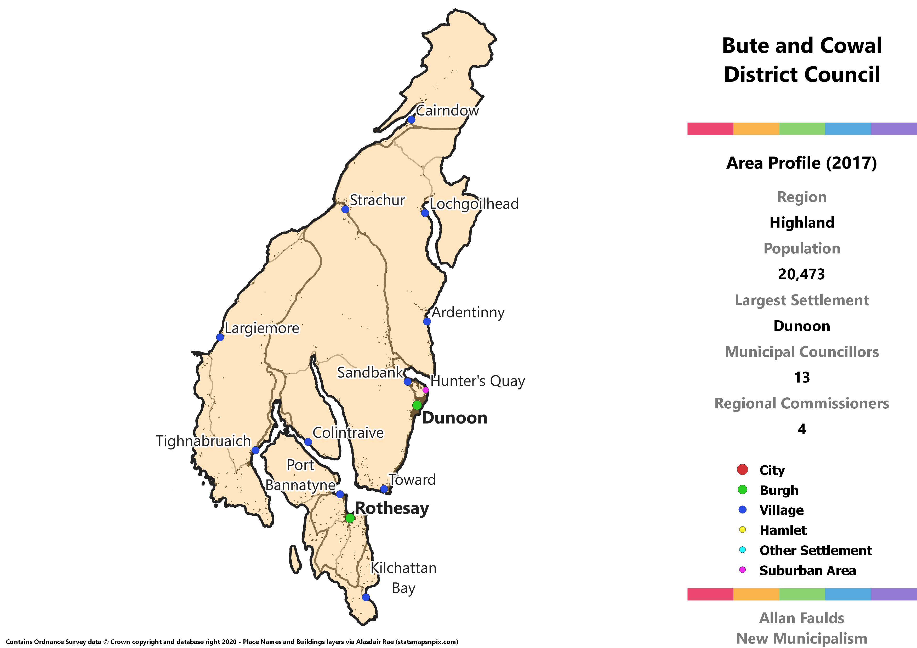
Area Profile (2017)
Population: 20,473
Largest Settlement: Dunoon
Municipal Councillors: 13
Regional Commissioners: 4
Municipality Description
The municipality in this region that’s the second most distant from the bulk of the Highlands, this combines the Cowal peninsula which forms the eastern part of historic Argyll with the island of Bute, which was once the centre of its own county. Both of these areas have a ferry connection to what is currently Inverclyde, a very short hop across the Firth of Clyde. As noted in the description of the overall region, that does make this placing a bit odd in transport terms, but this is an area that’s always going to be difficult to get spot on.
Although Bute doesn’t get its own District in this project, having previously also had a Burgh at Rothesay, it does benefit from the general strengthening of Island voices that results from pairing them with smaller mainland areas than at present. Bute makes up about 30% of the population of this district, whereas it’s just 7% of the current Argyll and Bute.
Perhaps because it includes the large town of Dunoon, this District would have a Labour councillor based on 2017 results. There aren’t a huge number of them across this region, given the rural nature.
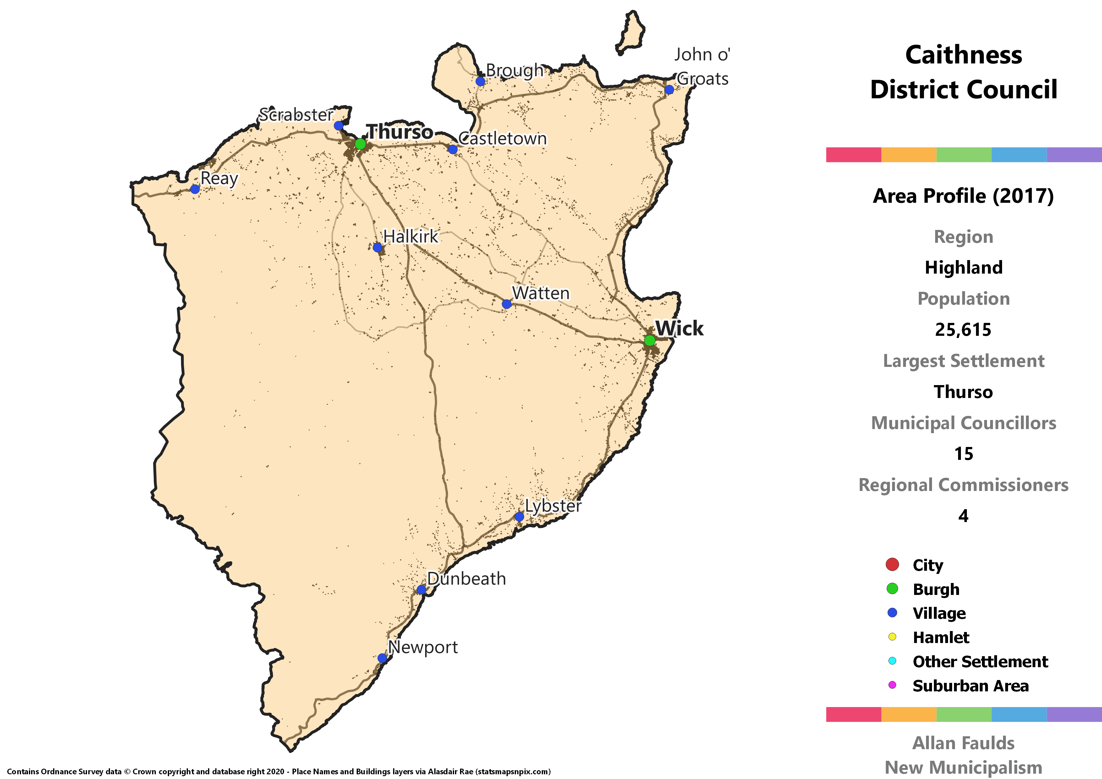
Caithness District
Area Profile (2017)
Population: 25,615
Largest Settlement: Thurso
Municipal Councillors: 15
Regional Commissioners: 4
Municipality Description
Not only does Caithness manage to exceed the normal 20,000 threshold, it actually goes past 25,000 residents to make it the only municipality in the region outside of Inverness to have more than the baseline 13 councillors. This is an almost perfect recreation of both the historic county and the 1973 Act District of Caithness, with some very minor changes that reflect current ward boundaries. There are – I counted – literally 3 buildings in total in the affected area, so I think that’s fine. This is exactly the kind of area that makes an obvious unit of local government and should exist rather than the daft massive Highland region.
Despite being at the far north of Scotland, and including the north eastern most tip of the island of Great Britain at John o’ Groats, Caithness is actually quite urbanised. Well over half the population live in the two former Burghs of Thurso and Wick. That urbanisation is likely how an extrapolation of 2017 results shows a pair of Labour councillors – or rather, it explains one of them, with the second being an artefact of particularly high support for successful Independents here going to waste. That does however also deliver an incredibly satisfying 5-4-3-2-1 pattern of councillors.
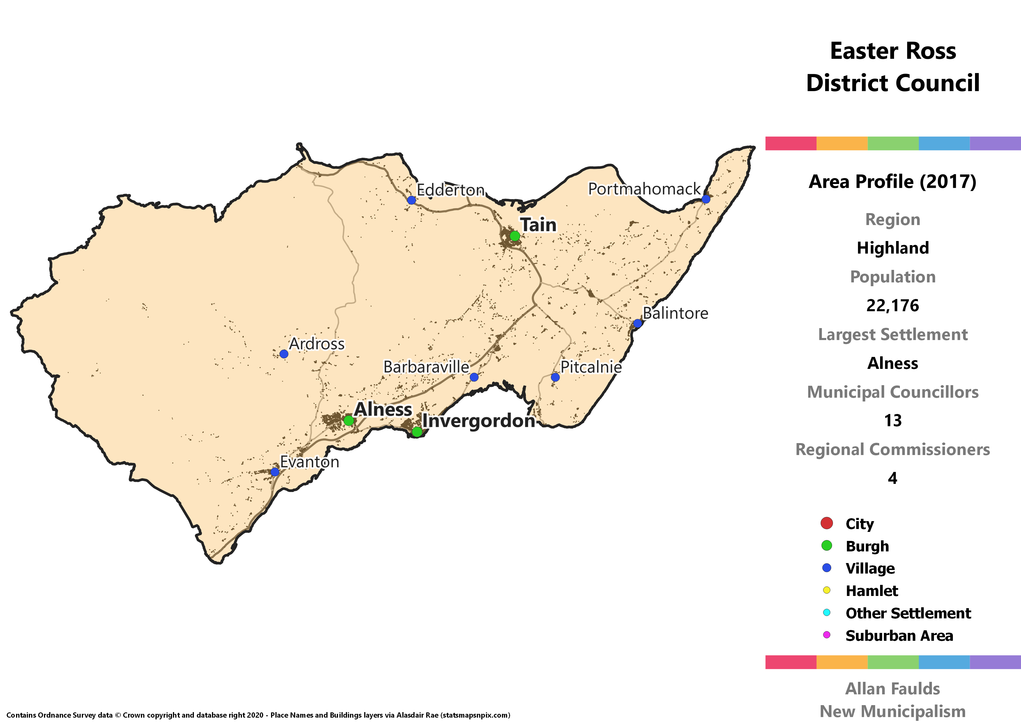
Easter Ross
Area Profile (2017)
Population: 22,176
Largest Settlement: Alness
Municipal Councillors: 13
Regional Commissioners: 4
Municipality Description
The division of Ross into Easter and Wester components isn’t clearly defined, so I’ve done my best here to capture a reasonable Easter Ross District. Although Ross as a whole is a massive area, the Easter side is actually quite small, defined to the north and south by the Dornoch and Cromarty Firths. It’s quite urbanised by Highland standards, including two historic Burghs at Tain and Invergordon, plus the rapidly growing town of Alness. That urbanisation helps make it one of the few municipalities I’ve created out of the current Highland to exceed 20,000 residents.
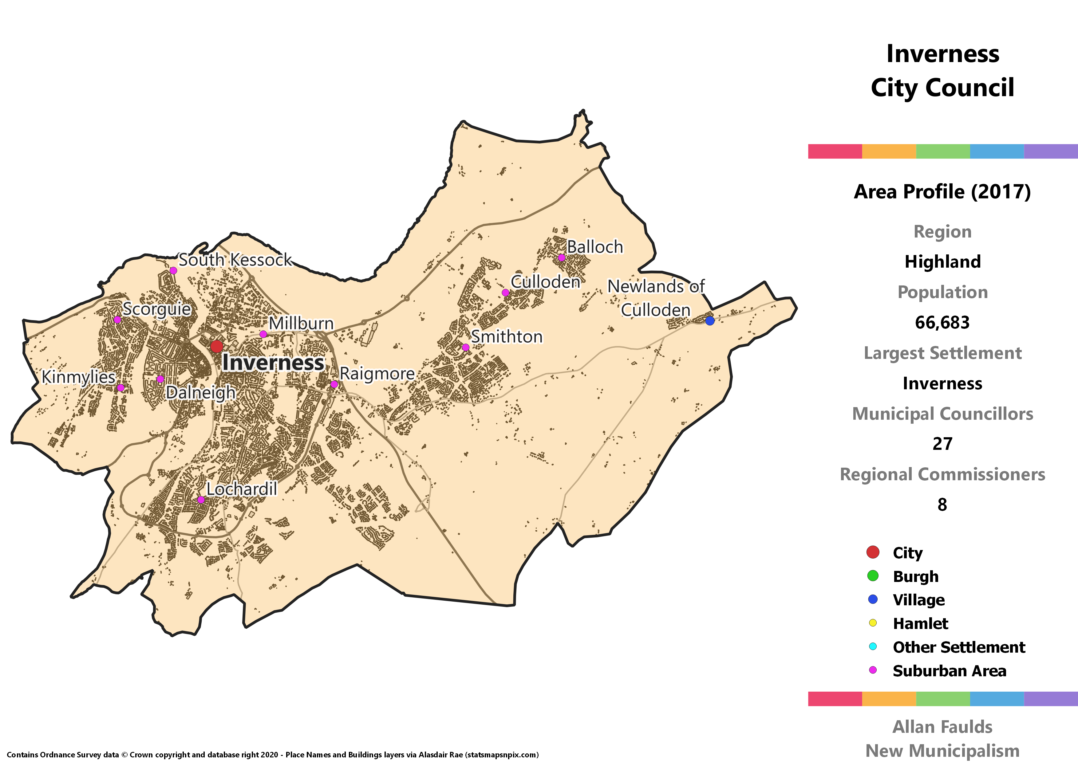
Inverness City Council
Area Profile (2017)
Population: 66,683
Largest Settlement: Inverness
Municipal Councillors: 27
Regional Commissioners: 8
Municipality Description
One of Scotland’s 7 cities and long recognised as Capital of the Highlands, the fact Inverness doesn’t have its own City Council simply heaps more absurdity on the behemoth that is the current Highland Council. It used to be its own Burgh before the 1973 Act, which made it the heart of a still over-large Inverness District. This proposed City Council strikes a balance as it extends far beyond the old Burgh boundary given the rapid growth of the city, the urban area of which has effectively expanded to include the village of Culloden, but doesn’t take in too much of the rural surrounds.
Inverness demonstrates the political diversity you’d expect of a major city, with an extrapolation of 2017 results indicating at least one seat for each of the Holyrood parties, plus a single Independent.
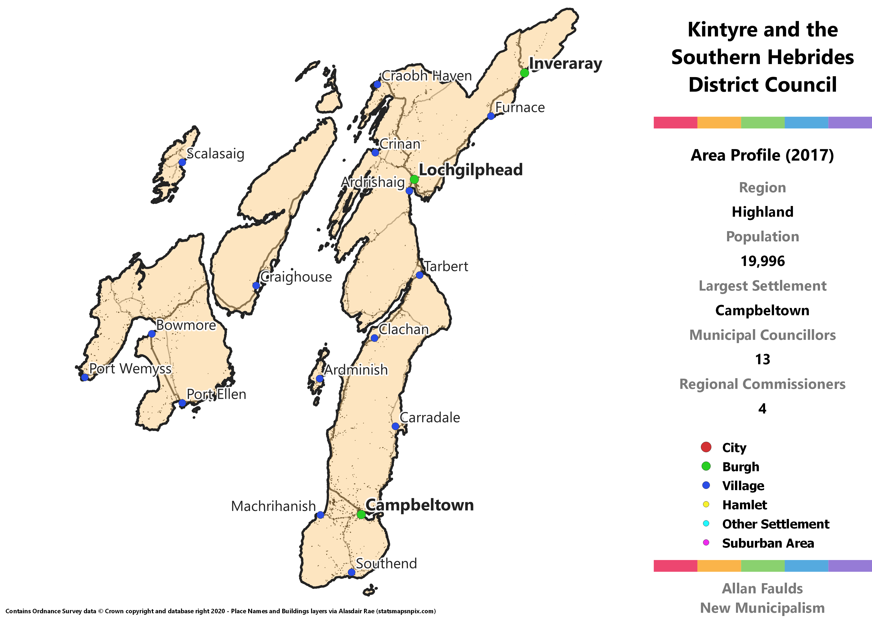
Kintyre and the Southern Hebrides District
Area Profile (2017)
Population: 19,996
Largest Settlement: Campbeltown
Municipal Councillors: 13
Regional Commissioners: 4
Municipality Description
Kintyre and the Southern Hebrides covers the southern part of the historic county of Argyll, plus the islands of the Inner Hebrides associated with the area by transport links. The most prominent of these is Islay, but it also includes Jura, Colonsay and Gigha. As with other municipalities including islands, their relative political heft is boosted by being in a smaller district, going from circa 4% as part of Argyll and Bute to around 19% in this proposal.
This District contains areas that are without a doubt the most remote from the likely centre of this region’s power at Inverness. The Kintyre peninsula stretches way down to a point that you can see Ireland from it on a clear day, and getting from Campbeltown to Inverness would be a mammoth undertaking. It has a ferry connection to Ayrshire and an air connection to Glasgow, emphasising the more Central Belt direction of transport here. Again it’s worth noting that Argyll is hard to really slot in anywhere. Environmentally friendly it may not be, but a specific chartered flight link from Campbeltown to Inverness for Regional Council business may be a necessity if this was ever implemented.
Lochaber and the Small Isles District
Area Profile (2017)
Population: 19,894
Largest Settlement: Fort William
Municipal Councillors: 13
Regional Commissioners: 4
Municipality Description
Lochaber and the Small Isles comes very close to simply re-creating the Lochaber District of the 1973 Act, with just a few minor differences due to the shape of the current council wards used as building blocks. That means it covers the southern portion of traditional Inverness-shire and the northern area of Argyll. In that Act, Lochaber was extended beyond the traditional River Leven-Black Water boundary to take in the Glencoe area, as well as absorbing the Morvern and Ardnamurchan areas which had no direct land connection to the rest of Argyll.
Strictly speaking the Small Isles are really very small and wouldn’t need to be in the District name, but honestly, they are adorable so why wouldn’t you put them in there?
Translating 2017 results to this District would see it as one of the relatively few Highland municipalities to have a Labour councillor. Also notable is that despite the fact this is historically Charles Kennedy’s stomping ground, at local level the Lib Dems would have been the smallest party based on those results.
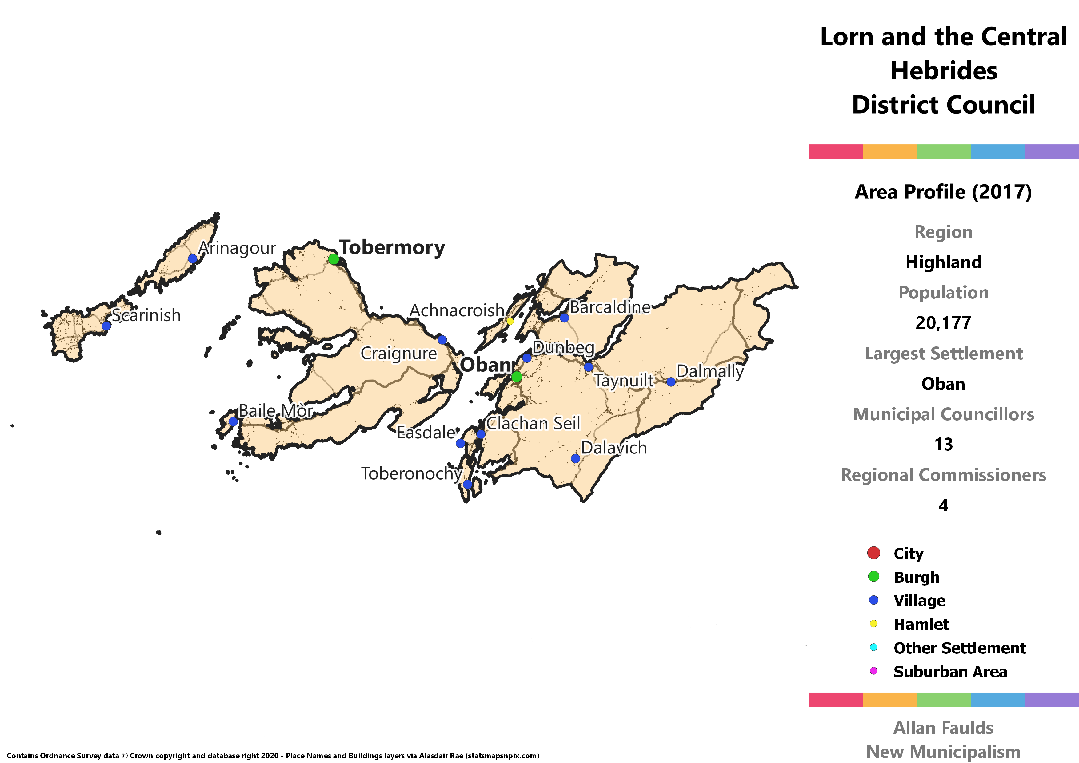
Lorn and the Central Hebrides District
Area Profile (2017)
Population: 20,177
Largest Settlement: Oban
Municipal Councillors: 13
Regional Commissioners: 4
Municipality Description
Centred on the former Burgh of Oban, Lorn and the Central Hebrides incorporates the northernmost part of Argyll (sans that which transferred to Highland in the 1973 Act) and the central stretch of the Inner Hebrides which are connected to the area. Mull is the primary island included, but it also takes in Tiree and Coll to the west, Lismore and Kerrera near Oban, and the Slate Islands to the south. Together, islands make up approximately 23% of the District, versus the roughly 5% they do as part of Argyll and Bute.
This District would be one of just two in the region not to have any Lib Dem councillors based on 2017 results. It would however have one each for Labour and the Greens, the only municipality in the region outside of Inverness where those two parties meet. For the Greens this is also the only part of the current Argyll and Bute where they’d see a councillor.
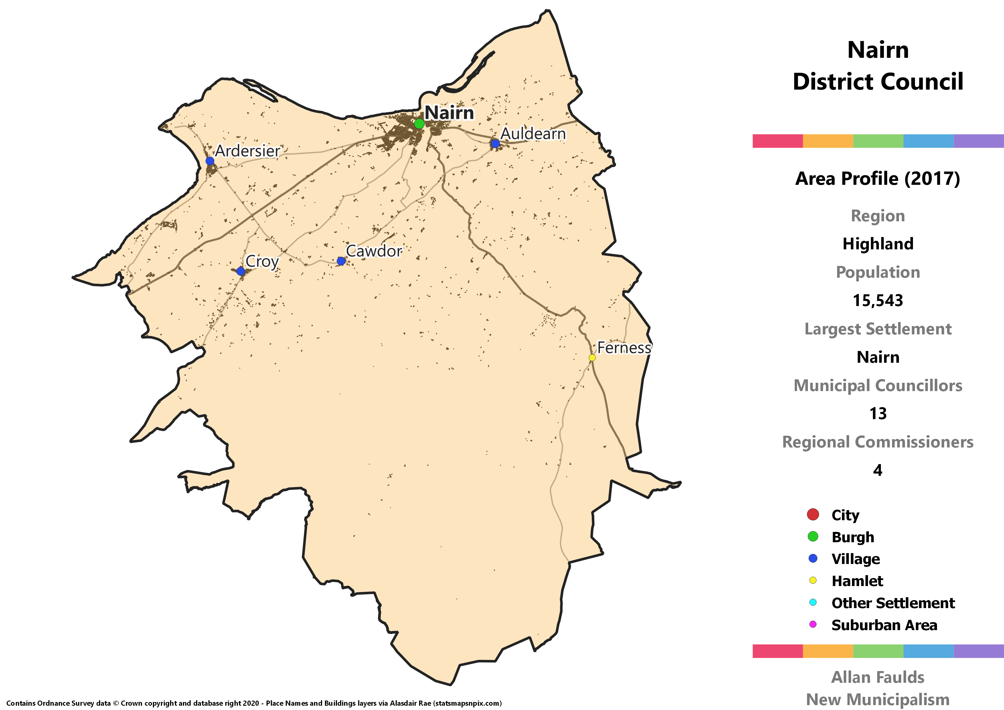
Nairn District
Area Profile (2017)
Population: 15,543
Largest Settlement: Nairn
Municipal Councillors: 13
Regional Commissioners: 4
Municipality Description
One of the smaller of Scotland’s traditional counties, the town of Nairn lost its Burgh status in the 1973 Act but the county as a whole at least continued as a District of the Highland Region. That status is re-instated here, though with a slightly expanded area that absorbs the villages of Ardersier and Croy from what was historically Inverness-shire. I’ve often been loath to cross such lines in this project, but with Inverness qualifying as a City and not wanting to over-extend it, I felt pulling that area into Nairn made sense.
There’s nothing too much to distinguish this District politically these days, but as a niche bit of electoral history, one of the Regional electoral divisions covering the town in 1990 elected Scotland’s first ever Green. He didn’t maintain formal affiliation with the party for much of his term, and they aren’t estimated to win a seat here based on 2017 results, but I thought it was interesting enough to mention!
Skye Island
Area Profile (2017)
Population: 10,462
Largest Settlement: Portree
Municipal Councillors: 13
Regional Commissioners: 4
Municipality Description
Skye ends up as the smallest municipality by population not just of the Highland region, but of the whole project. Coming in at just over half the 20,000 residents target, I reckon it’s just about big enough that should be justifiable. Technically this covers more than just the island of Skye, as it includes neighbouring islands. Of these, only Raasay has a population that you’d need more than one hand to count, and even then it’s below 200. In the 1973 Act’s Highland Region, Skye was combined with the Lochalsh area on the mainland to form a District, which I decided against on the basis that I felt the island could stand alone.
This is also the district where the simple municipality-wide list I’m using as the hypothetical electoral system most falls down. Independents win a whopping 71% of the vote between them, and all 7 Independents that stood in 2017 would have been elected. That means the SNP’s 5 seats came on just 19% of the vote. I’d hope that in reality a wider field of Independents would help ensure a more accurate spread. Additionally, this would be one of the only two municipalities in the region without any Lib Dem representation.
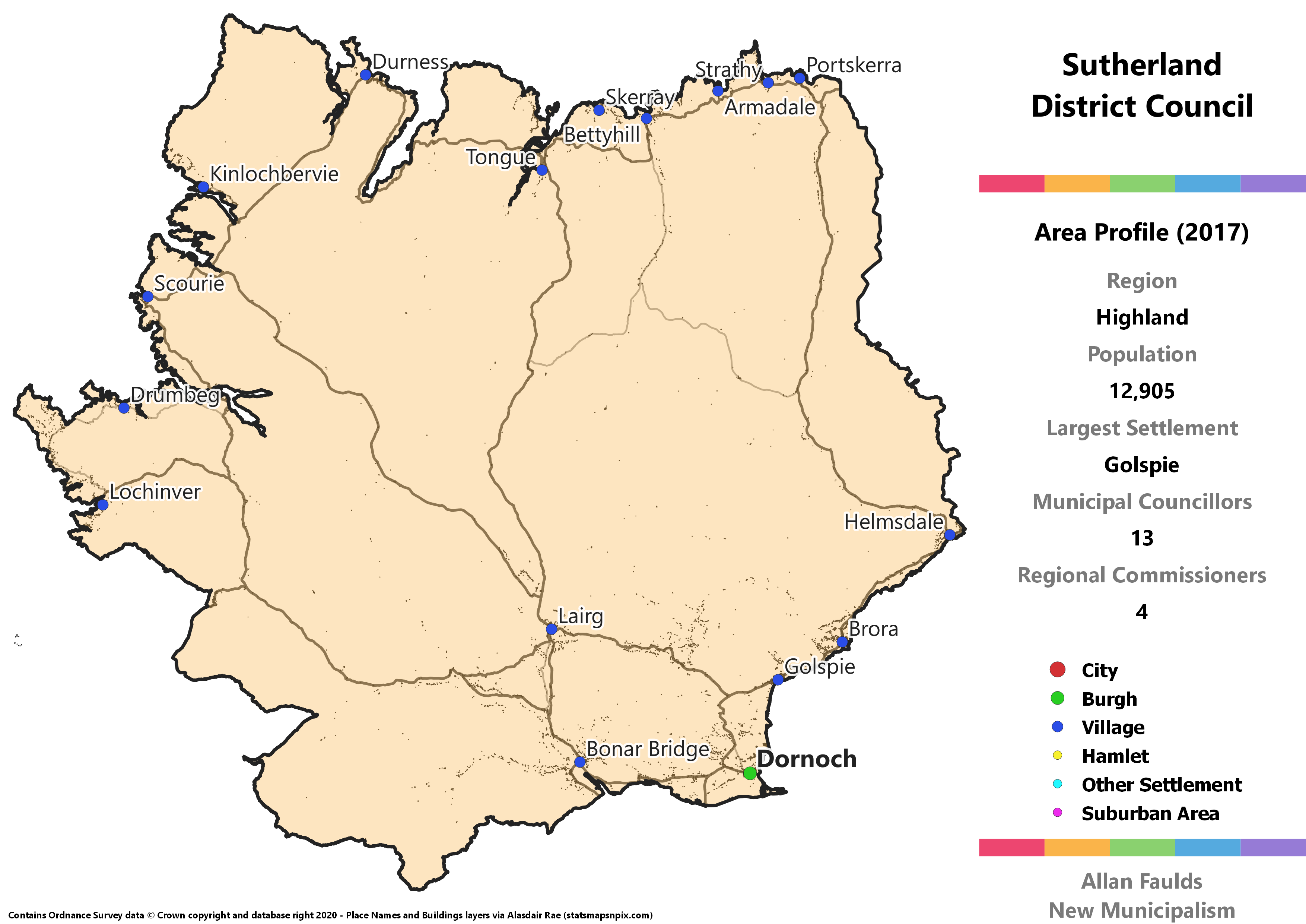
Sutherland District
Area Profile (2017)
Population: 12,905
Largest Settlement: Golspie
Municipal Councillors: 13
Regional Commissioners: 4
Municipality Description
Sutherland is a pretty massive bit of Scotland which has a long history as its own county. That was recognised in the 1973 Act when it retained status as a District. I feel it’s appropriate to crowbar it back out of the gigantic Highland region. Compared to the traditional county, both the 1973 District and this proposal have a little bit of what used to be Ross-shire south of the River Oykel and along the River Carron, which adds a little bit to the population.
Stretching from coast to coast, most of the population live along the south east, including the county town and former Burgh of Dornoch. Apart from at Lairg, the interior is relatively sparsely populated, with the remaining major villages along the northern and western coasts.
In spite of that rural nature, not only does extrapolating the 2017 results show Labour councillors, it actually shows a vote for them not very far off the other three parties. All four of them pull between 16% and 19% of the vote. That may be down to a particularly popular councillor in one of the existing wards this area covers, or it could be a reflection relatively high levels of deprivation by the standards of the rural Highlands.
Wester Ross District
Area Profile (2017)
Population: 18,009
Largest Settlement: Dingwall
Municipal Councillors: 13
Regional Commissioners: 4
Municipality Description
Wester Ross is the oft-quoted example of just how oversized local government in Scotland is. Most of this proposal is actually just one single ward on Highland Council at present, with only Dingwall in a separate one. It’s a massive area to be just one (and a bit) electoral division, and really should be its own District.
The haziness of the Easter vs Wester Ross boundary comes about primarily in the East, but from what I could make out Dingwall is basically at the very eastern edge of Wester Ross, despite literally being on the east coast. Apart from a ribbon of houses along the course of the main road and train line to Kyle of Lochalsh, most of the population west of Dingwall is found on the west coast.
The Greens would have picked up one of their dispersed group of councillors in this District, based on 2017 results.
