Lanarkshire Region Overview
Key Statistics
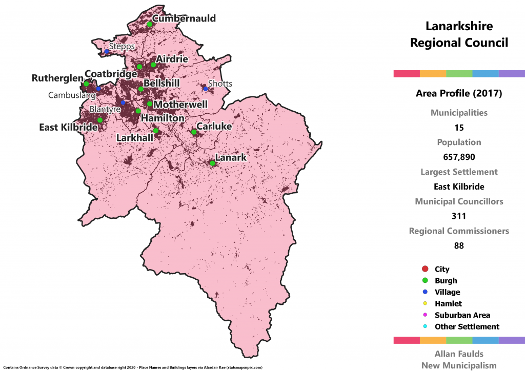
Municipalities: 15
Population: 657,890
Largest Settlement: East Kilbride
Municipal Councillors: 311
Regional Commissioners: 88
Region Description
The proposed Lanarkshire region is a neat and easy one, covering most of the historic Lanarkshire county, excluding those areas ceded to Glasgow and East Dunbartonshire over the course of the past two reorganisations. It also includes the Cumbernauld area which has been part of North Lanarkshire since the 1994 Act but was historically in Dunbartonshire. The Kilsyth area which was transferred out of Stirling in the 1973 Act isn’t included here, having been passed to the Clyde region.
Lanarkshire is one of a small handful of historic counties that really doesn’t need to be merged into a wider region. In fact, this version would be the largest local government unit in the country in terms of population, coming in about 5% larger than Glasgow. As such although there was an obvious rationale in terms of transport and so on for including it as part of Strathclyde in the 1973 Act, from a genuine local government perspective that was a grievous error.
I imagine the population was historically rather more evenly distributed, but these days Lanarkshire consists of a massively urbanised conurbation to the east of Glasgow, plus a large but much more sparsely populated rural southern end (Clydesdale) which extends so far as to rub against Dumfriesshire and the Borders. Although there’s therefore quite a substantial difference in terms of needs and character between these two areas, it made sense to me to largely preserve the historic county – not least because separating Clydesdale from it would remove Lanark itself.
Historically mostly a Labour stronghold, the area has swung towards the SNP in recent years. It’s still quite close between the two parties however, with this region having the highest relative number of Labour led municipalities. A particular quirk of the process of translating 2017 results to the Regional Council level is that the Independent Alliance North Lanarkshire pick up a seat on the council. A grouping of former Labour councillors, it benefited from the ability of local parties to bypass the threshold under my example list system.
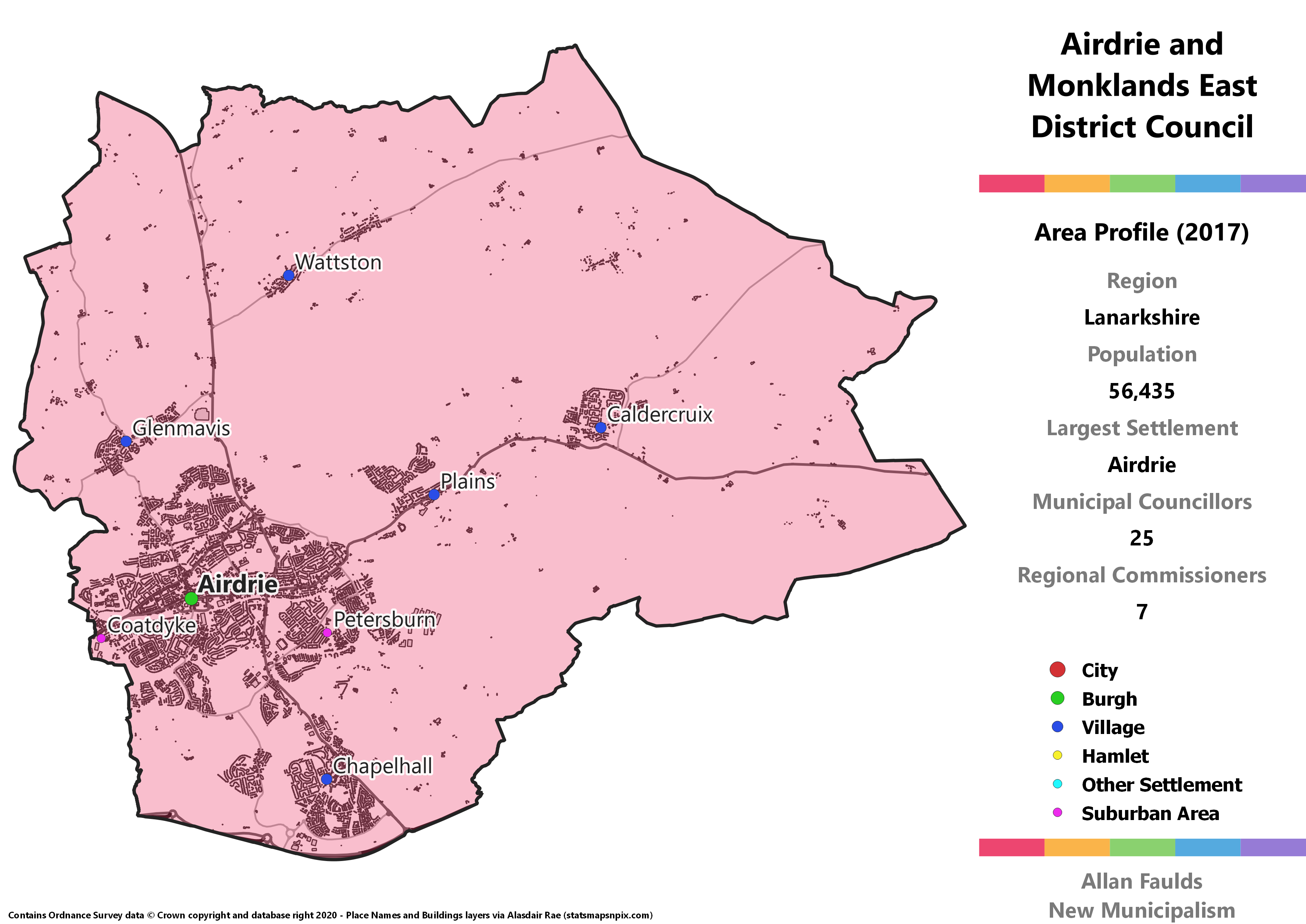
Airdrie and Monklands East District
Area Profile (2017)
Population: 56,435
Largest Settlement: Airdrie
Municipal Councillors: 25
Regional Commissioners: 7
Municipality Description
As much as I’d have liked to return Airdrie’s historic Burgh status, doing so would have left the villages surrounding it with nowhere obvious to connect to. This District therefore ends up covering most of the area of the 1973 Act’s Monklands District, hence the name. It’s otherwise a pretty standard urban West Central Belt area that doesn’t require much more explanation.
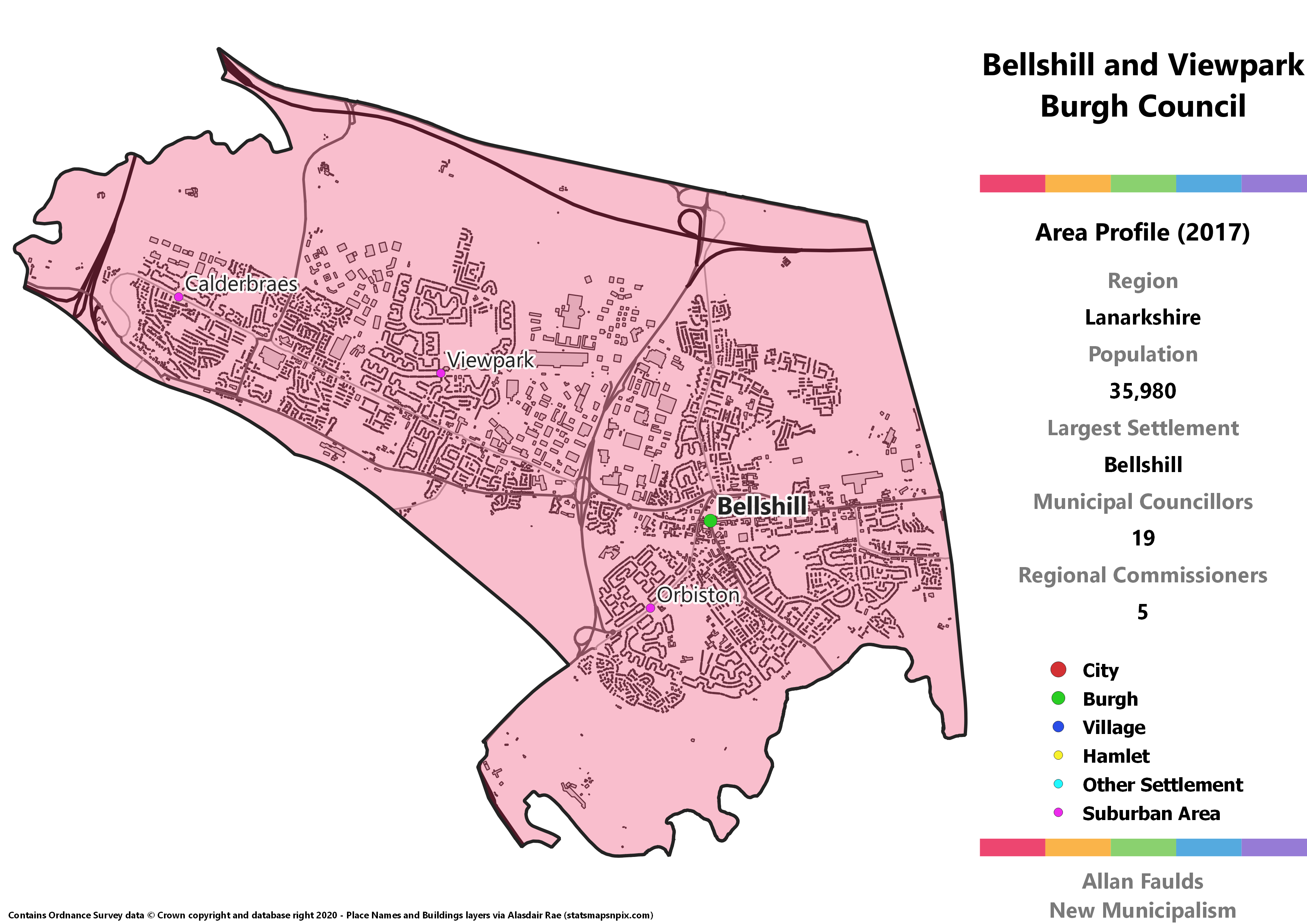
Bellshill and Viewpark Burgh
Area Profile (2017)
Population: 35,980
Largest Settlement: Bellshill
Municipal Councillors: 19
Regional Commissioners: 5
Municipality Description
Bellshill and Viewpark is effectively now the western end of a well-integrated wider Motherwell and Wishaw area, but it seems a reasonable area to snip off in the interests of local government. Urban sprawl doesn’t necessitate tightly bound local government, especially when there’s a wider Regional council to handle aspects of that. Although neither of the areas making up this Burgh held that status in the past, given the size and closeness of them I felt it was justified here.
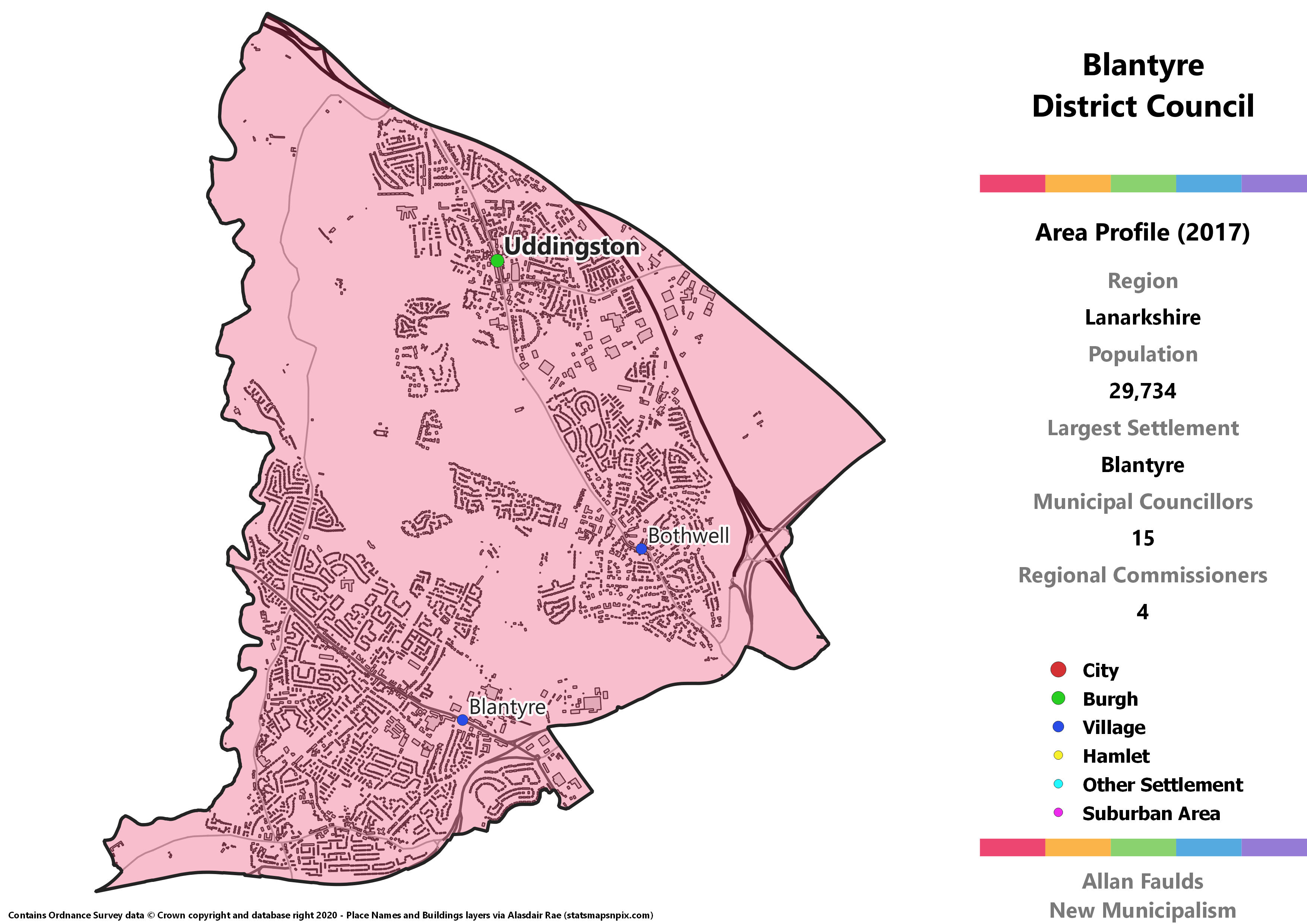
Blantyre District
Area Profile (2017)
Population: 29,734
Largest Settlement: Blantyre
Municipal Councillors: 15
Regional Commissioners: 4
Municipality Description
Someone once told me that simply naming this District “Blantyre” would get the rest of the population’s back up. A quick look at the SIMD 2016 data perhaps suggests why I was told that. Whilst Blantyre is (overwhelmingly, but not exclusively) made up of areas of high deprivation, Uddingston and Bothwell are (overwhelmingly, but not exclusively) made up of areas of low deprivation. A small but still grim reminder that people often turn their noses up at areas they perceive as poor? In any case, as much as it is often sensible to keep areas with such differences separate so the local council is most responsive to their different needs, there didn’t seem an easy way to do so here.
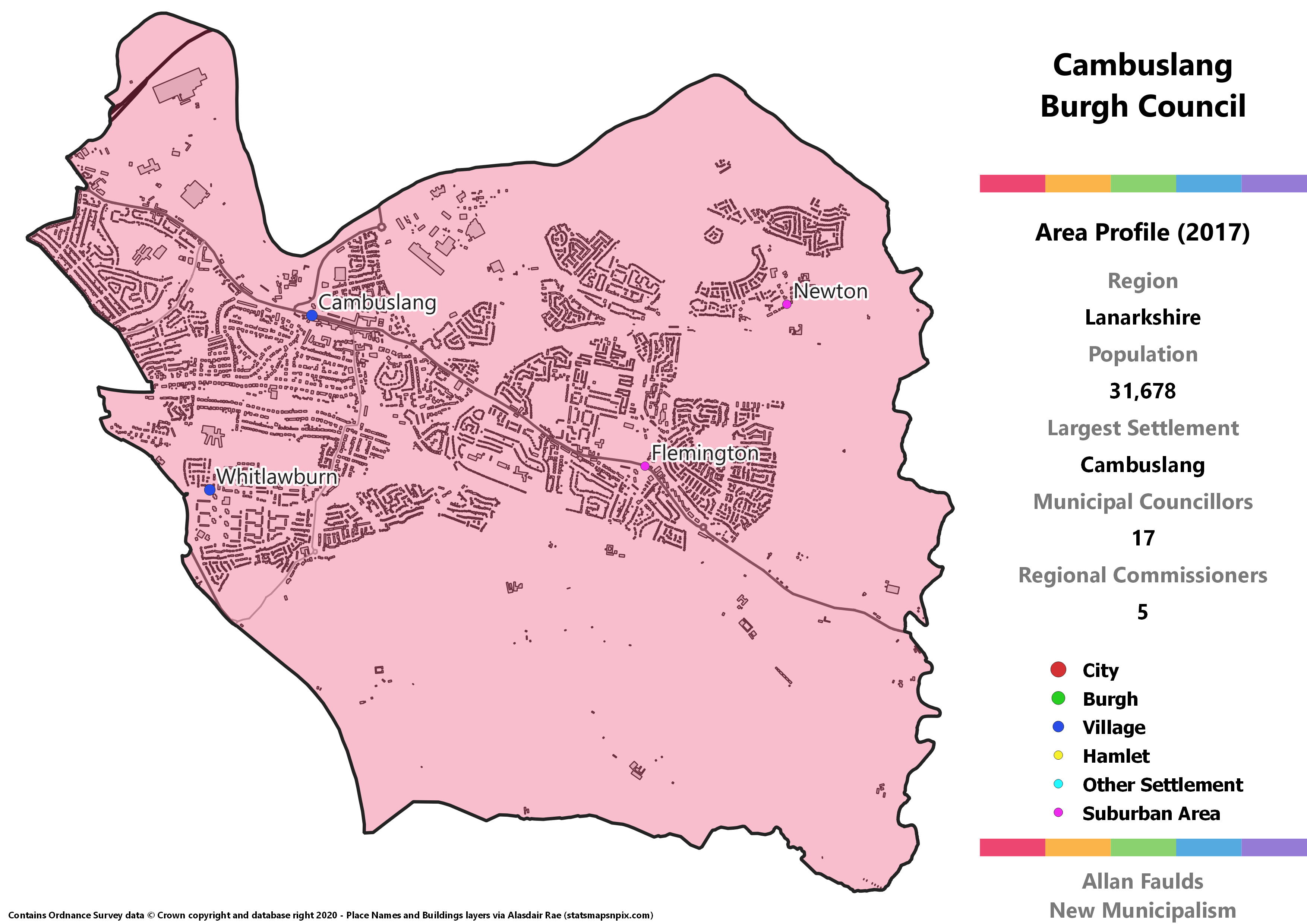
Cambuslang Burgh
Area Profile (2017)
Population: 32,678
Largest Settlement: Cambuslang
Municipal Councillors: 17
Regional Commissioners: 5
Municipality Description
Despite having a sizeable population these days, Cambuslang has never in the past had its own Burgh Council. In fact, having had Glasgow steadily grow into it, Cambuslang formed part of the City under the 1973 Act, before the 1994 Act pulled it back into a Lanarkshire area. Some might suggest that gives even more cause to absorb it than some of the other towns that now abut Glasgow. As I’m resistant to expanding what is already our largest city, I’ve instead given Cambuslang its own Burgh.
Based on 2017 results, Cambuslang would be one of just a handful of municipalities in Lanarkshire with a Lib Dem on the council. After neighbouring Rutherglen, Cambuslang has tended to be the strongest area for the party in South Lanarkshire, so that isn’t a huge surprise given a much expanded number of seats up for grabs.
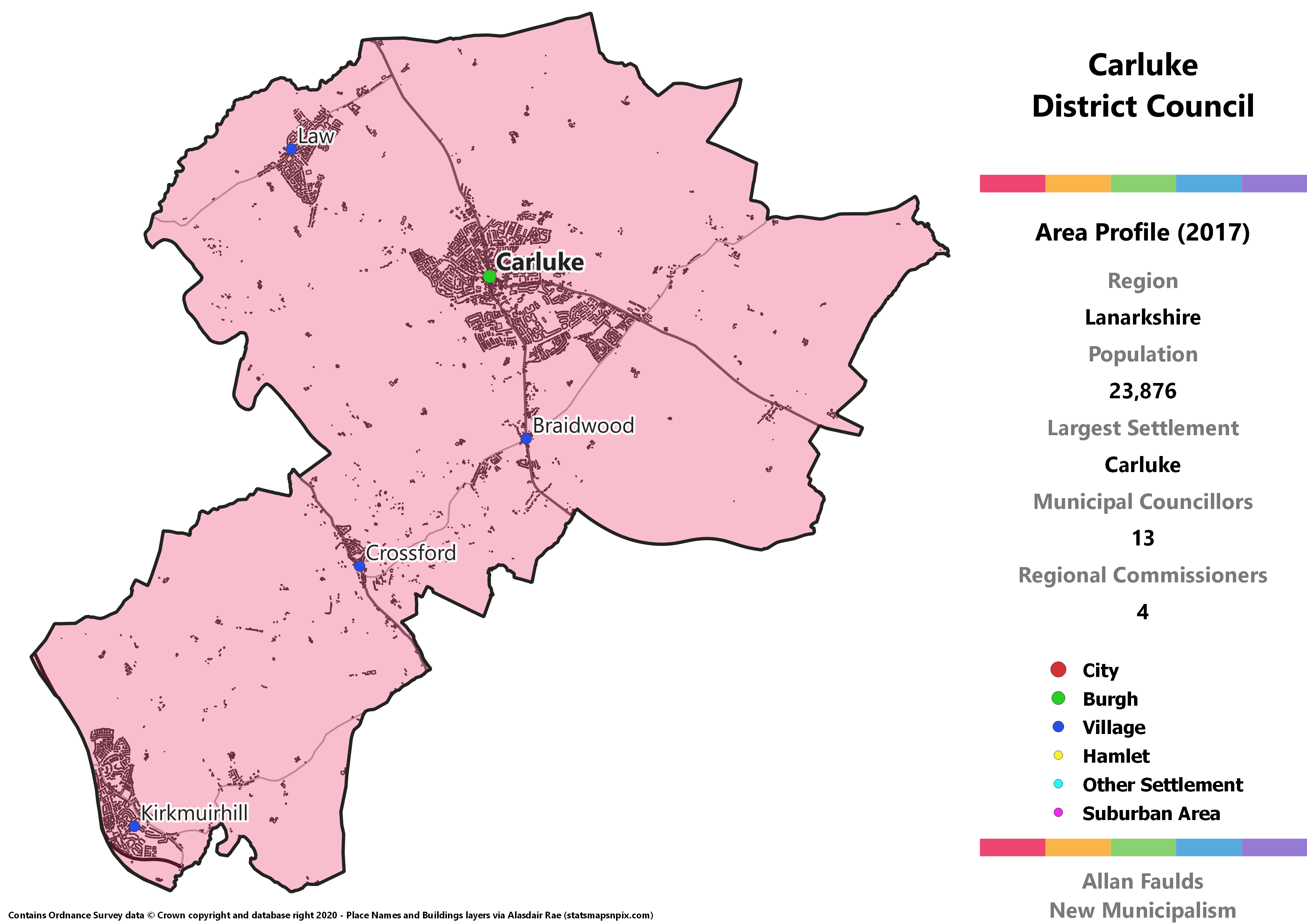
Carluke District District
Area Profile (2017)
Population: 23,876
Largest Settlement: Carluke
Municipal Councillors: 13
Regional Commissioners: 4
Municipality Description
Carluke is the only other municipality I’ve been able to split from the broader Clydesdale area in the south of Lanarkshire. The town of Carluke itself isn’t quite big enough to cross the population threshold, so it includes surrounding villages at Law, Braidwood and Crossford, plus a further reach out to Kirkmuirhill. In hindsight it might have been neater to leave the latter out and instead extend to the north east and incorporate Forth, but what’s done is done.
Clydesdale District
Area Profile (2017)
Population: 37,724
Largest Settlement: Lanark
Municipal Councillors: 19
Regional Commissioners: 5
Municipality Description
Clydesdale covers most of the rural portion in south and east of Lanarkshire. The biggest town in the area is Lanark itself, which having lent its name to the county has been somewhat left behind by the heavily urbanised areas to the north. Most of the rest of the population can be found in smaller villages scattered across the area, including another former Burgh at Biggar. If I hadn’t peeled Carluke out to be its own District, this would be identical to the 1973 Act’s Clydesdale District.
Likely because of its rural character, Clydesdale would be the only municipality in Lanarkshire where the Conservatives come out as the largest party when extrapolating from 2017 results.
Coatbridge Burgh
Area Profile (2017)
Population: 46,819
Largest Settlement: Coatbridge
Municipal Councillors: 23
Regional Commissioners: 6
Municipality Description
This Burgh almost perfectly recreates the pre-1973 Act Coatbridge Burgh, with just a small expansion to the southwest to include Bargeddie. Under that Act Coatbridge was part of the Monklands District alongside Airdrie. Although those two towns remain very tightly linked, given the population of both it made perfect sense to me to split them into their own municipalities.
When translating 2017 results to a full Burgh Council, Coatbridge stands out as one of the places an Independent Alliance North Lanarkshire councillor would have won a seat.
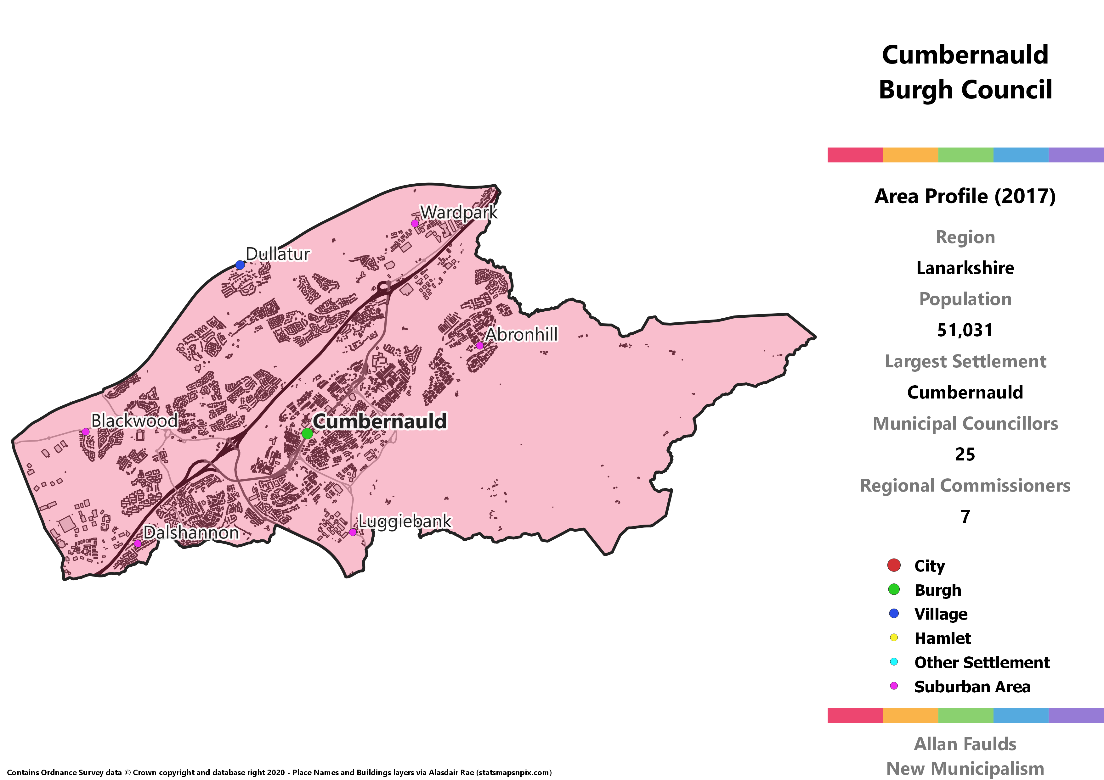
Cumbernauld Burgh
Area Profile (2017)
Population: 51,031
Largest Settlement: Cumbernauld
Municipal Councillors: 25
Regional Commissioners: 7
Municipality Description
Cumbernauld was one of the areas designated for a New Town after the Second World War, growing enormously from a few scattered villages into one of Scotland’s largest towns. Until the 1973 Act, this area formed part of the awkward Dunbartonshire exclave alongside Kirkintilloch. It was then paired up with Kilsyth from Stirling to form the Cumbernauld and Kilsyth District of Strathclyde, before finally ending up part of the current North Lanarkshire.
Although I’ve moved Kilsyth into the Clyde region, I’ve left Cumbernauld in Lanarkshire. You could argue to include it in Clyde to re-establish the historic Dunbartonshire link and I wouldn’t object overly, but it does look like the local connections these days are primarily to Lanarkshire.
Despite the use of a PR list system for these hypotheticals, Cumbernauld is one of the few municipalities to end up with a single party majority based on 2017 results. The SNP performing so strongly here actually has an interesting historical precedent, as way back in 1974 Cumbernauld and Kilsyth was the only place the party took majority control, which they held in 1977.
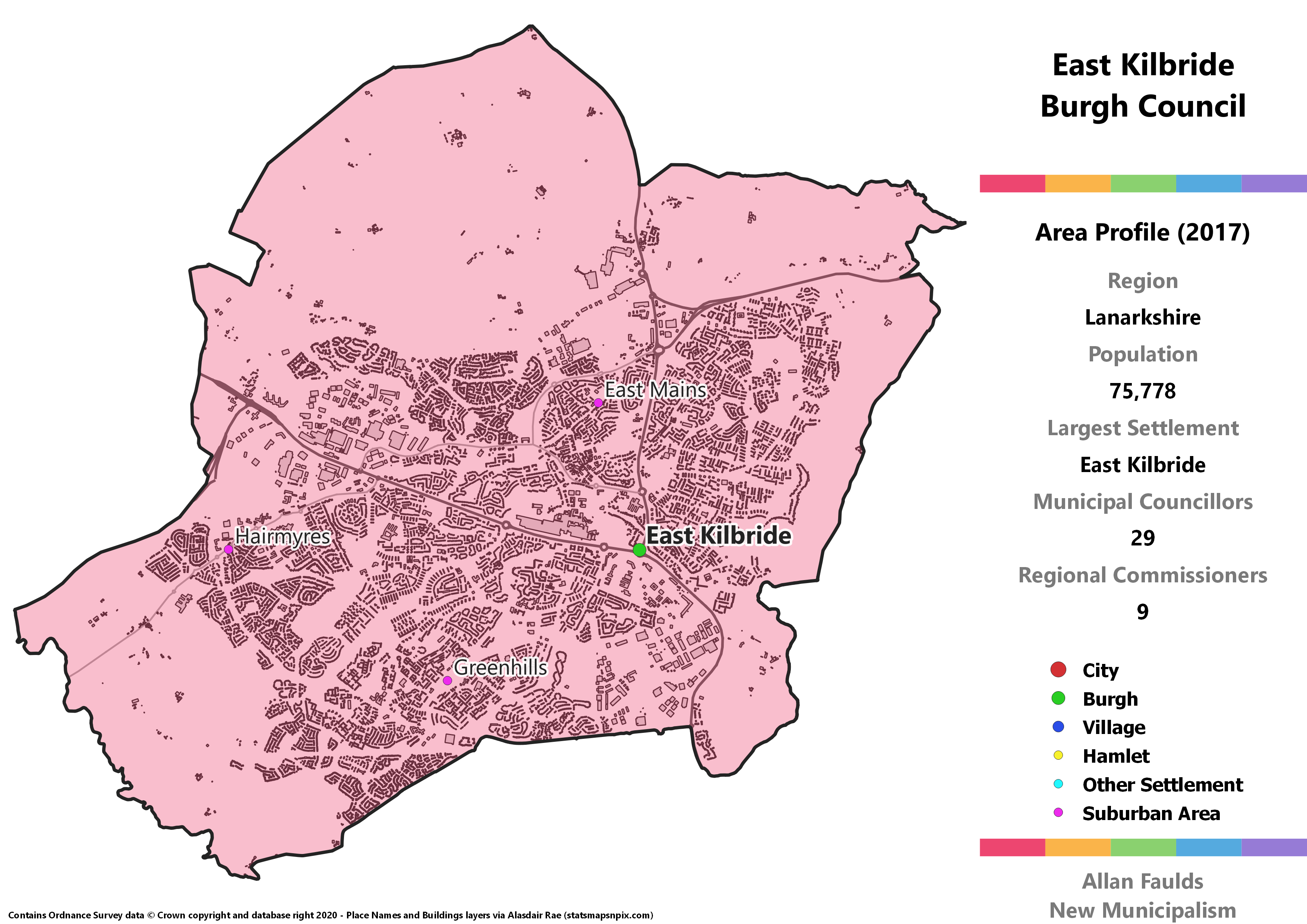
East Kilbride Burgh
Area Profile (2017)
Population: 75,778
Largest Settlement: East Kilbride
Municipal Councillors: 29
Regional Commissioners: 9
Municipality Description
Another of the post-war New Towns, East Kilbride has grown to such an extent it’s the second largest town in Scotland (behind Paisley), and the sixth largest settlement overall. It grew fast enough to have its own Burgh before the 1973 Act swept those away, and then gave its name to a wider District that extended to the south to take in Strathaven and the surrounding countryside. In this project it gets to go back to being its own Burgh.
The sheer size of the Burgh Council lends itself well to diversity, with each of the 5 major parties represented on the council according to an extrapolation of 2017 results. This would be the only municipality in the region with a Green, and one of just a handful with a Lib Dem.
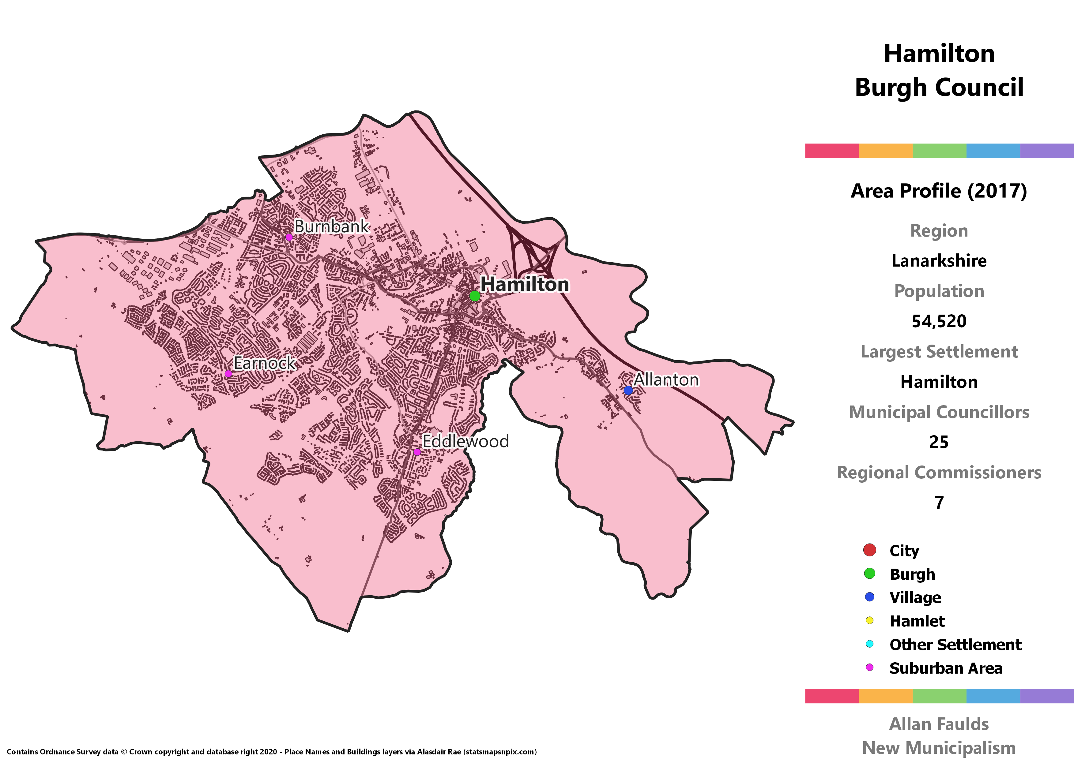
Hamilton Burgh
Area Profile (2017)
Population: 54,520
Largest Settlement: Hamilton
Municipal Councillors: 25
Regional Commissioners: 7
Municipality Description
Currently serving as the headquarters of South Lanarkshire Council, Hamilton was previously a Burgh in its own right then at the heart of a somewhat wider Hamilton District under the 1973 Act. As one of Lanarkshire’s major towns, it’s easy to justify returning that Burgh status. This proposal has expanded it slightly compared to the old version, partly to account for expansion of the town itself, and partly to draw in the village of Allanton that is now connected to it.
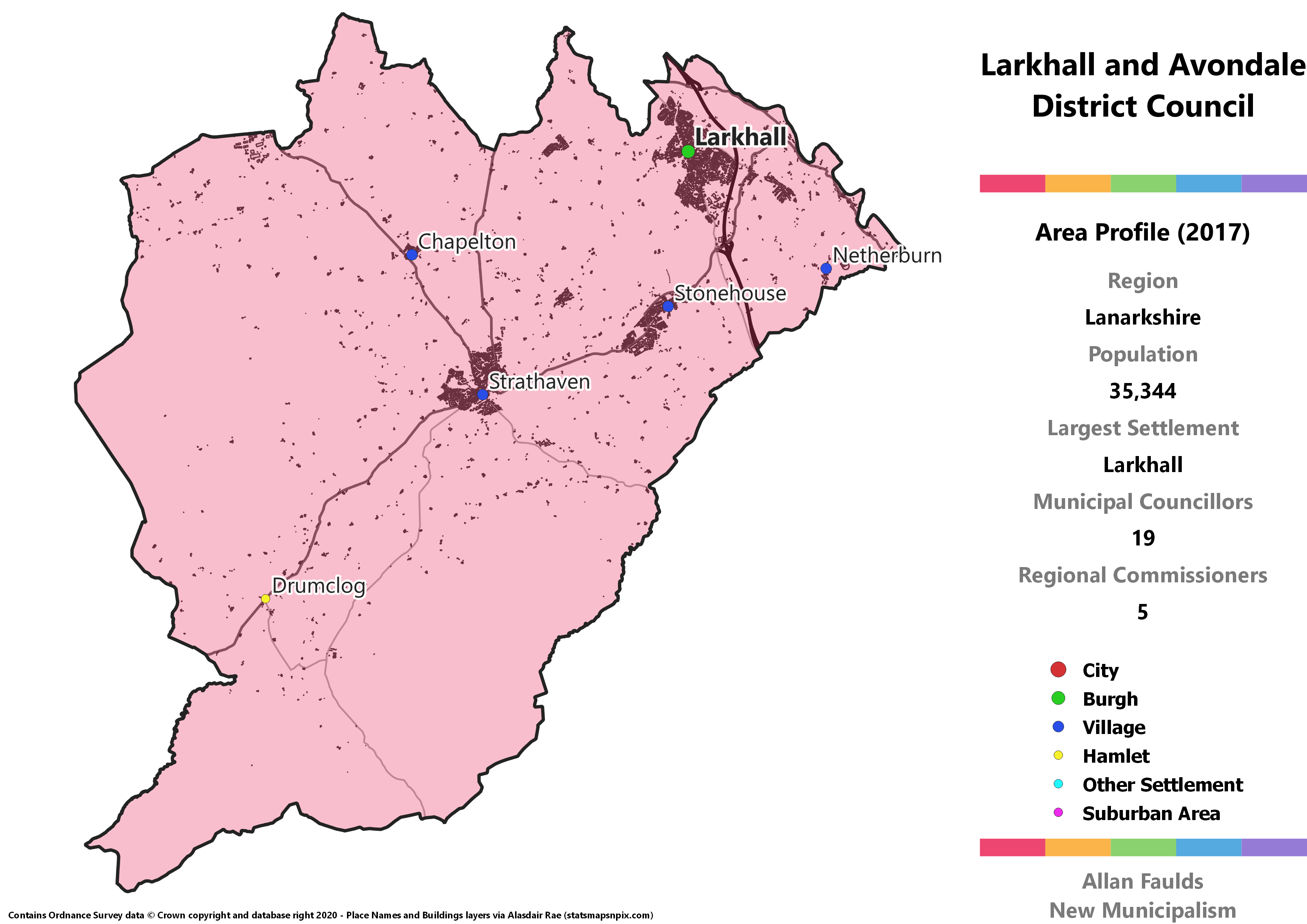
Larkhall and Avondale District
Area Profile (2017)
Population: 35,344
Largest Settlement: Larkhall
Municipal Councillors: 19
Regional Commissioners: 5
Municipality Description
Covering the south western corner of Lanarkshire, this District combines the town of Larkhall with smaller towns and villages, most prominently Strathaven and Stonehouse. These are all quite close together, with relatively few people in the more rural expanses. There’s nothing much else to note about this one, though I do have a feeling there’s something… off about the number of seats held by the three parties on the council.
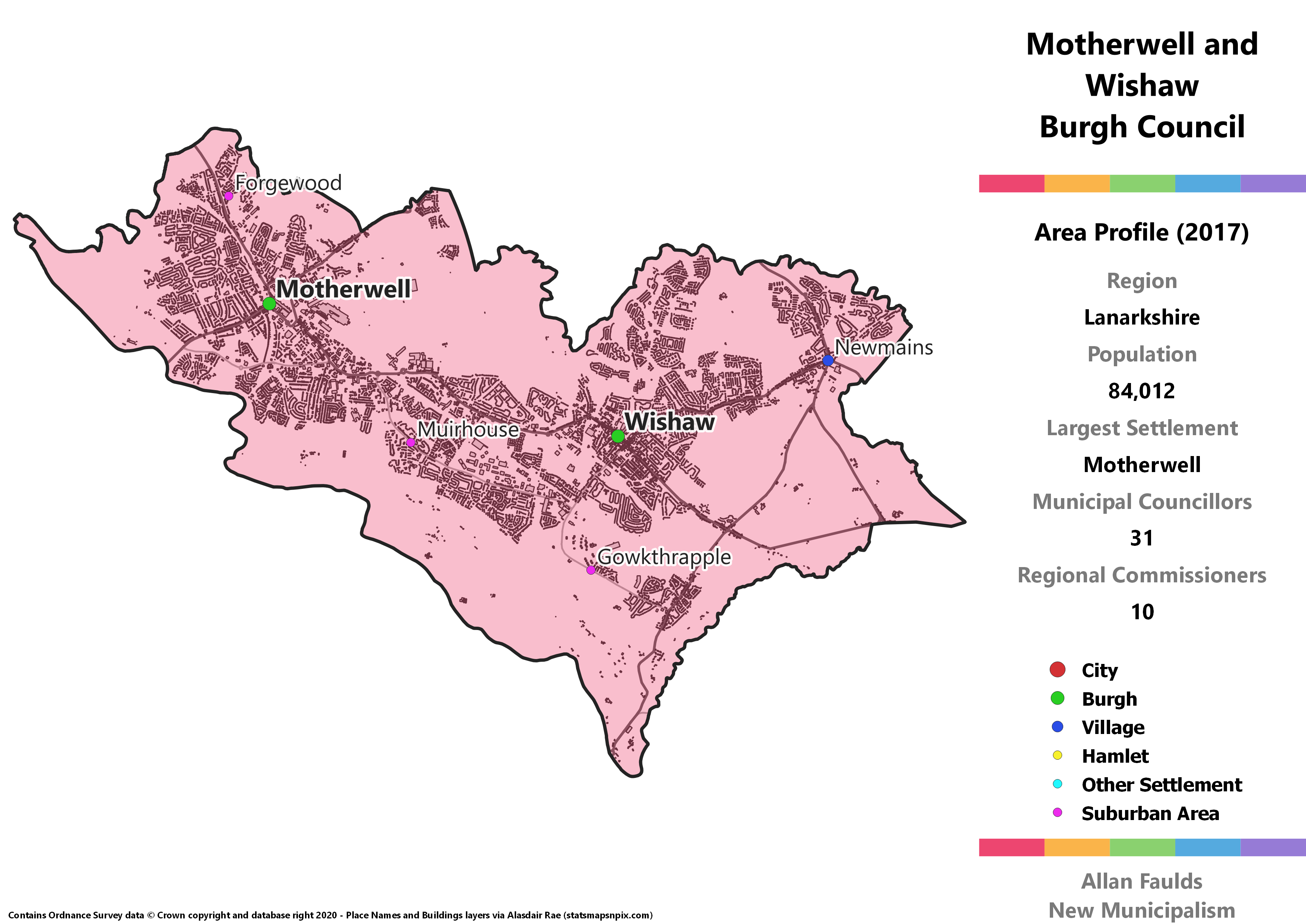
Motherwell and Wishaw Burgh
Area Profile (2017)
Population: 84,012
Largest Settlement: Motherwell
Municipal Councillors: 31
Regional Commissioners: 10
Municipality Description
Motherwell and Wishaw are individually large enough to be their own Burghs. An initial pass at this project a few years back did that. However, the two towns have always been interlinked, to the extent that they shared a single Burgh Council before the 1973 Act. I’ve therefore kept that historic link, figuring there must be some good reason for it. Throw in a few neighbouring villages that weren’t part of the old Burgh but are now closely tied to Wishaw and this ends up as the most populous non-City municipality in the country.
The towns were well contested by that Independent Alliance North Lanarkshire in 2017, meaning that when translating results for a larger Burgh they’d actually pick up two seats.
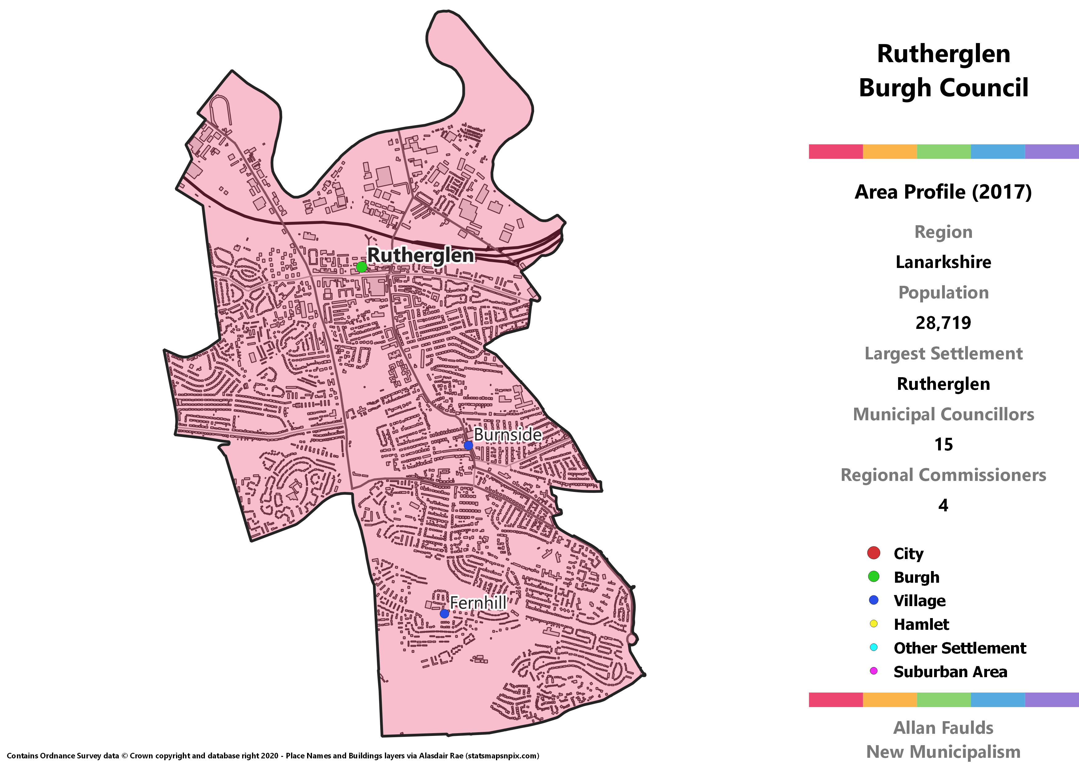
Rutherglen Burgh
Area Profile (2017)
Population: 28,719
Largest Settlement: Rutherglen
Municipal Councillors: 15
Regional Commissioners: 4
Municipality Description
Under the 1973 Act, Rutherglen became the first independent Burgh since Partick and Govan in 1912 to be absorbed by the City of Glasgow. Look at a map – or indeed, walking along any of the streets on the border – would make the reasons for doing so pretty clear. Despite that clear integration, the 1994 Act pulled Rutherglen back out of the city, and I’ve avoided adding any more bits to Glasgow in this project.
Not only does an extrapolation of 2017 results show Rutherglen as one of the few municipalities in the region to have any Lib Dems, it has a trio of them forming a larger group than the Conservatives. That reflects the continuing strength of the party in the area, with the Rutherglen North ward electing their only councillor in South Lanarkshire in reality. They were actually just 6 votes short of being the most supported party in that ward, though they were far behind that in the northern part of the town.
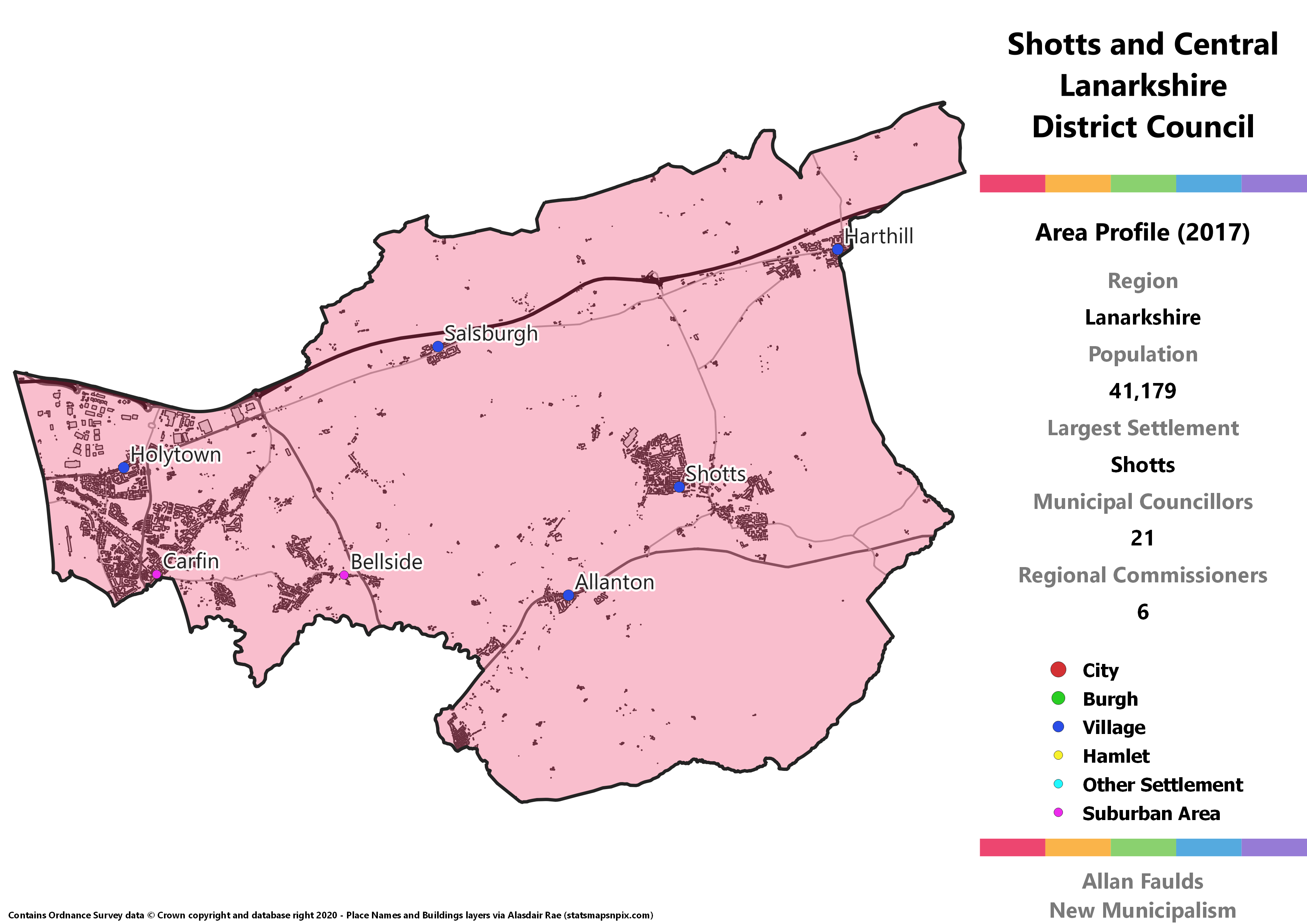
Shotts and Central Lanarkshire District
Area Profile (2017)
Population: 41,179
Largest Settlement: Shotts
Municipal Councillors: 21
Regional Commissioners: 6
Municipality Description
Shotts and Central Lanarkshire is a bit of an odd one, sort of behing what’s left over once everywhere else in North Lanarkshire is parcelled up neatly. This was (mostly) part of Motherwell and Wishaw District under the 1973 Act, and it combines the Holytown area which is part of the Motherwell urban area with the Fortissat area including the largest town at Shotts. As I said, it’s something of an oddity, but it’s what works according to the rules of the project.
In political terms what’s most notable about this isn’t just that 2017 results would indicate another of those Independent Alliance North Lanarkshire councillors. It’d also include a “British Union & Sovereignty Party” councillor. Standing at the time as “A Better Britain – Unionist Party”, they scored a surprise 11% in the Fortissat ward (they then came second with 23% in a by-election there a few months later). That’s enough to nab one of the seats on the hypothetical District Council.
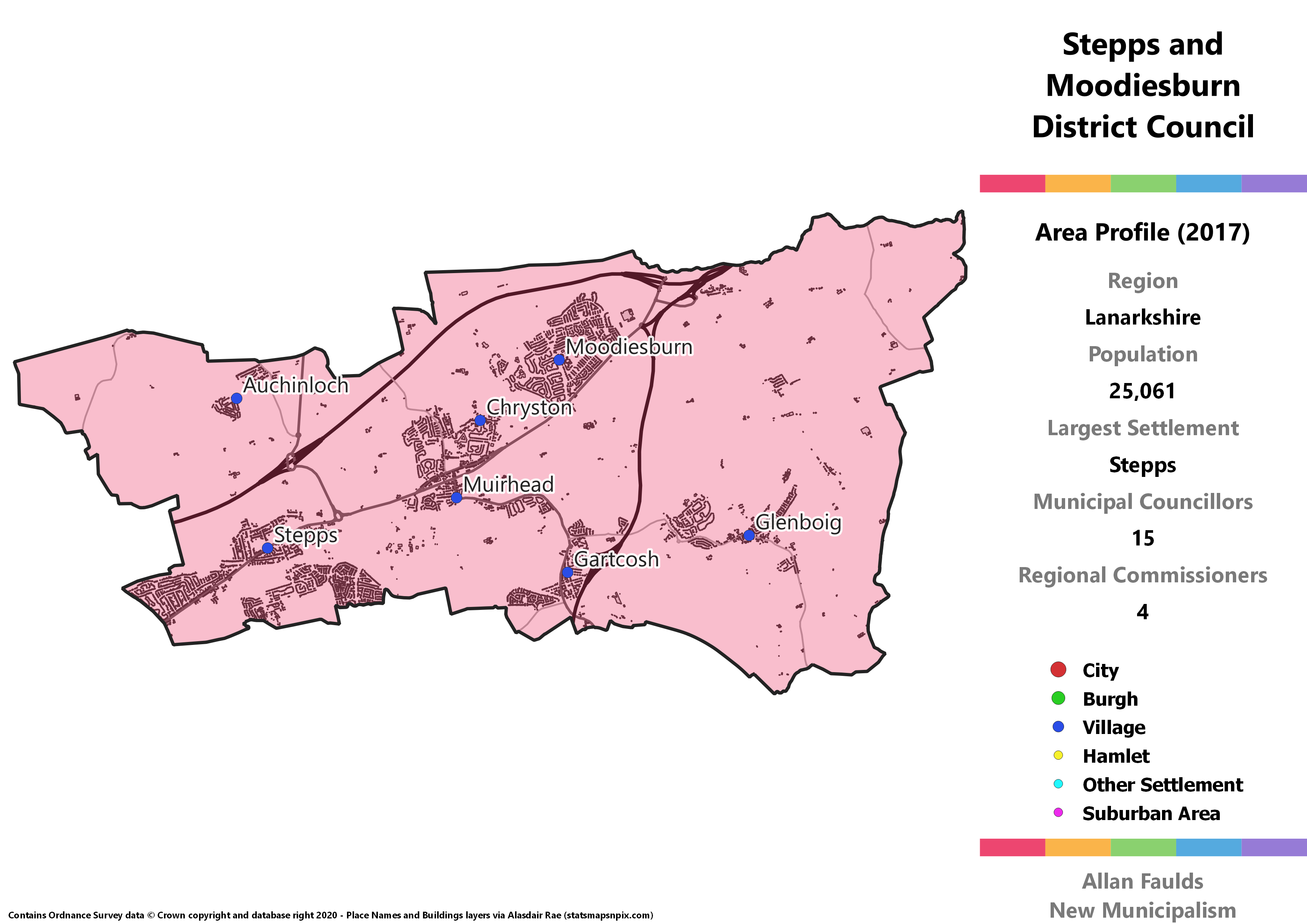
Stepps and Moodiesburn District
Area Profile (2017)
Population: 25,061
Largest Settlement: Stepps
Municipal Councillors: 15
Regional Commissioners: 4
Municipality Description
Stepps and Moodiesburn District basically covers that cluster of villages that’s wedged in between the current Glasgow and East Dunbartonshire Council areas. This area’s quirk is that it’s perhaps the least deprived proposed municipality in the region. That’s not the same as most affluent, as a look at SIMD 2016 suggests it’s pretty middling, but it’s only got a couple of very small areas in the most deprived quintile. That may partly explain or be explained by the fact that under the 1973 Act this area (except for Glenboig) was joined with Bishopbriggs, Kirkintilloch and the Campsie villages in the Strathkelvin District. Whereas those areas all went to East Dunbartonshire in the 1994 Act, this section remained in Lanarkshire.
